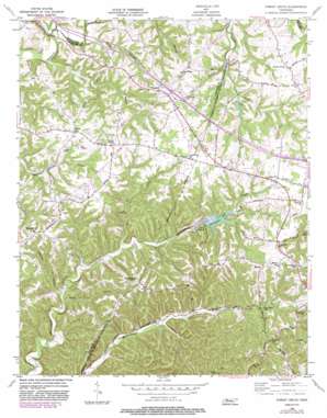
Forest Grove Topo Map Tennessee
To zoom in, hover over the map of Forest Grove
USGS Topo Quad 36086c8 - 1:24,000 scale
| Topo Map Name: | Forest Grove |
| USGS Topo Quad ID: | 36086c8 |
| Print Size: | ca. 21 1/4" wide x 27" high |
| Southeast Coordinates: | 36.25° N latitude / 86.875° W longitude |
| Map Center Coordinates: | 36.3125° N latitude / 86.9375° W longitude |
| U.S. State: | TN |
| Filename: | o36086c8.jpg |
| Download Map JPG Image: | Forest Grove topo map 1:24,000 scale |
| Map Type: | Topographic |
| Topo Series: | 7.5´ |
| Map Scale: | 1:24,000 |
| Source of Map Images: | United States Geological Survey (USGS) |
| Alternate Map Versions: |
Forest Grove TN 1955, updated 1956 Download PDF Buy paper map Forest Grove TN 1955, updated 1965 Download PDF Buy paper map Forest Grove TN 1955, updated 1977 Download PDF Buy paper map Forest Grove TN 1955, updated 1983 Download PDF Buy paper map Forest Grove TN 1955, updated 1983 Download PDF Buy paper map Forest Grove TN 1994, updated 1997 Download PDF Buy paper map Forest Grove TN 2010 Download PDF Buy paper map Forest Grove TN 2013 Download PDF Buy paper map Forest Grove TN 2016 Download PDF Buy paper map |
1:24,000 Topo Quads surrounding Forest Grove
> Back to 36086a1 at 1:100,000 scale
> Back to 36086a1 at 1:250,000 scale
> Back to U.S. Topo Maps home
Forest Grove topo map: Gazetteer
Forest Grove: Airports
Evans Airport elevation 177m 580′Forest Grove: Crossings
Interchange 31 elevation 237m 777′Forest Grove: Dams
Marrowbone Dam elevation 197m 646′Pals Lake Dam elevation 192m 629′
Forest Grove: Lakes
Glen Echo Lake elevation 193m 633′Lake Louise elevation 187m 613′
Marrowbone Lake elevation 197m 646′
Forest Grove: Populated Places
Bearwallow elevation 224m 734′Forest Grove elevation 236m 774′
Greenville elevation 254m 833′
Hoffasville (historical) elevation 214m 702′
Morny elevation 252m 826′
Mount Zion elevation 222m 728′
Pinnacle elevation 229m 751′
Rest (historical) elevation 231m 757′
West elevation 189m 620′
Westeria (historical) elevation 239m 784′
Forest Grove: Reservoirs
Marrowbone Lake elevation 197m 646′Pals Lake elevation 192m 629′
Setters Lake elevation 170m 557′
Forest Grove: Ridges
Paradise Ridge elevation 245m 803′Forest Grove: Streams
Bear Branch elevation 179m 587′Hollis Creek elevation 152m 498′
Jones Branch elevation 146m 479′
Long Branch elevation 185m 606′
Mudlick Creek elevation 175m 574′
North Fork Marrowbone Creek elevation 166m 544′
Procks Branch elevation 152m 498′
Forest Grove: Summits
Pinhook Hill elevation 257m 843′Forest Grove: Valleys
Beech Hollow elevation 152m 498′Crocker Hollow elevation 156m 511′
Forest Grove digital topo map on disk
Buy this Forest Grove topo map showing relief, roads, GPS coordinates and other geographical features, as a high-resolution digital map file on DVD:


