Harpeth Valley Topo Map Tennessee
To zoom in, hover over the map of Harpeth Valley
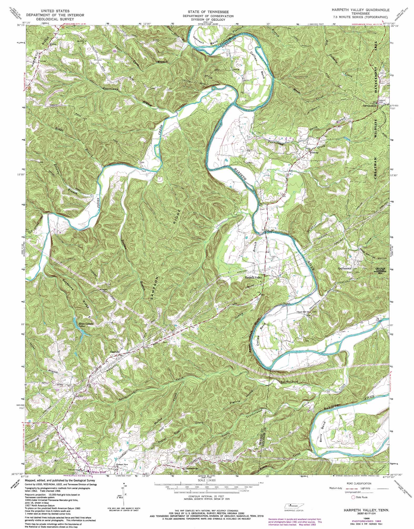
USGS Topo Quad 36087b2 - 1:24,000 scale
| Topo Map Name: | Harpeth Valley |
| USGS Topo Quad ID: | 36087b2 |
| Print Size: | ca. 21 1/4" wide x 27" high |
| Southeast Coordinates: | 36.125° N latitude / 87.125° W longitude |
| Map Center Coordinates: | 36.1875° N latitude / 87.1875° W longitude |
| U.S. State: | TN |
| Filename: | o36087b2.jpg |
| Download Map JPG Image: | Harpeth Valley topo map 1:24,000 scale |
| Map Type: | Topographic |
| Topo Series: | 7.5´ |
| Map Scale: | 1:24,000 |
| Source of Map Images: | United States Geological Survey (USGS) |
| Alternate Map Versions: |
Harpeth Valley TN 1966, updated 1967 Download PDF Buy paper map Harpeth Valley TN 1966, updated 1977 Download PDF Buy paper map Harpeth Valley TN 1966, updated 1984 Download PDF Buy paper map Harpeth Valley TN 2010 Download PDF Buy paper map Harpeth Valley TN 2013 Download PDF Buy paper map Harpeth Valley TN 2016 Download PDF Buy paper map |
1:24,000 Topo Quads surrounding Harpeth Valley
Palmyra |
Excell |
Henrietta |
Pleasant View |
Springfield South |
Slayden |
Cumberland Furnace |
Cheatham Dam |
Ashland City |
Forest Grove |
Vanleer |
Charlotte |
Harpeth Valley |
Lillamay |
Scottsboro |
Dickson |
Burns |
White Bluff |
Kingston Springs |
Bellevue |
Texas Hollow |
Lyles |
Craigfield |
Fairview |
Leipers Fork |
> Back to 36087a1 at 1:100,000 scale
> Back to 36086a1 at 1:250,000 scale
> Back to U.S. Topo Maps home
Harpeth Valley topo map: Gazetteer
Harpeth Valley: Bends
Bells Bend elevation 144m 472′Collier Bend elevation 122m 400′
Corlew Bend elevation 136m 446′
Johnson Bend elevation 127m 416′
Harpeth Valley: Bridges
Petway Bridge elevation 121m 396′Stringfellow Bridge (historical) elevation 126m 413′
Harpeth Valley: Cliffs
Paint Rock Bluff elevation 125m 410′Harpeth Valley: Crossings
Anderson Ford elevation 118m 387′Petway Ford elevation 121m 396′
Harpeth Valley: Dams
Hava Lakatu Lake Dam Number One elevation 168m 551′Harpeth Valley: Lakes
Hava-Lakatu Lakes elevation 174m 570′Harpeth Valley: Populated Places
Claylick elevation 239m 784′Dannertown elevation 227m 744′
Frog Pond elevation 251m 823′
Germantown elevation 230m 754′
Griffintown elevation 167m 547′
Harpeth Valley elevation 142m 465′
Nosegay (historical) elevation 228m 748′
Petway elevation 152m 498′
Taylortown elevation 238m 780′
Harpeth Valley: Reservoirs
Hava Lakatu Lake Number One elevation 168m 551′Harpeth Valley: Ridges
Backbone Ridge elevation 212m 695′Harpeth Ridge elevation 220m 721′
Sampson Ridge elevation 176m 577′
Harpeth Valley: Streams
Browns Branch elevation 129m 423′Flatrock Branch elevation 120m 393′
Gibson Branch elevation 176m 577′
Hatley Creek elevation 169m 554′
Hodge Branch elevation 127m 416′
Hurricane Creek elevation 147m 482′
Jones Creek elevation 147m 482′
Jordan Branch elevation 128m 419′
Leatherwood Creek elevation 128m 419′
Little Leatherwood Creek elevation 137m 449′
Lower Twin Branch elevation 120m 393′
Mann Creek elevation 126m 413′
Oakley Branch elevation 121m 396′
Poplar Flat Creek elevation 177m 580′
Porter Branch elevation 136m 446′
Smith Branch elevation 140m 459′
Sugarcamp Branch elevation 123m 403′
Sulphur Creek elevation 127m 416′
Trace Creek elevation 134m 439′
Turnipseed Creek elevation 127m 416′
Upper Forge Branch elevation 160m 524′
Upper Sugarcamp Branch elevation 121m 396′
Upper Twin Branch elevation 120m 393′
Woodward Branch elevation 126m 413′
Harpeth Valley: Valleys
Browns Hollow elevation 193m 633′Deep Springs Hollow elevation 145m 475′
England Hollow elevation 151m 495′
Lower Forge Hollow elevation 134m 439′
Upper Forge Hollow elevation 139m 456′
Harpeth Valley digital topo map on disk
Buy this Harpeth Valley topo map showing relief, roads, GPS coordinates and other geographical features, as a high-resolution digital map file on DVD: