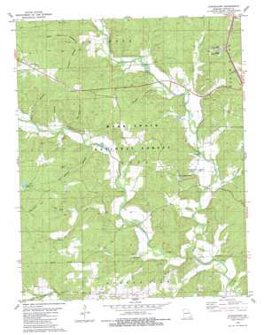
Stringtown Topo Map Missouri
To zoom in, hover over the map of Stringtown
USGS Topo Quad 36090g5 - 1:24,000 scale
| Topo Map Name: | Stringtown |
| USGS Topo Quad ID: | 36090g5 |
| Print Size: | ca. 21 1/4" wide x 27" high |
| Southeast Coordinates: | 36.75° N latitude / 90.5° W longitude |
| Map Center Coordinates: | 36.8125° N latitude / 90.5625° W longitude |
| U.S. State: | MO |
| Filename: | o36090g5.jpg |
| Download Map JPG Image: | Stringtown topo map 1:24,000 scale |
| Map Type: | Topographic |
| Topo Series: | 7.5´ |
| Map Scale: | 1:24,000 |
| Source of Map Images: | United States Geological Survey (USGS) |
| Alternate Map Versions: |
Stringtown MO 1980, updated 1980 Download PDF Buy paper map Stringtown MO 2011 Download PDF Buy paper map Stringtown MO 2015 Download PDF Buy paper map |
| FStopo: | US Forest Service topo Stringtown is available: Download FStopo PDF Download FStopo TIF |
1:24,000 Topo Quads surrounding Stringtown
> Back to 36090e1 at 1:100,000 scale
> Back to 36090a1 at 1:250,000 scale
> Back to U.S. Topo Maps home
Stringtown topo map: Gazetteer
Stringtown: Bridges
Millers Bridge elevation 110m 360′Nickey Bridge elevation 122m 400′
Stringtown: Dams
Carlton Lake Dam elevation 127m 416′Karls Lake Lower Dam elevation 122m 400′
Stringtown: Populated Places
Halloran elevation 139m 456′Milltown elevation 134m 439′
Stringtown elevation 148m 485′
Stringtown: Reservoirs
Beaver Lake elevation 172m 564′Carlton Lake elevation 127m 416′
Karls Lake elevation 122m 400′
Stringtown: Ridges
Oak Ridge elevation 154m 505′Stringtown: Streams
Camp Branch elevation 135m 442′Crooked Branch elevation 110m 360′
Fletcher Branch elevation 104m 341′
Goose Creek elevation 116m 380′
Harmon Branch elevation 134m 439′
Hurricane Creek elevation 110m 360′
Procter Branch elevation 104m 341′
Tenmile Creek elevation 104m 341′
Stringtown: Valleys
Blue Hole Hollow elevation 146m 479′Everhart Hollow elevation 159m 521′
Gobbler Hollow elevation 135m 442′
Grassy Hollow elevation 137m 449′
Mallady Hollow elevation 126m 413′
Old Still Hollow elevation 129m 423′
Smoky Hollow elevation 123m 403′
Wet Slash Hollow elevation 142m 465′
Stringtown digital topo map on disk
Buy this Stringtown topo map showing relief, roads, GPS coordinates and other geographical features, as a high-resolution digital map file on DVD:


