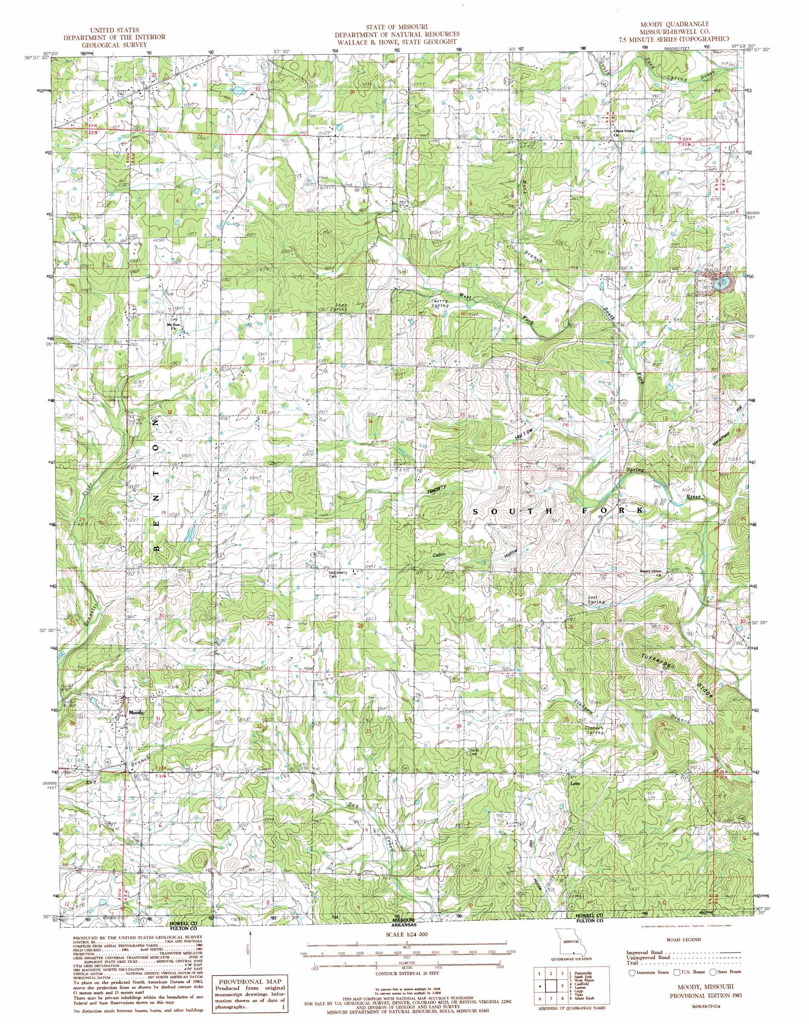
Moody Topo Map Missouri
To zoom in, hover over the map of Moody
USGS Topo Quad 36091e8 - 1:24,000 scale
| Topo Map Name: | Moody |
| USGS Topo Quad ID: | 36091e8 |
| Print Size: | ca. 21 1/4" wide x 27" high |
| Southeast Coordinates: | 36.5° N latitude / 91.875° W longitude |
| Map Center Coordinates: | 36.5625° N latitude / 91.9375° W longitude |
| U.S. State: | MO |
| Filename: | o36091e8.jpg |
| Download Map JPG Image: | Moody topo map 1:24,000 scale |
| Map Type: | Topographic |
| Topo Series: | 7.5´ |
| Map Scale: | 1:24,000 |
| Source of Map Images: | United States Geological Survey (USGS) |
| Alternate Map Versions: |
West Plains SW MO 1976, updated 1977 Download PDF Buy paper map Moody MO 1983, updated 1984 Download PDF Buy paper map Moody MO 2012 Download PDF Buy paper map Moody MO 2015 Download PDF Buy paper map |
1:24,000 Topo Quads surrounding Moody
Dora |
Siloam Springs |
Pomona |
White Church |
Peace Valley |
Cureall Nw |
Pottersville |
South Fork |
West Plains |
Brandsville |
Bakersfield |
Caulfield |
Moody |
Lanton |
Koshkonong |
Gamaliel |
Gepp |
Viola |
Salem Knob |
Camp |
Norfork Dam North |
Elizabeth |
Byron |
Salem |
Agnos |
> Back to 36091e1 at 1:100,000 scale
> Back to 36090a1 at 1:250,000 scale
> Back to U.S. Topo Maps home
Moody topo map: Gazetteer
Moody: Populated Places
China elevation 319m 1046′Lebo elevation 282m 925′
Moody elevation 298m 977′
Moody: Ridges
Turkeypen Ridge elevation 274m 898′Moody: Springs
Aunt Cindy Spring elevation 293m 961′Cherry Spring elevation 292m 958′
Gladden Spring elevation 264m 866′
Lapp Spring elevation 315m 1033′
Lost Spring elevation 274m 898′
Moody Spring elevation 280m 918′
Moody: Streams
Fourche Creek elevation 273m 895′Monk Branch elevation 273m 895′
Moody Creek elevation 263m 862′
Spring Creek elevation 292m 958′
Moody: Valleys
Cabin Hollow elevation 257m 843′Mansfield Hollow elevation 247m 810′
Newberry Hollow elevation 261m 856′
Moody digital topo map on disk
Buy this Moody topo map showing relief, roads, GPS coordinates and other geographical features, as a high-resolution digital map file on DVD: