Bergman Topo Map Arkansas
To zoom in, hover over the map of Bergman
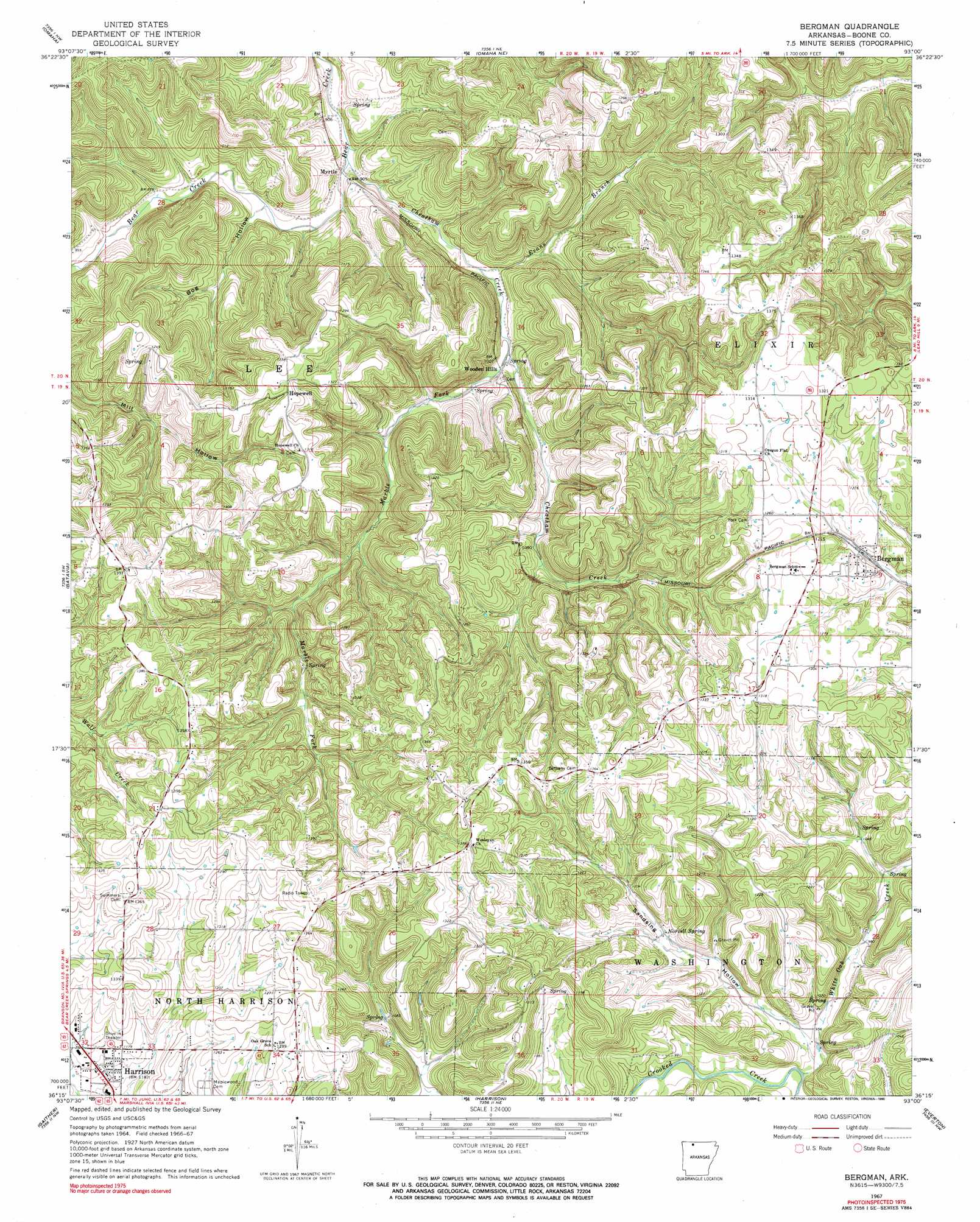
USGS Topo Quad 36093c1 - 1:24,000 scale
| Topo Map Name: | Bergman |
| USGS Topo Quad ID: | 36093c1 |
| Print Size: | ca. 21 1/4" wide x 27" high |
| Southeast Coordinates: | 36.25° N latitude / 93° W longitude |
| Map Center Coordinates: | 36.3125° N latitude / 93.0625° W longitude |
| U.S. State: | AR |
| Filename: | o36093c1.jpg |
| Download Map JPG Image: | Bergman topo map 1:24,000 scale |
| Map Type: | Topographic |
| Topo Series: | 7.5´ |
| Map Scale: | 1:24,000 |
| Source of Map Images: | United States Geological Survey (USGS) |
| Alternate Map Versions: |
Bergman AR 1967, updated 1968 Download PDF Buy paper map Bergman AR 1967, updated 1990 Download PDF Buy paper map Bergman AR 2011 Download PDF Buy paper map Bergman AR 2014 Download PDF Buy paper map |
1:24,000 Topo Quads surrounding Bergman
Table Rock Dam |
Hollister |
Mincy |
Protem Sw |
Protem |
Denver |
Omaha |
Omaha Ne |
Diamond City |
Peel |
Alpena |
Batavia |
Bergman |
Zinc |
Pyatt |
Osage Ne |
Gaither |
Harrison |
Everton |
Bruno |
Ponca |
Jasper |
Hasty |
Western Grove |
Saint Joe |
> Back to 36093a1 at 1:100,000 scale
> Back to 36092a1 at 1:250,000 scale
> Back to U.S. Topo Maps home
Bergman topo map: Gazetteer
Bergman: Populated Places
Bergman elevation 368m 1207′Hopewell elevation 401m 1315′
Myrtle elevation 253m 830′
Oregon (historical) elevation 392m 1286′
Wooden Hills elevation 294m 964′
Bergman: Springs
Norvell Spring elevation 323m 1059′Bergman: Streams
Cheatham Creek elevation 253m 830′Evans Branch elevation 292m 958′
Marble Fork elevation 288m 944′
White Oak Creek elevation 283m 928′
Bergman: Valleys
Bog Hollow elevation 268m 879′Sandsing Hollow elevation 288m 944′
Bergman digital topo map on disk
Buy this Bergman topo map showing relief, roads, GPS coordinates and other geographical features, as a high-resolution digital map file on DVD: