Kinusta Mesa Topo Map Arizona
To zoom in, hover over the map of Kinusta Mesa
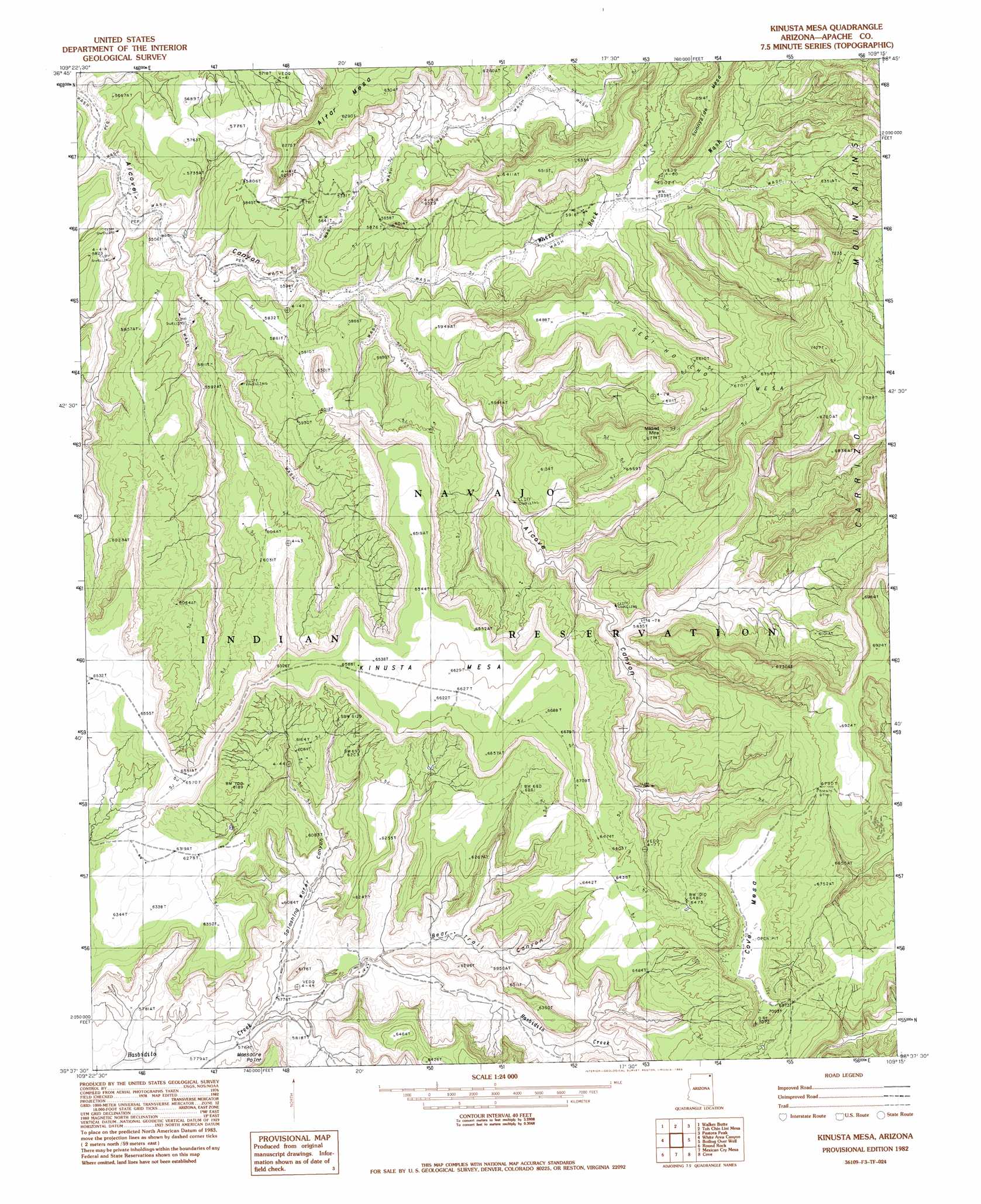
USGS Topo Quad 36109f3 - 1:24,000 scale
| Topo Map Name: | Kinusta Mesa |
| USGS Topo Quad ID: | 36109f3 |
| Print Size: | ca. 21 1/4" wide x 27" high |
| Southeast Coordinates: | 36.625° N latitude / 109.25° W longitude |
| Map Center Coordinates: | 36.6875° N latitude / 109.3125° W longitude |
| U.S. State: | AZ |
| Filename: | o36109f3.jpg |
| Download Map JPG Image: | Kinusta Mesa topo map 1:24,000 scale |
| Map Type: | Topographic |
| Topo Series: | 7.5´ |
| Map Scale: | 1:24,000 |
| Source of Map Images: | United States Geological Survey (USGS) |
| Alternate Map Versions: |
Los Gigantes NE AZ 1953, updated 1954 Download PDF Buy paper map Kinusta Mesa AZ 1982, updated 1983 Download PDF Buy paper map Kinusta Mesa AZ 2011 Download PDF Buy paper map Kinusta Mesa AZ 2014 Download PDF Buy paper map |
1:24,000 Topo Quads surrounding Kinusta Mesa
Walker Creek Reservoir |
Toh Atin Mesa West |
Toh Atin Mesa East |
Cow Butte |
Teec Nos Pos |
Hogansaani Spring |
Walker Butte |
Toh Chin Lini Mesa |
Pastora Peak |
Beclabito |
Dancing Rocks |
White Area Canyon |
Kinusta Mesa |
Boiling Over Well |
Horse Mesa |
Little Round Rock |
Round Rock |
Mexican Cry Mesa |
Cove |
Red Valley |
Many Farms Ne |
Fire Dance Mesa |
Bad Bug Butte |
Lukachukai |
Roof Butte |
> Back to 36109e1 at 1:100,000 scale
> Back to 36108a1 at 1:250,000 scale
> Back to U.S. Topo Maps home
Kinusta Mesa topo map: Gazetteer
Kinusta Mesa: Mines
Mildred Mine elevation 1987m 6519′Kinusta Mesa: Summits
Alcove Mesa elevation 1997m 6551′Cove Mesa elevation 2161m 7089′
Kinusta Mesa elevation 2043m 6702′
Segi Ho Cho Mesa elevation 2057m 6748′
Kinusta Mesa: Valleys
Bear Trail Canyon elevation 1756m 5761′Splashing Water Canyon elevation 1756m 5761′
White Rock Wash elevation 1713m 5620′
Kinusta Mesa digital topo map on disk
Buy this Kinusta Mesa topo map showing relief, roads, GPS coordinates and other geographical features, as a high-resolution digital map file on DVD: