Five Mounds Topo Map Kansas
To zoom in, hover over the map of Five Mounds
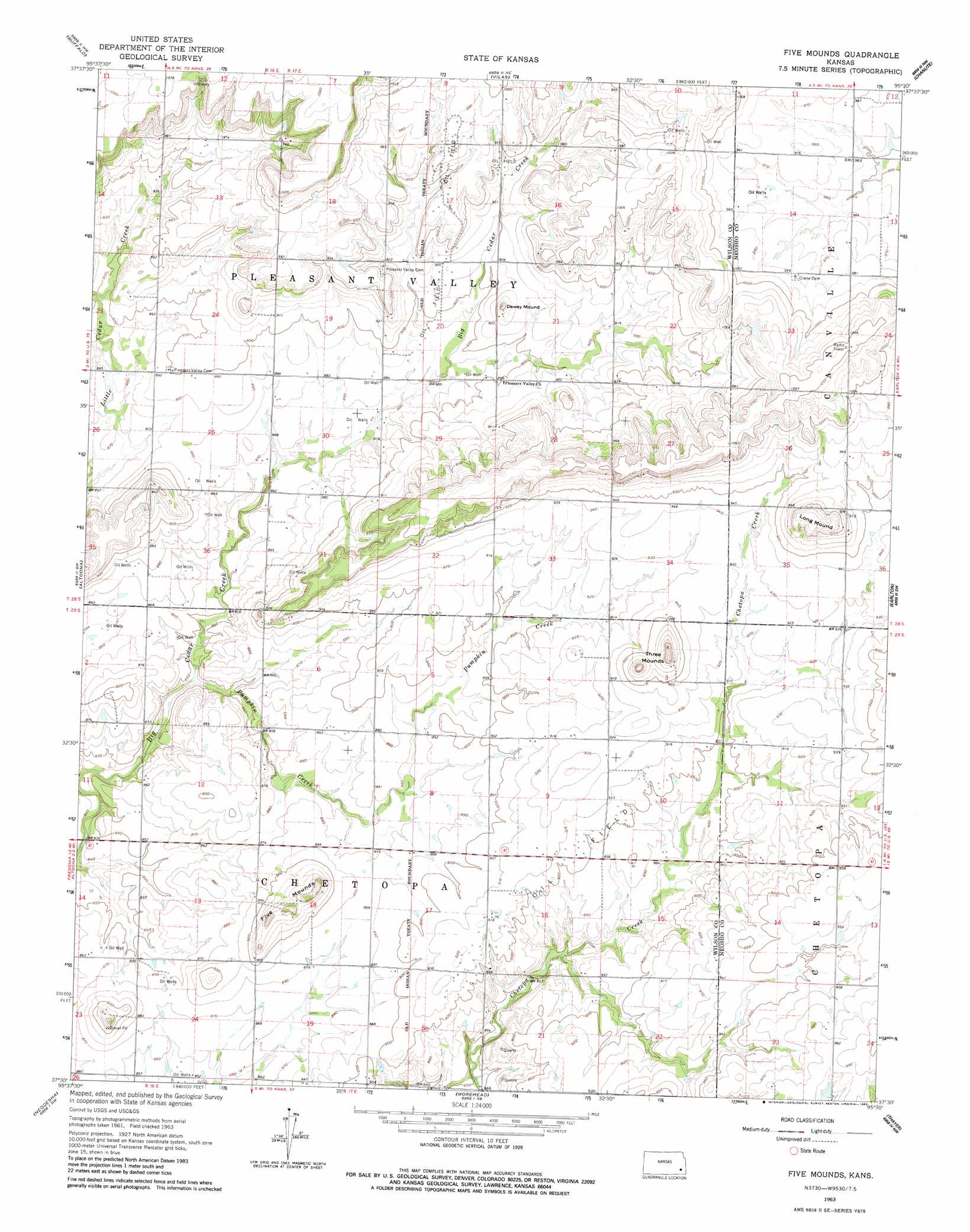
USGS Topo Quad 37095e5 - 1:24,000 scale
| Topo Map Name: | Five Mounds |
| USGS Topo Quad ID: | 37095e5 |
| Print Size: | ca. 21 1/4" wide x 27" high |
| Southeast Coordinates: | 37.5° N latitude / 95.5° W longitude |
| Map Center Coordinates: | 37.5625° N latitude / 95.5625° W longitude |
| U.S. State: | KS |
| Filename: | o37095e5.jpg |
| Download Map JPG Image: | Five Mounds topo map 1:24,000 scale |
| Map Type: | Topographic |
| Topo Series: | 7.5´ |
| Map Scale: | 1:24,000 |
| Source of Map Images: | United States Geological Survey (USGS) |
| Alternate Map Versions: |
Five Mounds KS 1963, updated 1964 Download PDF Buy paper map Five Mounds KS 1963, updated 1983 Download PDF Buy paper map Five Mounds KS 2010 Download PDF Buy paper map Five Mounds KS 2012 Download PDF Buy paper map Five Mounds KS 2015 Download PDF Buy paper map |
1:24,000 Topo Quads surrounding Five Mounds
Toronto Se |
Rose |
Yates Center Se |
Humboldt |
Iola Se |
Middletown |
Buffalo |
Vilas |
Chanute |
Rollin |
Fredonia |
Altoona |
Five Mounds |
Earlton |
Shaw |
Lafontaine |
Neodesha |
Morehead |
Thayer |
Galesburg |
Table Mound |
Sycamore |
Cherryvale |
Dennis |
Parsons West |
> Back to 37095e1 at 1:100,000 scale
> Back to 37094a1 at 1:250,000 scale
> Back to U.S. Topo Maps home
Five Mounds topo map: Gazetteer
Five Mounds: Lakes
Leonards Lake elevation 312m 1023′Five Mounds: Streams
Pumpkin Creek elevation 253m 830′Five Mounds: Summits
Dewey Mound elevation 299m 980′Five Mounds elevation 299m 980′
Long Mound elevation 316m 1036′
Three Mounds elevation 311m 1020′
Five Mounds digital topo map on disk
Buy this Five Mounds topo map showing relief, roads, GPS coordinates and other geographical features, as a high-resolution digital map file on DVD: