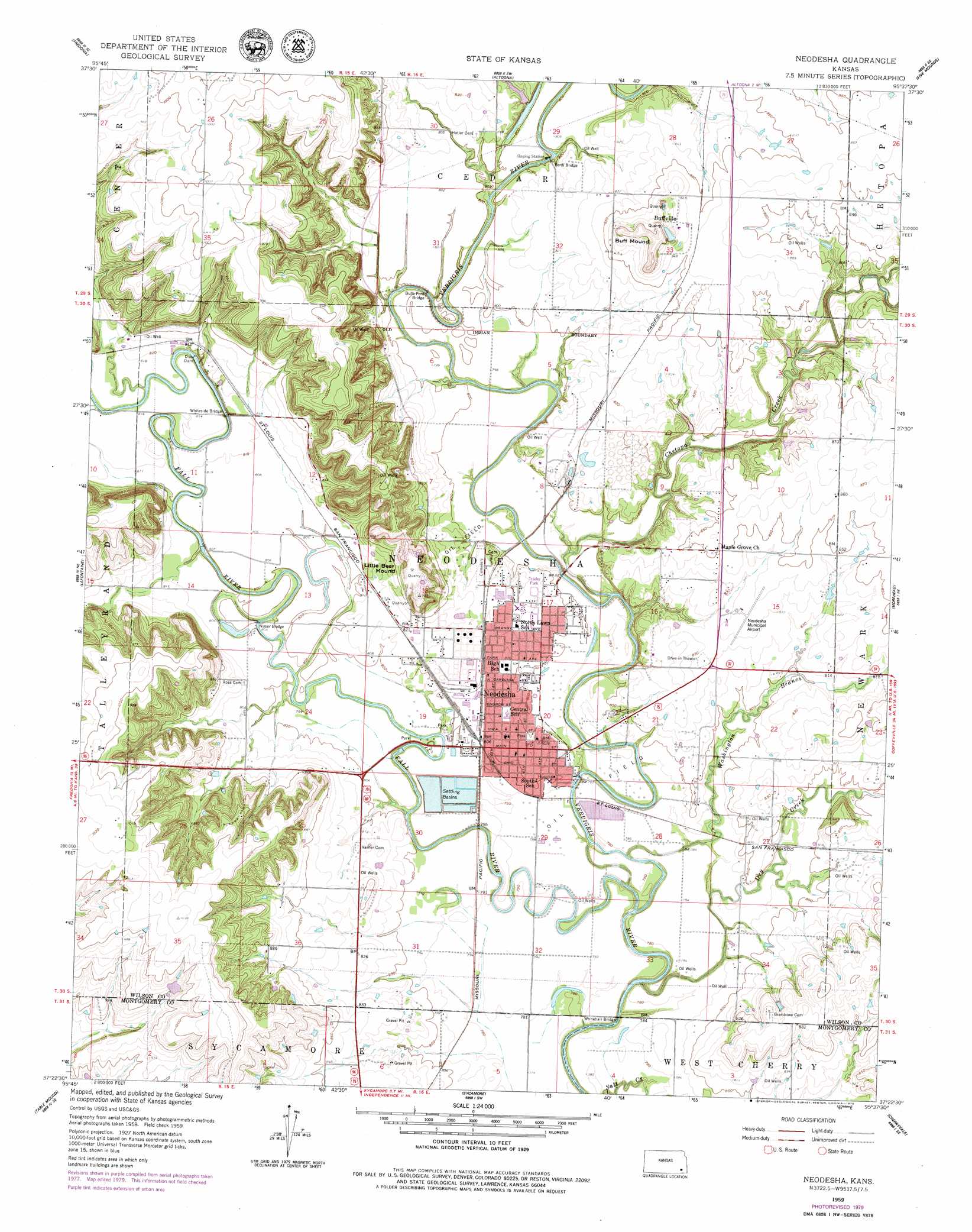
Neodesha Topo Map Kansas
To zoom in, hover over the map of Neodesha
USGS Topo Quad 37095d6 - 1:24,000 scale
| Topo Map Name: | Neodesha |
| USGS Topo Quad ID: | 37095d6 |
| Print Size: | ca. 21 1/4" wide x 27" high |
| Southeast Coordinates: | 37.375° N latitude / 95.625° W longitude |
| Map Center Coordinates: | 37.4375° N latitude / 95.6875° W longitude |
| U.S. State: | KS |
| Filename: | o37095d6.jpg |
| Download Map JPG Image: | Neodesha topo map 1:24,000 scale |
| Map Type: | Topographic |
| Topo Series: | 7.5´ |
| Map Scale: | 1:24,000 |
| Source of Map Images: | United States Geological Survey (USGS) |
| Alternate Map Versions: |
Neodesha KS 1959, updated 1960 Download PDF Buy paper map Neodesha KS 1959, updated 1979 Download PDF Buy paper map Neodesha KS 2010 Download PDF Buy paper map Neodesha KS 2012 Download PDF Buy paper map Neodesha KS 2016 Download PDF Buy paper map |
1:24,000 Topo Quads surrounding Neodesha
Coyville |
Middletown |
Buffalo |
Vilas |
Chanute |
New Albany |
Fredonia |
Altoona |
Five Mounds |
Earlton |
Buxton |
Lafontaine |
Neodesha |
Morehead |
Thayer |
Elk City |
Table Mound |
Sycamore |
Cherryvale |
Dennis |
Caney Nw |
Bolton |
Independence |
Liberty |
Mound Valley |
> Back to 37095a1 at 1:100,000 scale
> Back to 37094a1 at 1:250,000 scale
> Back to U.S. Topo Maps home
Neodesha topo map: Gazetteer
Neodesha: Airports
Neodesha Municipal Airport elevation 255m 836′Neodesha: Bridges
Bulls Ford Bridge elevation 245m 803′Huser Bridge elevation 241m 790′
Verdi Bridge elevation 244m 800′
Whitechair Bridge elevation 231m 757′
Whiteside Bridge elevation 243m 797′
Neodesha: Dams
Dun Dam elevation 246m 807′Neodesha: Oilfields
Norman Number One Oil Well elevation 248m 813′Neodesha: Populated Places
Buffville elevation 266m 872′Hilford elevation 247m 810′
Neodesha elevation 247m 810′
Neodesha: Streams
Chetopa Creek elevation 239m 784′Dry Creek elevation 232m 761′
Fall River elevation 231m 757′
Washington Branch elevation 234m 767′
Neodesha: Summits
Buff Mound elevation 262m 859′Neodesha digital topo map on disk
Buy this Neodesha topo map showing relief, roads, GPS coordinates and other geographical features, as a high-resolution digital map file on DVD: