Sycamore Topo Map Kansas
To zoom in, hover over the map of Sycamore
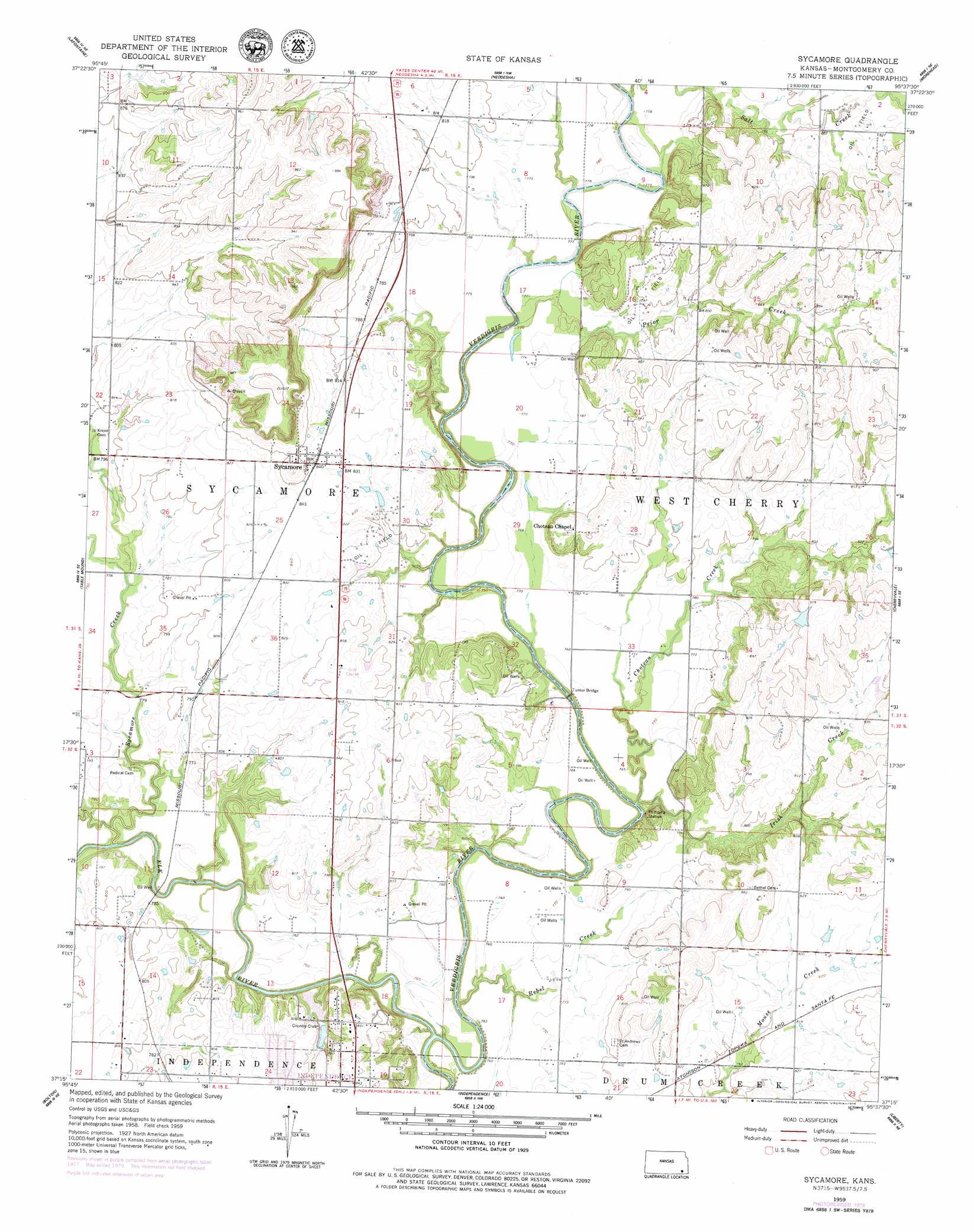
USGS Topo Quad 37095c6 - 1:24,000 scale
| Topo Map Name: | Sycamore |
| USGS Topo Quad ID: | 37095c6 |
| Print Size: | ca. 21 1/4" wide x 27" high |
| Southeast Coordinates: | 37.25° N latitude / 95.625° W longitude |
| Map Center Coordinates: | 37.3125° N latitude / 95.6875° W longitude |
| U.S. State: | KS |
| Filename: | o37095c6.jpg |
| Download Map JPG Image: | Sycamore topo map 1:24,000 scale |
| Map Type: | Topographic |
| Topo Series: | 7.5´ |
| Map Scale: | 1:24,000 |
| Source of Map Images: | United States Geological Survey (USGS) |
| Alternate Map Versions: |
Sycamore KS 1959, updated 1960 Download PDF Buy paper map Sycamore KS 1959, updated 1975 Download PDF Buy paper map Sycamore KS 1959, updated 1979 Download PDF Buy paper map Sycamore KS 2010 Download PDF Buy paper map Sycamore KS 2012 Download PDF Buy paper map Sycamore KS 2016 Download PDF Buy paper map |
1:24,000 Topo Quads surrounding Sycamore
New Albany |
Fredonia |
Altoona |
Five Mounds |
Earlton |
Buxton |
Lafontaine |
Neodesha |
Morehead |
Thayer |
Elk City |
Table Mound |
Sycamore |
Cherryvale |
Dennis |
Caney Nw |
Bolton |
Independence |
Liberty |
Mound Valley |
Caney |
Tyro |
Coffeyville West |
Coffeyville East |
Valeda |
> Back to 37095a1 at 1:100,000 scale
> Back to 37094a1 at 1:250,000 scale
> Back to U.S. Topo Maps home
Sycamore topo map: Gazetteer
Sycamore: Bridges
Sycamore Bridge elevation 232m 761′Turner Bridge elevation 227m 744′
Sycamore: Populated Places
Sycamore elevation 257m 843′Sycamore: Streams
Choteau Creek elevation 227m 744′Elk River elevation 224m 734′
Irish Creek elevation 227m 744′
Prior Creek elevation 229m 751′
Rebel Creek elevation 226m 741′
Salt Creek elevation 231m 757′
Sycamore Creek elevation 228m 748′
Sycamore: Summits
Little Bear Mound elevation 237m 777′Sycamore digital topo map on disk
Buy this Sycamore topo map showing relief, roads, GPS coordinates and other geographical features, as a high-resolution digital map file on DVD: