Crows Landing Topo Map California
To zoom in, hover over the map of Crows Landing
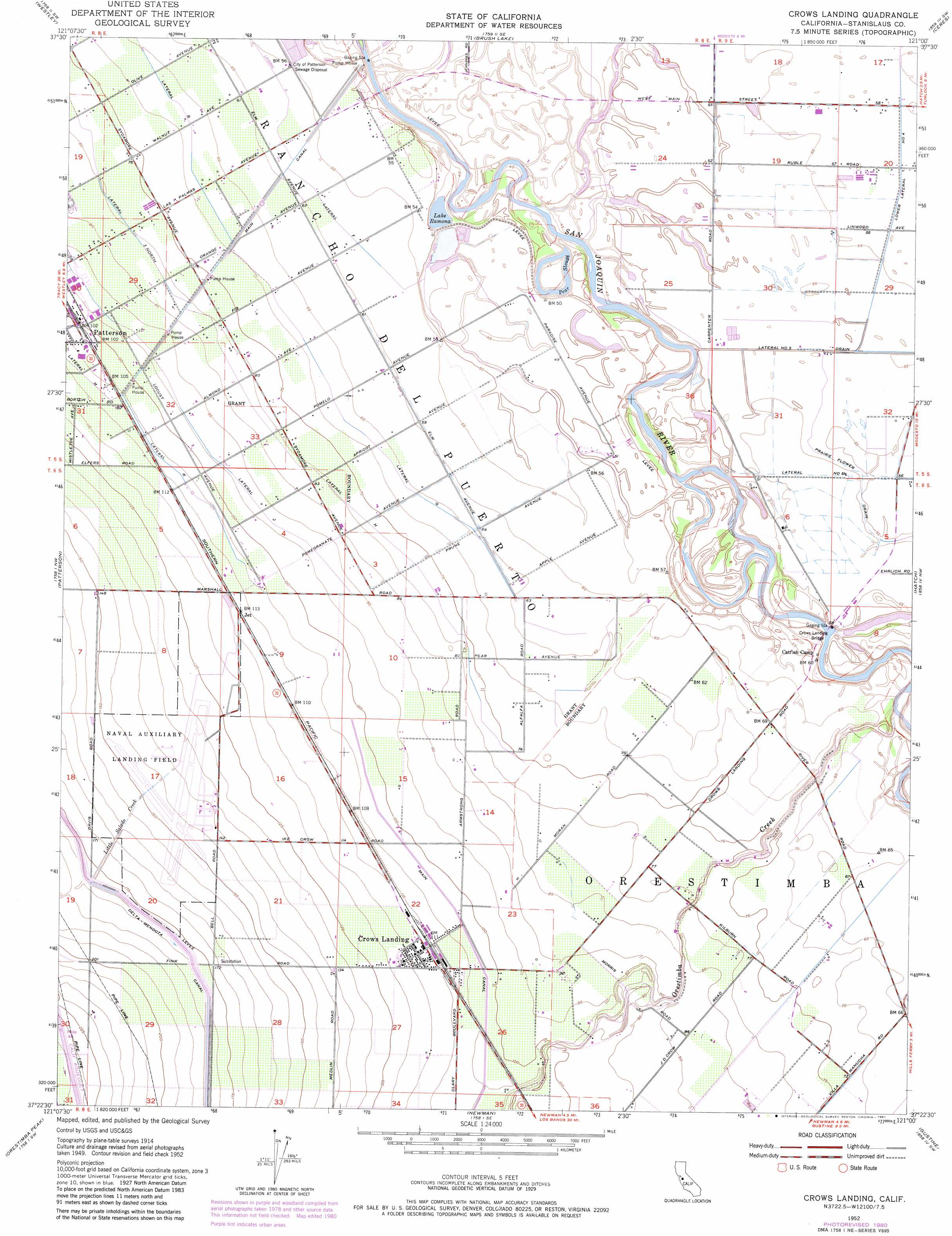
USGS Topo Quad 37121d1 - 1:24,000 scale
| Topo Map Name: | Crows Landing |
| USGS Topo Quad ID: | 37121d1 |
| Print Size: | ca. 21 1/4" wide x 27" high |
| Southeast Coordinates: | 37.375° N latitude / 121° W longitude |
| Map Center Coordinates: | 37.4375° N latitude / 121.0625° W longitude |
| U.S. State: | CA |
| Filename: | o37121d1.jpg |
| Download Map JPG Image: | Crows Landing topo map 1:24,000 scale |
| Map Type: | Topographic |
| Topo Series: | 7.5´ |
| Map Scale: | 1:24,000 |
| Source of Map Images: | United States Geological Survey (USGS) |
| Alternate Map Versions: |
Crows Landing CA 1952, updated 1954 Download PDF Buy paper map Crows Landing CA 1952, updated 1973 Download PDF Buy paper map Crows Landing CA 1952, updated 1973 Download PDF Buy paper map Crows Landing CA 1952, updated 1981 Download PDF Buy paper map Crows Landing CA 1952, updated 1981 Download PDF Buy paper map Crows Landing CA 1952, updated 1981 Download PDF Buy paper map Crows Landing CA 2012 Download PDF Buy paper map Crows Landing CA 2015 Download PDF Buy paper map |
1:24,000 Topo Quads surrounding Crows Landing
Vernalis |
Ripon |
Salida |
Riverbank |
Waterford |
Solyo |
Westley |
Brush Lake |
Ceres |
Denair |
Copper Mountain |
Patterson |
Crows Landing |
Hatch |
Turlock |
Wilcox Ridge |
Orestimba Peak |
Newman |
Gustine |
Stevinson |
Mustang Peak |
Crevison Peak |
Howard Ranch |
Ingomar |
San Luis Ranch |
> Back to 37121a1 at 1:100,000 scale
> Back to 37120a1 at 1:250,000 scale
> Back to U.S. Topo Maps home
Crows Landing topo map: Gazetteer
Crows Landing: Bridges
Crows Landing Bridge elevation 13m 42′Crows Landing: Canals
Lateral F elevation 18m 59′Lateral G elevation 21m 68′
Lateral H elevation 25m 82′
Lateral J elevation 29m 95′
Lateral K elevation 33m 108′
Main Canal elevation 21m 68′
Crows Landing: Guts
Pear Slough elevation 13m 42′Crows Landing: Populated Places
Crows Landing elevation 35m 114′Jet elevation 35m 114′
Crows Landing: Reservoirs
Lake Ramona elevation 14m 45′Crows Landing: Streams
Little Salado Creek elevation 36m 118′Orestimba Creek elevation 14m 45′
Salado Creek elevation 25m 82′
Crows Landing digital topo map on disk
Buy this Crows Landing topo map showing relief, roads, GPS coordinates and other geographical features, as a high-resolution digital map file on DVD: