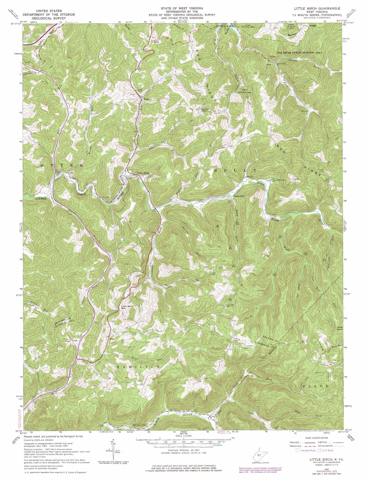
Little Birch Topo Map West Virginia
To zoom in, hover over the map of Little Birch
USGS Topo Quad 38080e6 - 1:24,000 scale
| Topo Map Name: | Little Birch |
| USGS Topo Quad ID: | 38080e6 |
| Print Size: | ca. 21 1/4" wide x 27" high |
| Southeast Coordinates: | 38.5° N latitude / 80.625° W longitude |
| Map Center Coordinates: | 38.5625° N latitude / 80.6875° W longitude |
| U.S. State: | WV |
| Filename: | o38080e6.jpg |
| Download Map JPG Image: | Little Birch topo map 1:24,000 scale |
| Map Type: | Topographic |
| Topo Series: | 7.5´ |
| Map Scale: | 1:24,000 |
| Source of Map Images: | United States Geological Survey (USGS) |
| Alternate Map Versions: |
Little Birch WV 1967, updated 1968 Download PDF Buy paper map Little Birch WV 1967, updated 1977 Download PDF Buy paper map Little Birch WV 2010 Download PDF Buy paper map Little Birch WV 2014 Download PDF Buy paper map Little Birch WV 2016 Download PDF Buy paper map |
1:24,000 Topo Quads surrounding Little Birch
Normantown |
Cedarville |
Burnsville |
Orlando |
Walkersville |
Rosedale |
Gassaway |
Sutton |
Newville |
Hacker Valley |
Strange Creek |
Herold |
Little Birch |
Erbacon |
Diana |
Swandale |
Widen |
Tioga |
Cowen |
Webster Springs |
Gilboa |
Summersville |
Craigsville |
Camden On Gauley |
Webster Springs Sw |
> Back to 38080e1 at 1:100,000 scale
> Back to 38080a1 at 1:250,000 scale
> Back to U.S. Topo Maps home
Little Birch topo map: Gazetteer
Little Birch: Flats
Hickory Flats elevation 664m 2178′Little Birch: Populated Places
Holstead (historical) elevation 521m 1709′Little Birch elevation 347m 1138′
Skyles (historical) elevation 384m 1259′
Tesla elevation 360m 1181′
Waggy (historical) elevation 571m 1873′
Little Birch: Post Offices
Little Birch Post Office elevation 357m 1171′Little Birch: Ridges
Barker Ridge elevation 526m 1725′Bug Ridge elevation 530m 1738′
Little Birch: Streams
Bear Run elevation 325m 1066′Bluelick Run elevation 411m 1348′
Brier Run elevation 474m 1555′
Carpenter Fork elevation 350m 1148′
Coon Den Run elevation 432m 1417′
Fisher Run elevation 352m 1154′
Gravel Fork elevation 408m 1338′
Laurel Run elevation 333m 1092′
May Fork elevation 435m 1427′
Ramp Run elevation 364m 1194′
Right Fork Little Birch River elevation 397m 1302′
Road Fork elevation 398m 1305′
Rose Run elevation 365m 1197′
Seng Run elevation 347m 1138′
Skyles Creek elevation 381m 1250′
Spring Run elevation 358m 1174′
Spruce Fork elevation 335m 1099′
Twolick Run elevation 337m 1105′
Windy Run elevation 326m 1069′
Little Birch: Summits
Little Birch Mountain elevation 577m 1893′Pilot Knob elevation 693m 2273′
Little Birch digital topo map on disk
Buy this Little Birch topo map showing relief, roads, GPS coordinates and other geographical features, as a high-resolution digital map file on DVD:
Western Virginia & Southern West Virginia
Buy digital topo maps: Western Virginia & Southern West Virginia