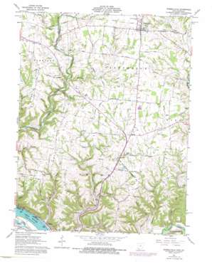
Russellville Topo Map Ohio
To zoom in, hover over the map of Russellville
USGS Topo Quad 38083g7 - 1:24,000 scale
| Topo Map Name: | Russellville |
| USGS Topo Quad ID: | 38083g7 |
| Print Size: | ca. 21 1/4" wide x 27" high |
| Southeast Coordinates: | 38.75° N latitude / 83.75° W longitude |
| Map Center Coordinates: | 38.8125° N latitude / 83.8125° W longitude |
| U.S. States: | OH, KY |
| Filename: | o38083g7.jpg |
| Download Map JPG Image: | Russellville topo map 1:24,000 scale |
| Map Type: | Topographic |
| Topo Series: | 7.5´ |
| Map Scale: | 1:24,000 |
| Source of Map Images: | United States Geological Survey (USGS) |
| Alternate Map Versions: |
Russellville OH 1961, updated 1963 Download PDF Buy paper map Russellville OH 1961, updated 1963 Download PDF Buy paper map Russellville OH 1961, updated 1976 Download PDF Buy paper map Russellville OH 2010 Download PDF Buy paper map Russellville OH 2013 Download PDF Buy paper map Russellville OH 2016 Download PDF Buy paper map |
1:24,000 Topo Quads surrounding Russellville
> Back to 38083e1 at 1:100,000 scale
> Back to 38082a1 at 1:250,000 scale
> Back to U.S. Topo Maps home
Russellville topo map: Gazetteer
Russellville: Parks
Rankin House State Memorial elevation 256m 839′Russellville: Populated Places
Hillman (historical) elevation 237m 777′Port Chardon Mobile Home Park elevation 153m 501′
Redoak elevation 273m 895′
Russellville elevation 293m 961′
Stringtown elevation 161m 528′
Russellville: Post Offices
Red Oak Post Office (historical) elevation 272m 892′Russelville Post Office elevation 293m 961′
Russellville: Ridges
Dixon Ridge elevation 275m 902′Hillman Ridge elevation 275m 902′
Pisgah Ridge elevation 269m 882′
Russellville: Streams
Brady Run elevation 192m 629′Bull Run elevation 243m 797′
Camp Run elevation 244m 800′
Cornick Run elevation 153m 501′
Indian Lick elevation 164m 538′
Lafferty Run elevation 159m 521′
Lee Creek elevation 152m 498′
Myers Run elevation 250m 820′
Myers Run elevation 220m 721′
Rocky Run elevation 250m 820′
Scott Run elevation 213m 698′
Sutherland Run elevation 244m 800′
Washburn Run elevation 218m 715′
West Fork Redoak Creek elevation 234m 767′
Russellville: Valleys
Chicken Hollow elevation 190m 623′Fox Hollow elevation 162m 531′
Mefford Hollow elevation 186m 610′
Myers Hollow elevation 215m 705′
Russellville digital topo map on disk
Buy this Russellville topo map showing relief, roads, GPS coordinates and other geographical features, as a high-resolution digital map file on DVD:
Western Virginia & Southern West Virginia
Buy digital topo maps: Western Virginia & Southern West Virginia


