Stamping Ground Topo Map Kentucky
To zoom in, hover over the map of Stamping Ground
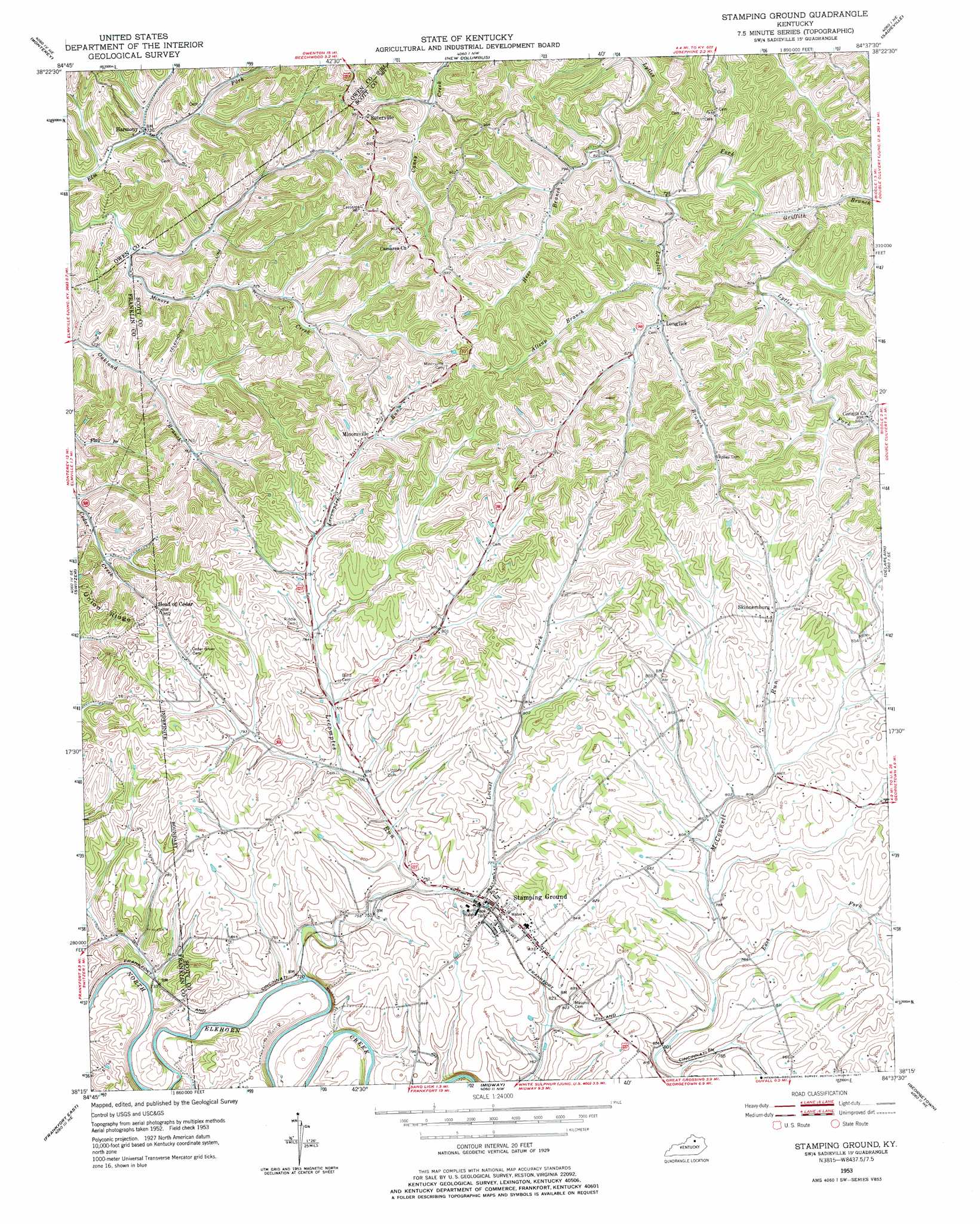
USGS Topo Quad 38084c6 - 1:24,000 scale
| Topo Map Name: | Stamping Ground |
| USGS Topo Quad ID: | 38084c6 |
| Print Size: | ca. 21 1/4" wide x 27" high |
| Southeast Coordinates: | 38.25° N latitude / 84.625° W longitude |
| Map Center Coordinates: | 38.3125° N latitude / 84.6875° W longitude |
| U.S. State: | KY |
| Filename: | o38084c6.jpg |
| Download Map JPG Image: | Stamping Ground topo map 1:24,000 scale |
| Map Type: | Topographic |
| Topo Series: | 7.5´ |
| Map Scale: | 1:24,000 |
| Source of Map Images: | United States Geological Survey (USGS) |
| Alternate Map Versions: |
Stamping Ground KY 1953, updated 1955 Download PDF Buy paper map Stamping Ground KY 1953, updated 1973 Download PDF Buy paper map Stamping Ground KY 1953, updated 1977 Download PDF Buy paper map Stamping Ground KY 2010 Download PDF Buy paper map Stamping Ground KY 2013 Download PDF Buy paper map Stamping Ground KY 2016 Download PDF Buy paper map |
1:24,000 Topo Quads surrounding Stamping Ground
New Liberty |
Owenton |
Lawrenceville |
Mason |
Berry |
Gratz |
Monterey |
New Columbus |
Sadieville |
Breckinridge |
Polsgrove |
Switzer |
Stamping Ground |
Delaplain |
Leesburg |
Frankfort West |
Frankfort East |
Midway |
Georgetown |
Centerville |
Lawrenceburg |
Tyrone |
Versailles |
Lexington West |
Lexington East |
> Back to 38084a1 at 1:100,000 scale
> Back to 38084a1 at 1:250,000 scale
> Back to U.S. Topo Maps home
Stamping Ground topo map: Gazetteer
Stamping Ground: Populated Places
Harmony elevation 223m 731′Longlick elevation 248m 813′
Minorsville elevation 252m 826′
Skinnersburg elevation 256m 839′
Stamping Ground elevation 242m 793′
Suterville elevation 285m 935′
Stamping Ground: Post Offices
Harmony Post Office (historical) elevation 224m 734′Sutterville Post Office (historical) elevation 292m 958′
Stamping Ground: Streams
Allsup Branch elevation 247m 810′East Fork McConnell Run elevation 235m 770′
Griffith Branch elevation 247m 810′
Hess Branch elevation 242m 793′
Lecomptes Run elevation 216m 708′
Locust Fork elevation 225m 738′
Longlick Branch elevation 243m 797′
Sebree Branch elevation 214m 702′
Stamping Ground digital topo map on disk
Buy this Stamping Ground topo map showing relief, roads, GPS coordinates and other geographical features, as a high-resolution digital map file on DVD: