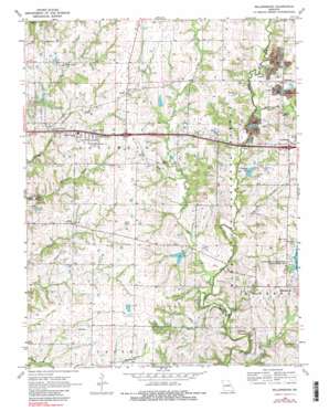
Millersburg Topo Map Missouri
To zoom in, hover over the map of Millersburg
USGS Topo Quad 38092h2 - 1:24,000 scale
| Topo Map Name: | Millersburg |
| USGS Topo Quad ID: | 38092h2 |
| Print Size: | ca. 21 1/4" wide x 27" high |
| Southeast Coordinates: | 38.875° N latitude / 92.125° W longitude |
| Map Center Coordinates: | 38.9375° N latitude / 92.1875° W longitude |
| U.S. State: | MO |
| Filename: | o38092h2.jpg |
| Download Map JPG Image: | Millersburg topo map 1:24,000 scale |
| Map Type: | Topographic |
| Topo Series: | 7.5´ |
| Map Scale: | 1:24,000 |
| Source of Map Images: | United States Geological Survey (USGS) |
| Alternate Map Versions: |
Millersburg MO 1969, updated 1971 Download PDF Buy paper map Millersburg MO 1969, updated 1983 Download PDF Buy paper map Millersburg MO 1969, updated 1983 Download PDF Buy paper map Millersburg MO 2000, updated 2002 Download PDF Buy paper map Millersburg MO 2012 Download PDF Buy paper map Millersburg MO 2015 Download PDF Buy paper map |
| FStopo: | US Forest Service topo Millersburg is available: Download FStopo PDF Download FStopo TIF |
1:24,000 Topo Quads surrounding Millersburg
> Back to 38092e1 at 1:100,000 scale
> Back to 38092a1 at 1:250,000 scale
> Back to U.S. Topo Maps home
Millersburg topo map: Gazetteer
Millersburg: Dams
Cheng Lake Dam elevation 254m 833′Daly Dam elevation 258m 846′
Lake Chateau Dam elevation 240m 787′
Lake Lavista Dam elevation 256m 839′
Landhuis Lake Dam elevation 264m 866′
Newman Lake Number 2 Dam elevation 245m 803′
Turkey Farm Lake Dam elevation 254m 833′
Welch Lake Dam elevation 241m 790′
Millersburg: Lakes
Corns Lake elevation 255m 836′Millersburg: Populated Places
Boonesborough (historical) elevation 252m 826′Harg elevation 258m 846′
Lindbergh elevation 268m 879′
Shaw elevation 265m 869′
Stephens elevation 267m 875′
Millersburg: Reservoirs
Lake Lavista elevation 256m 839′Landhuis Lake elevation 264m 866′
Newman Lake elevation 247m 810′
Number 153 Reservoir elevation 254m 833′
Troy Newman Lake 1 elevation 240m 787′
Troy Newman Lake 2 elevation 245m 803′
Millersburg: Streams
Bone Branch elevation 243m 797′Little Cedar Creek elevation 228m 748′
Manacle Creek elevation 241m 790′
Sally Branch elevation 234m 767′
Millersburg digital topo map on disk
Buy this Millersburg topo map showing relief, roads, GPS coordinates and other geographical features, as a high-resolution digital map file on DVD:


