Spring Hill Topo Map Kansas
To zoom in, hover over the map of Spring Hill
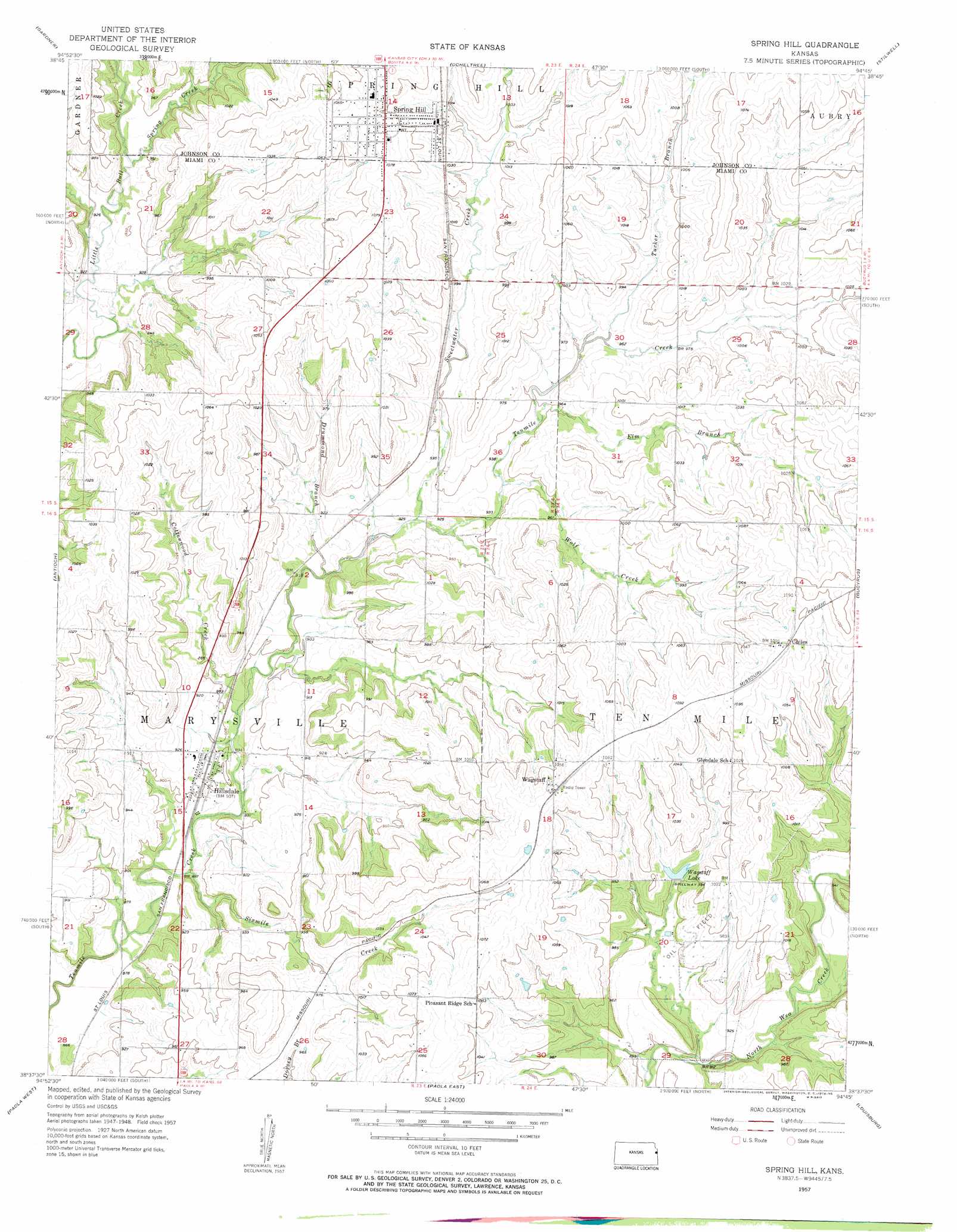
USGS Topo Quad 38094f7 - 1:24,000 scale
| Topo Map Name: | Spring Hill |
| USGS Topo Quad ID: | 38094f7 |
| Print Size: | ca. 21 1/4" wide x 27" high |
| Southeast Coordinates: | 38.625° N latitude / 94.75° W longitude |
| Map Center Coordinates: | 38.6875° N latitude / 94.8125° W longitude |
| U.S. State: | KS |
| Filename: | o38094f7.jpg |
| Download Map JPG Image: | Spring Hill topo map 1:24,000 scale |
| Map Type: | Topographic |
| Topo Series: | 7.5´ |
| Map Scale: | 1:24,000 |
| Source of Map Images: | United States Geological Survey (USGS) |
| Alternate Map Versions: |
Spring Hill KS 1957, updated 1958 Download PDF Buy paper map Spring Hill KS 2009 Download PDF Buy paper map Spring Hill KS 2012 Download PDF Buy paper map Spring Hill KS 2015 Download PDF Buy paper map |
1:24,000 Topo Quads surrounding Spring Hill
Eudora |
De Soto |
Olathe |
Lenexa |
Grandview |
Edgerton |
Gardner |
Ocheltree |
Stilwell |
Belton |
Wellsville |
Antioch |
Spring Hill |
Bucyrus |
West Line |
Rantoul |
Paola West |
Paola East |
Louisburg |
Freeman |
Lane |
Osawatomie |
Fontana |
New Lancaster |
Drexel |
> Back to 38094e1 at 1:100,000 scale
> Back to 38094a1 at 1:250,000 scale
> Back to U.S. Topo Maps home
Spring Hill topo map: Gazetteer
Spring Hill: Airports
Linders Cow-Chip Airport elevation 293m 961′Weiss Airport elevation 309m 1013′
Spring Hill: Populated Places
Chiles elevation 334m 1095′Hillsdale elevation 271m 889′
Spring Hill elevation 324m 1062′
Wagstaff elevation 323m 1059′
Spring Hill: Post Offices
Spring Hill Post Office elevation 318m 1043′Spring Hill: Reservoirs
Wagstaff Lake elevation 294m 964′Spring Hill: Streams
Cottonwood Creek elevation 268m 879′Drummond Branch elevation 274m 898′
Elm Branch elevation 286m 938′
Sixmile Creek elevation 264m 866′
Spring Creek elevation 282m 925′
Sweetwater Creek elevation 277m 908′
Tucker Branch elevation 293m 961′
Wolf Creek elevation 282m 925′
Spring Hill digital topo map on disk
Buy this Spring Hill topo map showing relief, roads, GPS coordinates and other geographical features, as a high-resolution digital map file on DVD: