North Pass Topo Map Colorado
To zoom in, hover over the map of North Pass
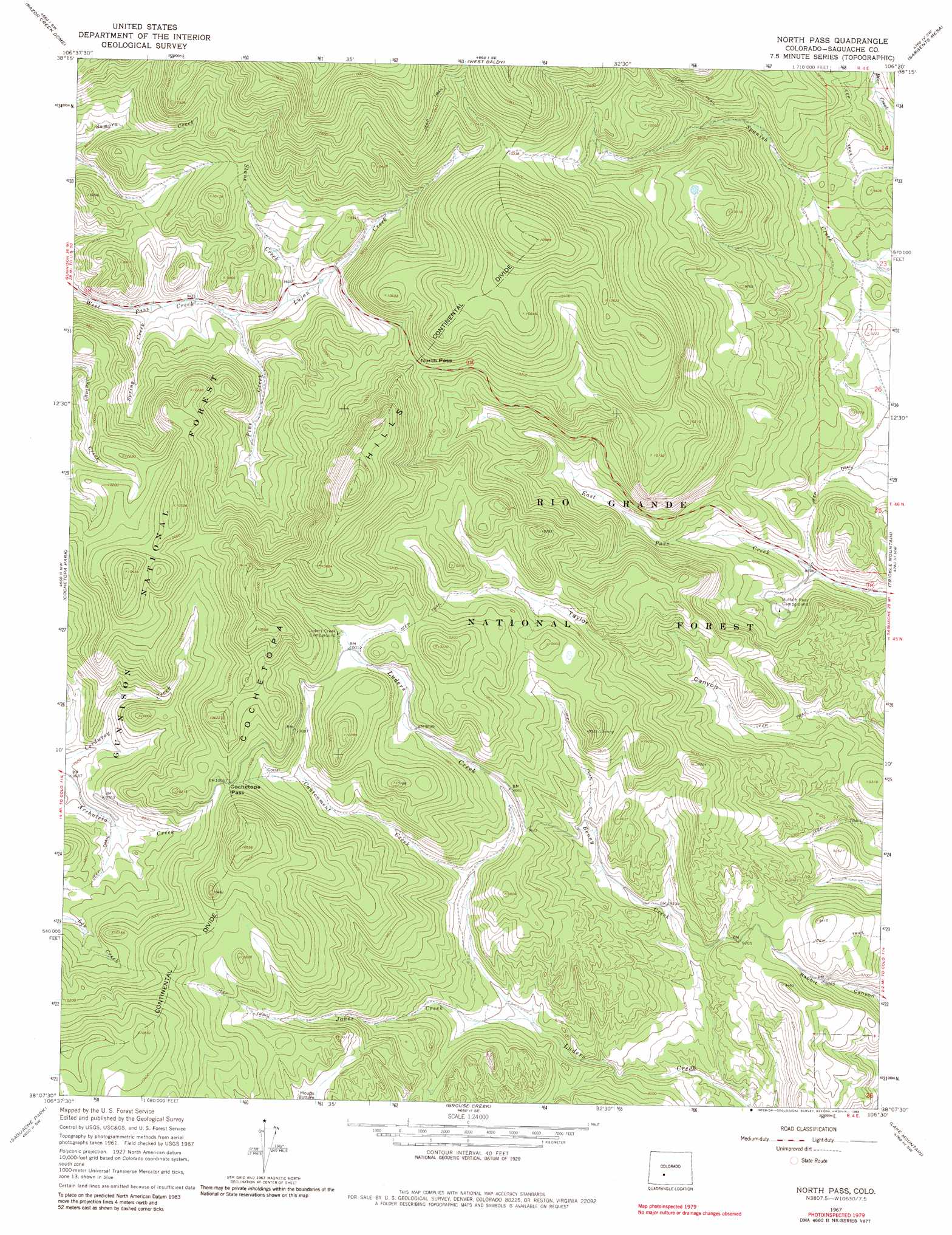
USGS Topo Quad 38106b5 - 1:24,000 scale
| Topo Map Name: | North Pass |
| USGS Topo Quad ID: | 38106b5 |
| Print Size: | ca. 21 1/4" wide x 27" high |
| Southeast Coordinates: | 38.125° N latitude / 106.5° W longitude |
| Map Center Coordinates: | 38.1875° N latitude / 106.5625° W longitude |
| U.S. State: | CO |
| Filename: | o38106b5.jpg |
| Download Map JPG Image: | North Pass topo map 1:24,000 scale |
| Map Type: | Topographic |
| Topo Series: | 7.5´ |
| Map Scale: | 1:24,000 |
| Source of Map Images: | United States Geological Survey (USGS) |
| Alternate Map Versions: |
North Pass CO 1967 Download PDF Buy paper map North Pass CO 1967, updated 1970 Download PDF Buy paper map North Pass CO 1967, updated 1970 Download PDF Buy paper map North Pass CO 1967, updated 1983 Download PDF Buy paper map North Pass CO 2001, updated 2005 Download PDF Buy paper map North Pass CO 2011 Download PDF Buy paper map North Pass CO 2013 Download PDF Buy paper map North Pass CO 2016 Download PDF Buy paper map |
| FStopo: | US Forest Service topo North Pass is available: Download FStopo PDF Download FStopo TIF |
1:24,000 Topo Quads surrounding North Pass
Iris |
Houston Gulch |
Doyleville |
Sargents |
Pahlone Peak |
Sawtooth Mountain |
Razor Creek Dome |
West Baldy |
Sargents Mesa |
Chester |
Cold Spring Park |
Cochetopa Park |
North Pass |
Trickle Mountain |
Lake Mountain Ne |
Elk Park |
Saguache Park |
Grouse Creek |
Lake Mountain |
Laughlin Gulch |
Halfmoon Pass |
Mesa Mountain |
Bowers Peak |
Lookout Mountain |
Lime Creek |
> Back to 38106a1 at 1:100,000 scale
> Back to 38106a1 at 1:250,000 scale
> Back to U.S. Topo Maps home
North Pass topo map: Gazetteer
North Pass: Gaps
Cochetopa Pass elevation 3109m 10200′North Pass elevation 3051m 10009′
North Pass: Ranges
Cochetopa Hills elevation 3258m 10688′North Pass: Streams
Benny Creek elevation 2659m 8723′Cantonment Creek elevation 2863m 9393′
Jakes Creek elevation 2783m 9130′
Lujan Creek elevation 2888m 9475′
Pine Creek elevation 2888m 9475′
Slane Creek elevation 2909m 9543′
Spring Creek elevation 2865m 9399′
North Pass digital topo map on disk
Buy this North Pass topo map showing relief, roads, GPS coordinates and other geographical features, as a high-resolution digital map file on DVD: