Dolores Point South Topo Map Utah
To zoom in, hover over the map of Dolores Point South
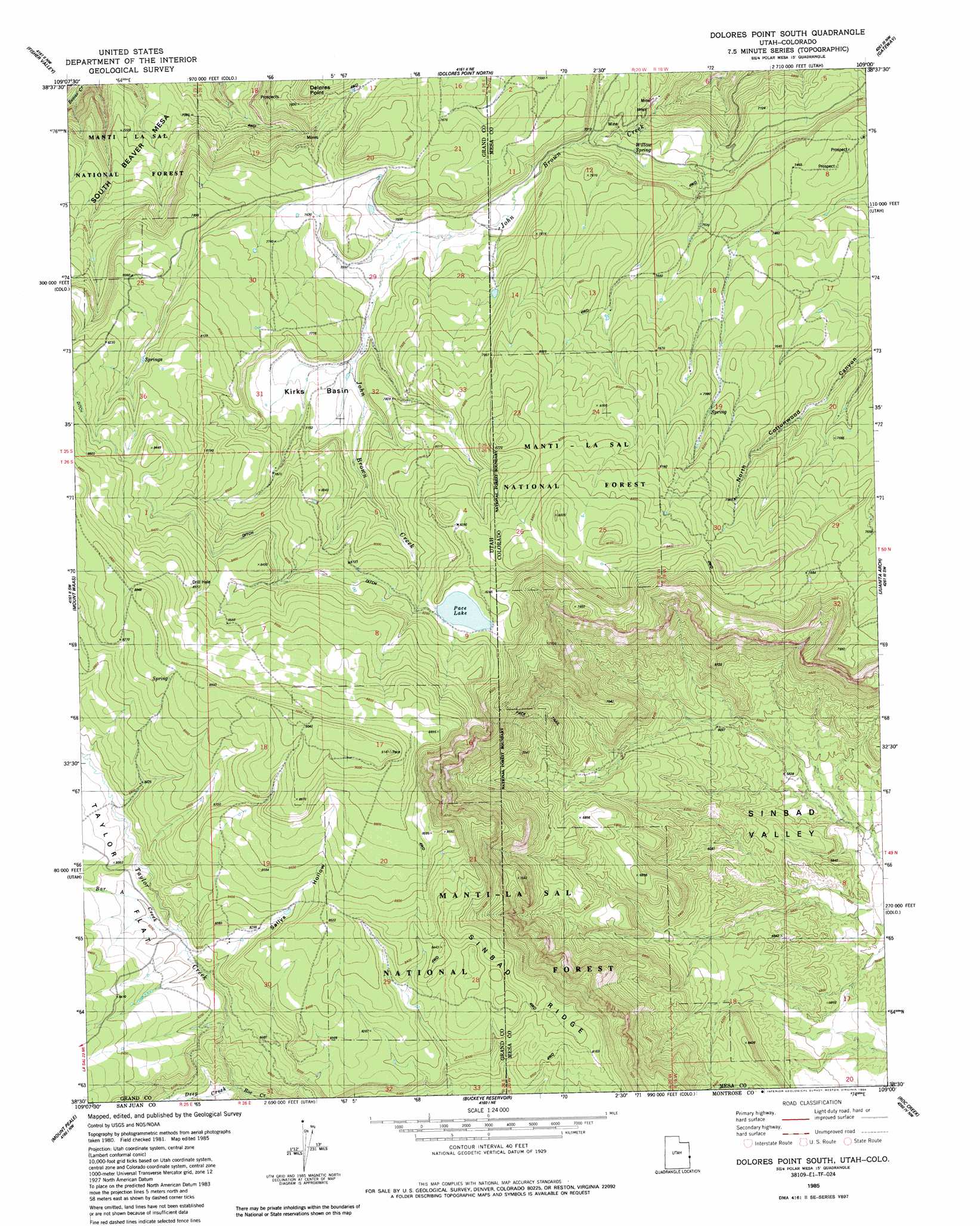
USGS Topo Quad 38109e1 - 1:24,000 scale
| Topo Map Name: | Dolores Point South |
| USGS Topo Quad ID: | 38109e1 |
| Print Size: | ca. 21 1/4" wide x 27" high |
| Southeast Coordinates: | 38.5° N latitude / 109° W longitude |
| Map Center Coordinates: | 38.5625° N latitude / 109.0625° W longitude |
| U.S. States: | UT, CO |
| Filename: | o38109e1.jpg |
| Download Map JPG Image: | Dolores Point South topo map 1:24,000 scale |
| Map Type: | Topographic |
| Topo Series: | 7.5´ |
| Map Scale: | 1:24,000 |
| Source of Map Images: | United States Geological Survey (USGS) |
| Alternate Map Versions: |
Mt. Waas 4 SE CO 1954, updated 1955 Download PDF Buy paper map Dolores Point South CO 1985, updated 1986 Download PDF Buy paper map Dolores Point South CO 1985, updated 1986 Download PDF Buy paper map Dolores Point South CO 2001, updated 2004 Download PDF Buy paper map Dolores Point South CO 2011 Download PDF Buy paper map Dolores Point South CO 2013 Download PDF Buy paper map Dolores Point South CO 2016 Download PDF Buy paper map |
| FStopo: | US Forest Service topo Dolores Point South is available: Download FStopo PDF Download FStopo TIF |
1:24,000 Topo Quads surrounding Dolores Point South
Dewey |
Blue Chief Mesa |
Steamboat Mesa |
Two V Basin |
Fish Creek |
Fisher Towers |
Fisher Valley |
Dolores Point North |
Gateway |
Pine Mountain |
Warner Lake |
Mount Waas |
Dolores Point South |
Juanita Arch |
Calamity Mesa |
Mount Tukuhnikivatz |
Mount Peale |
Buckeye Reservoir |
Roc Creek |
Red Canyon |
La Sal West |
La Sal East |
Wray Mesa |
Paradox |
Davis Mesa |
> Back to 38109e1 at 1:100,000 scale
> Back to 38108a1 at 1:250,000 scale
> Back to U.S. Topo Maps home
Dolores Point South topo map: Gazetteer
Dolores Point South: Basins
Kirks Basin elevation 2344m 7690′Dolores Point South: Dams
Pace Dam elevation 2468m 8097′Dolores Point South: Mines
Homestead Mine elevation 2236m 7335′Lucky Day Mine elevation 2197m 7208′
Packrat Group Mine elevation 2236m 7335′
The Duke Mine elevation 2345m 7693′
Dolores Point South: Reservoirs
Pace Lake elevation 2488m 8162′Dolores Point South: Ridges
Sinbad Ridge elevation 2536m 8320′Dolores Point South: Springs
Willow Spring elevation 2205m 7234′Dolores Point South: Streams
Bar A Creek elevation 2486m 8156′Bear Creek elevation 2405m 7890′
Deep Creek elevation 2336m 7664′
John Brown Creek elevation 1965m 6446′
Taylor Creek elevation 2344m 7690′
Dolores Point South: Valleys
Sallys Hollow elevation 2475m 8120′Dolores Point South digital topo map on disk
Buy this Dolores Point South topo map showing relief, roads, GPS coordinates and other geographical features, as a high-resolution digital map file on DVD: