Meadow Topo Map Utah
To zoom in, hover over the map of Meadow
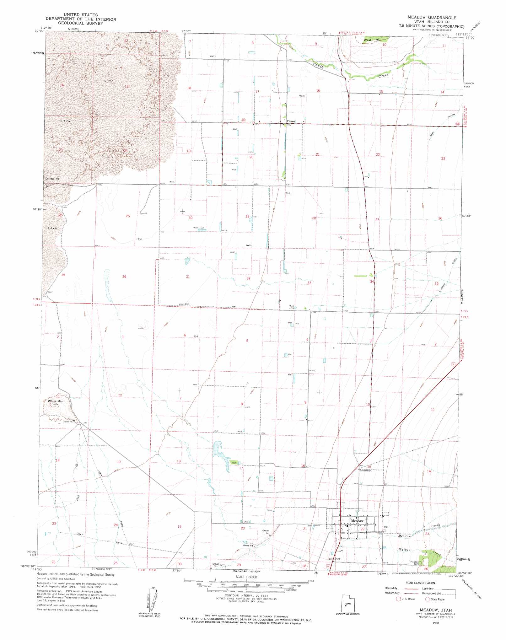
USGS Topo Quad 38112h4 - 1:24,000 scale
| Topo Map Name: | Meadow |
| USGS Topo Quad ID: | 38112h4 |
| Print Size: | ca. 21 1/4" wide x 27" high |
| Southeast Coordinates: | 38.875° N latitude / 112.375° W longitude |
| Map Center Coordinates: | 38.9375° N latitude / 112.4375° W longitude |
| U.S. State: | UT |
| Filename: | o38112h4.jpg |
| Download Map JPG Image: | Meadow topo map 1:24,000 scale |
| Map Type: | Topographic |
| Topo Series: | 7.5´ |
| Map Scale: | 1:24,000 |
| Source of Map Images: | United States Geological Survey (USGS) |
| Alternate Map Versions: |
Meadow UT 1960, updated 1962 Download PDF Buy paper map Meadow UT 2011 Download PDF Buy paper map Meadow UT 2014 Download PDF Buy paper map |
1:24,000 Topo Quads surrounding Meadow
Sunstone Knoll |
Pavant Butte North |
Mccornick |
Duggins Creek |
Scipio Pass |
Clear Lake |
Pavant Butte South |
The Sink |
Holden |
Coffee Peak |
Sand Ridge |
Tabernacle Hill |
Meadow |
Fillmore |
Mount Catherine |
Black Point |
Sixmile Point |
Kanosh |
Sunset Peak |
White Pine Peak |
Antelope Valley |
Dog Valley Peak |
Red Ridge |
Joseph Peak |
Elsinore |
> Back to 38112e1 at 1:100,000 scale
> Back to 38112a1 at 1:250,000 scale
> Back to U.S. Topo Maps home
Meadow topo map: Gazetteer
Meadow: Populated Places
Flowell elevation 1435m 4708′Meadow elevation 1475m 4839′
Meadow: Streams
Meadow Creek elevation 1476m 4842′Pine Creek elevation 1488m 4881′
Walker Creek elevation 1475m 4839′
Meadow: Summits
White Mountain elevation 1472m 4829′Meadow digital topo map on disk
Buy this Meadow topo map showing relief, roads, GPS coordinates and other geographical features, as a high-resolution digital map file on DVD: