Peavine Ranch Topo Map Nevada
To zoom in, hover over the map of Peavine Ranch
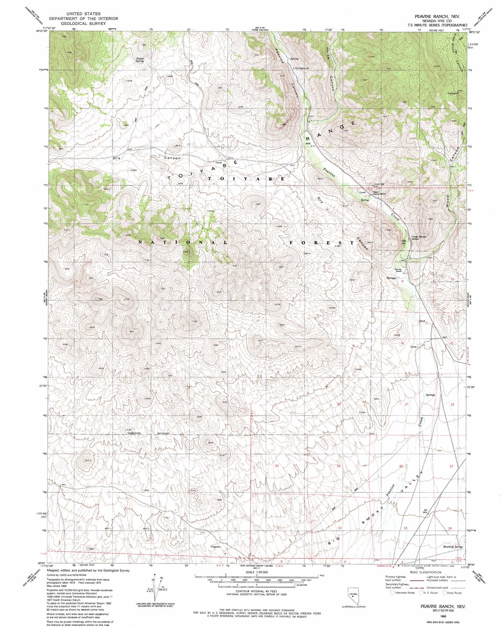
USGS Topo Quad 38117e3 - 1:24,000 scale
| Topo Map Name: | Peavine Ranch |
| USGS Topo Quad ID: | 38117e3 |
| Print Size: | ca. 21 1/4" wide x 27" high |
| Southeast Coordinates: | 38.5° N latitude / 117.25° W longitude |
| Map Center Coordinates: | 38.5625° N latitude / 117.3125° W longitude |
| U.S. State: | NV |
| Filename: | o38117e3.jpg |
| Download Map JPG Image: | Peavine Ranch topo map 1:24,000 scale |
| Map Type: | Topographic |
| Topo Series: | 7.5´ |
| Map Scale: | 1:24,000 |
| Source of Map Images: | United States Geological Survey (USGS) |
| Alternate Map Versions: |
Peavine Ranch NV 1980, updated 1980 Download PDF Buy paper map Peavine Ranch NV 1980, updated 1990 Download PDF Buy paper map Peavine Ranch NV 2011 Download PDF Buy paper map Peavine Ranch NV 2014 Download PDF Buy paper map |
| FStopo: | US Forest Service topo Peavine Ranch is available: Download FStopo PDF Download FStopo TIF |
1:24,000 Topo Quads surrounding Peavine Ranch
Grantsville |
Bakeoven Creek |
Arc Dome |
Carvers |
Carvers Se |
Mount Ardivey |
Farrington Canyon |
Toms Canyon |
Pablo Canyon Ranch |
Round Mountain |
Cloverdale Ranch |
Secret Basin |
Peavine Ranch |
Seyler Peak |
Manhattan |
Outlaw Springs Ne |
Rainier Mountain |
San Antonio Ranch |
Baxter Spring Nw |
Baxter Spring |
Outlaw Springs Se |
San Antonio Ranch Sw |
Liberty Springs |
San Antonio Well |
Henrys Well |
> Back to 38117e1 at 1:100,000 scale
> Back to 38116a1 at 1:250,000 scale
> Back to U.S. Topo Maps home
Peavine Ranch topo map: Gazetteer
Peavine Ranch: Populated Places
Indian Springs (historical) elevation 1753m 5751′Peavine (historical) elevation 1817m 5961′
Peavine Ranch: Post Offices
Peavine Post Office (historical) elevation 1817m 5961′Peavine Ranch: Springs
Mustang Spring elevation 1696m 5564′Seyler Spring elevation 2060m 6758′
Peavine Ranch: Streams
Horse Creek elevation 1899m 6230′Peavine Ranch: Valleys
Horse Canyon elevation 1899m 6230′Peavine Canyon elevation 1755m 5757′
Wood Canyon elevation 1837m 6026′
Peavine Ranch digital topo map on disk
Buy this Peavine Ranch topo map showing relief, roads, GPS coordinates and other geographical features, as a high-resolution digital map file on DVD: