Scottville Topo Map Illinois
To zoom in, hover over the map of Scottville
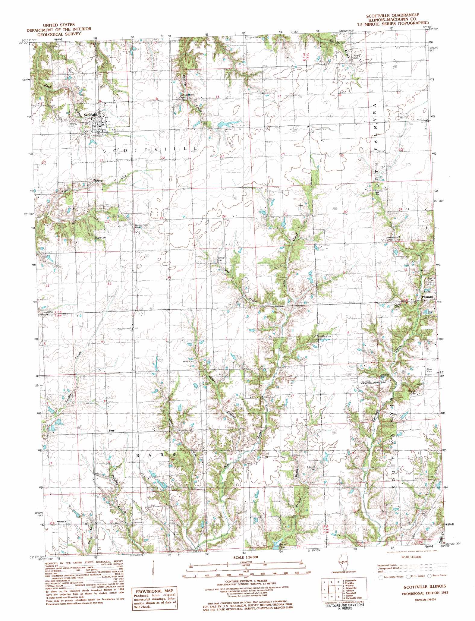
USGS Topo Quad 39090d1 - 1:24,000 scale
| Topo Map Name: | Scottville |
| USGS Topo Quad ID: | 39090d1 |
| Print Size: | ca. 21 1/4" wide x 27" high |
| Southeast Coordinates: | 39.375° N latitude / 90° W longitude |
| Map Center Coordinates: | 39.4375° N latitude / 90.0625° W longitude |
| U.S. State: | IL |
| Filename: | o39090d1.jpg |
| Download Map JPG Image: | Scottville topo map 1:24,000 scale |
| Map Type: | Topographic |
| Topo Series: | 7.5´ |
| Map Scale: | 1:24,000 |
| Source of Map Images: | United States Geological Survey (USGS) |
| Alternate Map Versions: |
Scottville IL 1983, updated 1984 Download PDF Buy paper map Scottville IL 2012 Download PDF Buy paper map Scottville IL 2015 Download PDF Buy paper map |
1:24,000 Topo Quads surrounding Scottville
Lynnville |
Jacksonville |
Alexander |
New Berlin |
Loami |
Manchester |
Nortonville |
Franklin |
Waverly |
Virden North |
Roodhouse East |
Athensville |
Scottville |
Palmyra |
Virden South |
Daum |
Greenfield |
Hettick |
Carlinville West |
Carlinville East |
Jerseyville North |
Medora |
Summerville |
Plainview |
Gillespie North |
> Back to 39090a1 at 1:100,000 scale
> Back to 39090a1 at 1:250,000 scale
> Back to U.S. Topo Maps home
Scottville topo map: Gazetteer
Scottville: Airports
James W Andrew Airport elevation 201m 659′Scottville: Dams
MSDGC Dam Number 5 elevation 211m 692′Scottville: Populated Places
Barr elevation 203m 666′Scottville elevation 201m 659′
Scottville: Post Offices
Scottville Post Office elevation 201m 659′Scottville: Streams
Goose Creek elevation 171m 561′Hicks Creek elevation 187m 613′
Little Negro Lick elevation 181m 593′
Miller Branch elevation 177m 580′
Scottville digital topo map on disk
Buy this Scottville topo map showing relief, roads, GPS coordinates and other geographical features, as a high-resolution digital map file on DVD: