Palmyra Topo Map Illinois
To zoom in, hover over the map of Palmyra
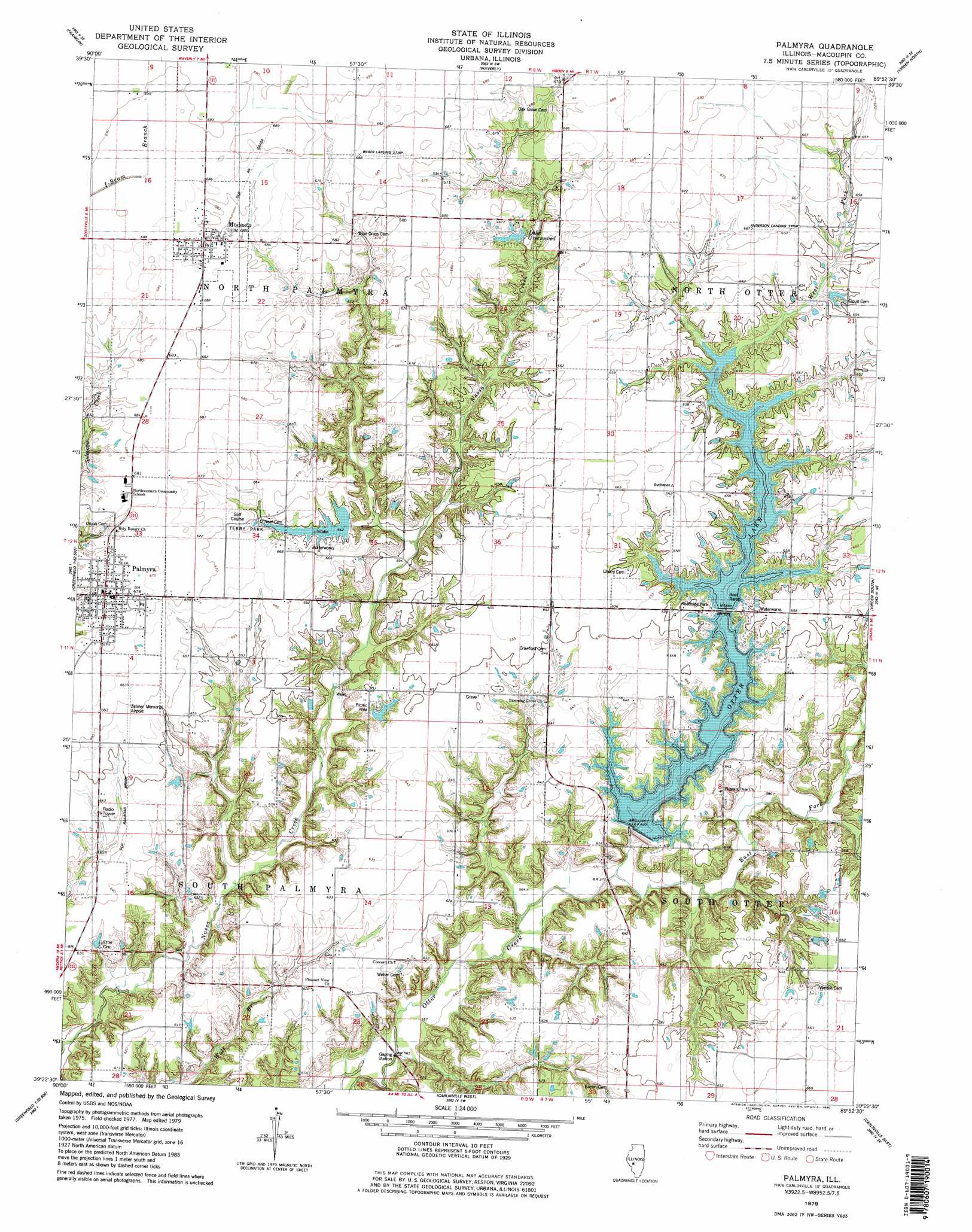
USGS Topo Quad 39089d8 - 1:24,000 scale
| Topo Map Name: | Palmyra |
| USGS Topo Quad ID: | 39089d8 |
| Print Size: | ca. 21 1/4" wide x 27" high |
| Southeast Coordinates: | 39.375° N latitude / 89.875° W longitude |
| Map Center Coordinates: | 39.4375° N latitude / 89.9375° W longitude |
| U.S. State: | IL |
| Filename: | o39089d8.jpg |
| Download Map JPG Image: | Palmyra topo map 1:24,000 scale |
| Map Type: | Topographic |
| Topo Series: | 7.5´ |
| Map Scale: | 1:24,000 |
| Source of Map Images: | United States Geological Survey (USGS) |
| Alternate Map Versions: |
Palmyra IL 1979, updated 1980 Download PDF Buy paper map Palmyra IL 1979, updated 1980 Download PDF Buy paper map Palmyra IL 1998, updated 2002 Download PDF Buy paper map Palmyra IL 2012 Download PDF Buy paper map Palmyra IL 2015 Download PDF Buy paper map |
1:24,000 Topo Quads surrounding Palmyra
Jacksonville |
Alexander |
New Berlin |
Loami |
Chatham |
Nortonville |
Franklin |
Waverly |
Virden North |
Divernon |
Athensville |
Scottville |
Palmyra |
Virden South |
Farmersville |
Greenfield |
Hettick |
Carlinville West |
Carlinville East |
Atwater |
Medora |
Summerville |
Plainview |
Gillespie North |
Litchfield |
> Back to 39089a1 at 1:100,000 scale
> Back to 39088a1 at 1:250,000 scale
> Back to U.S. Topo Maps home
Palmyra topo map: Gazetteer
Palmyra: Airports
Anderson Landing Strip elevation 201m 659′Nelson Weber Airport elevation 209m 685′
Zelmer Memorial Airpark elevation 201m 659′
Palmyra: Dams
Otter Lake Dam elevation 187m 613′Palmyra-Modesto City Lake Dam elevation 196m 643′
Palmyra: Parks
Goodes Woods Nature Preserve elevation 201m 659′Terry Park elevation 198m 649′
Palmyra: Populated Places
Modesto elevation 208m 682′Palmyra elevation 205m 672′
Palmyra: Reservoirs
Lake Greenwood elevation 198m 649′Otter Lake elevation 187m 613′
Palmyra-Modesto City Lake elevation 196m 643′
Palmyra: Streams
East Fork Otter Creek elevation 171m 561′West Fork Otter Creek elevation 171m 561′
Palmyra digital topo map on disk
Buy this Palmyra topo map showing relief, roads, GPS coordinates and other geographical features, as a high-resolution digital map file on DVD:
Northern Illinois, Northern Indiana & Southwestern Michigan
Buy digital topo maps: Northern Illinois, Northern Indiana & Southwestern Michigan