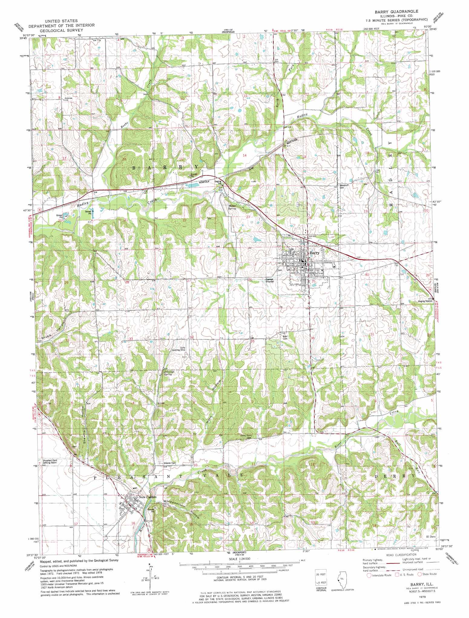
Barry Topo Map Illinois
To zoom in, hover over the map of Barry
USGS Topo Quad 39091f1 - 1:24,000 scale
| Topo Map Name: | Barry |
| USGS Topo Quad ID: | 39091f1 |
| Print Size: | ca. 21 1/4" wide x 27" high |
| Southeast Coordinates: | 39.625° N latitude / 91° W longitude |
| Map Center Coordinates: | 39.6875° N latitude / 91.0625° W longitude |
| U.S. State: | IL |
| Filename: | o39091f1.jpg |
| Download Map JPG Image: | Barry topo map 1:24,000 scale |
| Map Type: | Topographic |
| Topo Series: | 7.5´ |
| Map Scale: | 1:24,000 |
| Source of Map Images: | United States Geological Survey (USGS) |
| Alternate Map Versions: |
Barry IL 1978, updated 1978 Download PDF Buy paper map Barry IL 1998, updated 2002 Download PDF Buy paper map Barry IL 2012 Download PDF Buy paper map Barry IL 2015 Download PDF Buy paper map |
1:24,000 Topo Quads surrounding Barry
Quincy East |
Columbus |
Liberty |
Kellerville |
Mount Sterling |
Marblehead |
Payson |
Richfield |
Fishhook |
Perry West |
Hannibal East |
Hull |
Barry |
Baylis |
New Salem |
Hannibal Se |
Ashburn |
Rockport |
Summer Hill |
Pittsfield |
Frankford |
Vera |
Louisana |
Pleasant Hill West |
Pleasant Hill East |
> Back to 39091e1 at 1:100,000 scale
> Back to 39090a1 at 1:250,000 scale
> Back to U.S. Topo Maps home
Barry topo map: Gazetteer
Barry: Airports
Barry Balloonport elevation 228m 748′Gully Landing Strip elevation 211m 692′
Potter Airport elevation 208m 682′
Barry: Parks
Barry Historic District elevation 221m 725′Barry: Populated Places
Barry elevation 218m 715′New Canton elevation 145m 475′
Barry: Springs
Jennings Spring elevation 188m 616′Weber Spring elevation 173m 567′
Barry: Streams
Beebe Creek elevation 154m 505′Bull Run elevation 168m 551′
North Fork Hadley Creek elevation 171m 561′
Barry: Valleys
Horn Hollow elevation 150m 492′Shewhart Hollow elevation 152m 498′
Whippoorwill Hollow elevation 144m 472′
Barry digital topo map on disk
Buy this Barry topo map showing relief, roads, GPS coordinates and other geographical features, as a high-resolution digital map file on DVD: