New Salem Topo Map Illinois
To zoom in, hover over the map of New Salem
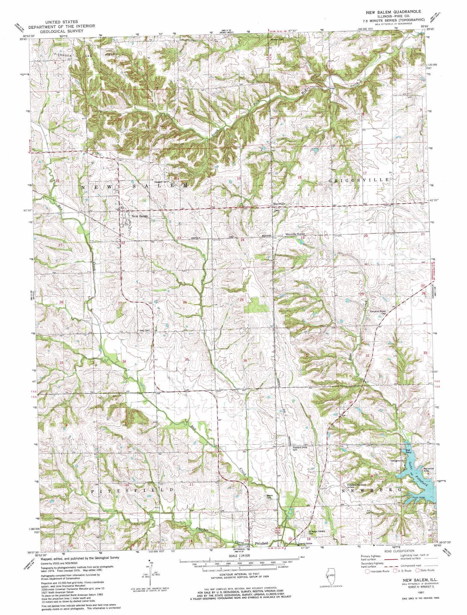
USGS Topo Quad 39090f7 - 1:24,000 scale
| Topo Map Name: | New Salem |
| USGS Topo Quad ID: | 39090f7 |
| Print Size: | ca. 21 1/4" wide x 27" high |
| Southeast Coordinates: | 39.625° N latitude / 90.75° W longitude |
| Map Center Coordinates: | 39.6875° N latitude / 90.8125° W longitude |
| U.S. State: | IL |
| Filename: | o39090f7.jpg |
| Download Map JPG Image: | New Salem topo map 1:24,000 scale |
| Map Type: | Topographic |
| Topo Series: | 7.5´ |
| Map Scale: | 1:24,000 |
| Source of Map Images: | United States Geological Survey (USGS) |
| Alternate Map Versions: |
New Salem IL 1981, updated 1981 Download PDF Buy paper map New Salem IL 1998, updated 2001 Download PDF Buy paper map New Salem IL 2012 Download PDF Buy paper map New Salem IL 2015 Download PDF Buy paper map |
1:24,000 Topo Quads surrounding New Salem
Liberty |
Kellerville |
Mount Sterling |
Versailles |
Cooperstown |
Richfield |
Fishhook |
Perry West |
Perry East |
Meredosia |
Barry |
Baylis |
New Salem |
Griggsville |
Florence |
Rockport |
Summer Hill |
Pittsfield |
Milton |
Bedford |
Louisana |
Pleasant Hill West |
Pleasant Hill East |
Pearl West |
Pearl East |
> Back to 39090e1 at 1:100,000 scale
> Back to 39090a1 at 1:250,000 scale
> Back to U.S. Topo Maps home
New Salem topo map: Gazetteer
New Salem: Airports
Pittsfield Penstone Municipal Airport elevation 213m 698′New Salem: Populated Places
Dutton (historical) elevation 230m 754′Maysville elevation 216m 708′
New Salem elevation 239m 784′
New Salem: Streams
Panther Creek elevation 198m 649′New Salem digital topo map on disk
Buy this New Salem topo map showing relief, roads, GPS coordinates and other geographical features, as a high-resolution digital map file on DVD: