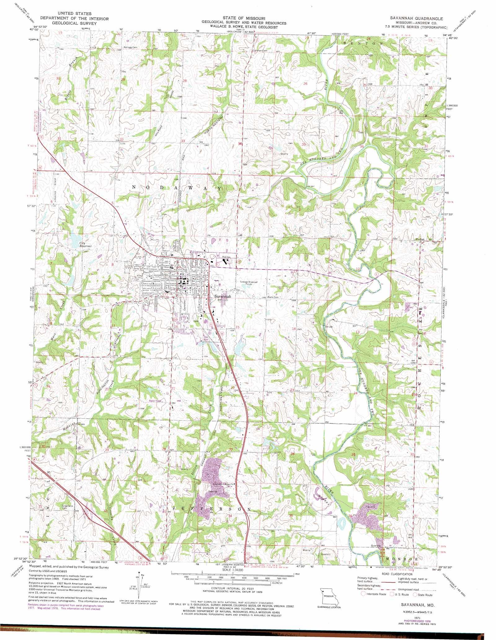
Savannah Topo Map Missouri
To zoom in, hover over the map of Savannah
USGS Topo Quad 39094h7 - 1:24,000 scale
| Topo Map Name: | Savannah |
| USGS Topo Quad ID: | 39094h7 |
| Print Size: | ca. 21 1/4" wide x 27" high |
| Southeast Coordinates: | 39.875° N latitude / 94.75° W longitude |
| Map Center Coordinates: | 39.9375° N latitude / 94.8125° W longitude |
| U.S. State: | MO |
| Filename: | o39094h7.jpg |
| Download Map JPG Image: | Savannah topo map 1:24,000 scale |
| Map Type: | Topographic |
| Topo Series: | 7.5´ |
| Map Scale: | 1:24,000 |
| Source of Map Images: | United States Geological Survey (USGS) |
| Alternate Map Versions: |
Savannah MO 1971, updated 1973 Download PDF Buy paper map Savannah MO 1971, updated 1978 Download PDF Buy paper map Savannah MO 2012 Download PDF Buy paper map Savannah MO 2014 Download PDF Buy paper map |
1:24,000 Topo Quads surrounding Savannah
Maitland |
Bolckow Nw |
Barnard |
Guilford |
Stanberry |
New Point |
Fillmore |
Blockow |
Whitesville |
King City |
Forbes |
Amazonia |
Savannah |
Helena |
Union Star |
Troy |
Wathena |
Saint Joseph North |
Cosby |
Clarksdale |
Atchison Ne |
Halls |
Saint Joseph South |
Agency |
Hemple |
> Back to 39094e1 at 1:100,000 scale
> Back to 39094a1 at 1:250,000 scale
> Back to U.S. Topo Maps home
Savannah topo map: Gazetteer
Savannah: Airports
Worth Airport elevation 341m 1118′Savannah: Dams
Andrew County Lake Dam elevation 307m 1007′Ford Lake Dam elevation 301m 987′
Kelley Lake Dam elevation 296m 971′
Savannah City Reservoir Dam elevation 311m 1020′
Savannah: Populated Places
Kodiak elevation 304m 997′Savannah elevation 337m 1105′
Savannah: Reservoirs
Andrew County Lake elevation 307m 1007′City Reservoir elevation 311m 1020′
Ford Lake elevation 301m 987′
Kelley Lake elevation 296m 971′
Savannah digital topo map on disk
Buy this Savannah topo map showing relief, roads, GPS coordinates and other geographical features, as a high-resolution digital map file on DVD: