Hanover Se Topo Map Kansas
To zoom in, hover over the map of Hanover Se
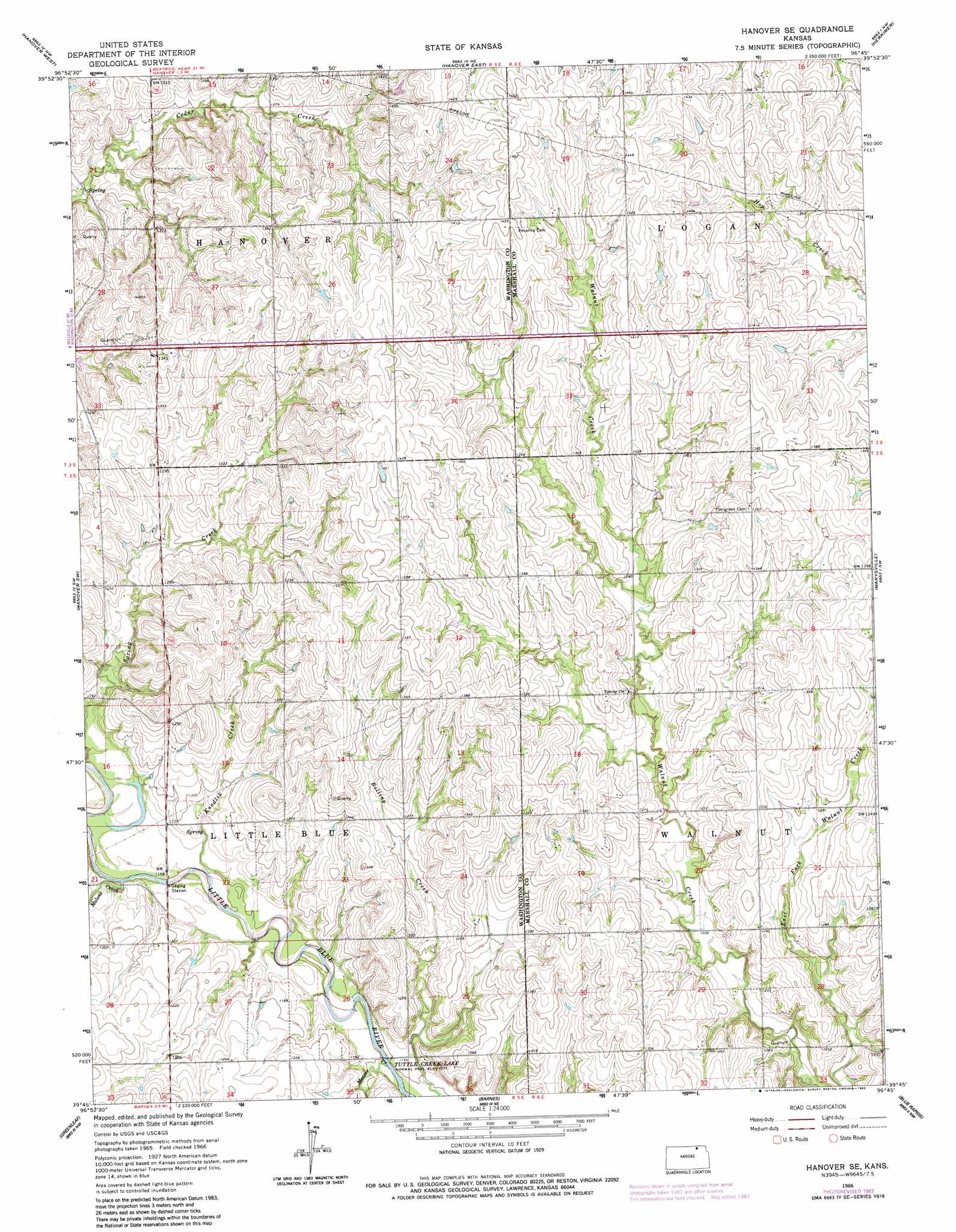
USGS Topo Quad 39096g7 - 1:24,000 scale
| Topo Map Name: | Hanover Se |
| USGS Topo Quad ID: | 39096g7 |
| Print Size: | ca. 21 1/4" wide x 27" high |
| Southeast Coordinates: | 39.75° N latitude / 96.75° W longitude |
| Map Center Coordinates: | 39.8125° N latitude / 96.8125° W longitude |
| U.S. State: | KS |
| Filename: | o39096g7.jpg |
| Download Map JPG Image: | Hanover Se topo map 1:24,000 scale |
| Map Type: | Topographic |
| Topo Series: | 7.5´ |
| Map Scale: | 1:24,000 |
| Source of Map Images: | United States Geological Survey (USGS) |
| Alternate Map Versions: |
Hanover SE KS 1966, updated 1967 Download PDF Buy paper map Hanover SE KS 1966, updated 1983 Download PDF Buy paper map Hanover SE KS 2009 Download PDF Buy paper map Hanover SE KS 2012 Download PDF Buy paper map Hanover SE KS 2016 Download PDF Buy paper map |
1:24,000 Topo Quads surrounding Hanover Se
Endicott |
Diller |
Odell |
Wymore |
Barneston |
Washington Ne |
Hanover West |
Hanover East |
Herkimer |
Oketo |
Washington |
Hanover Sw |
Hanover Se |
Marysville |
Home |
Linn |
Greenleaf |
Barnes |
Blue Rapids |
Blue Rapids Ne |
Linn Se |
Kimeo |
Greenleaf Se |
Blue Rapids Sw |
Blue Rapids Se |
> Back to 39096e1 at 1:100,000 scale
> Back to 39096a1 at 1:250,000 scale
> Back to U.S. Topo Maps home
Hanover Se topo map: Gazetteer
Hanover Se: Streams
Knedlik Creek elevation 351m 1151′Malone Creek elevation 351m 1151′
Mercer Creek elevation 348m 1141′
Hanover Se digital topo map on disk
Buy this Hanover Se topo map showing relief, roads, GPS coordinates and other geographical features, as a high-resolution digital map file on DVD: