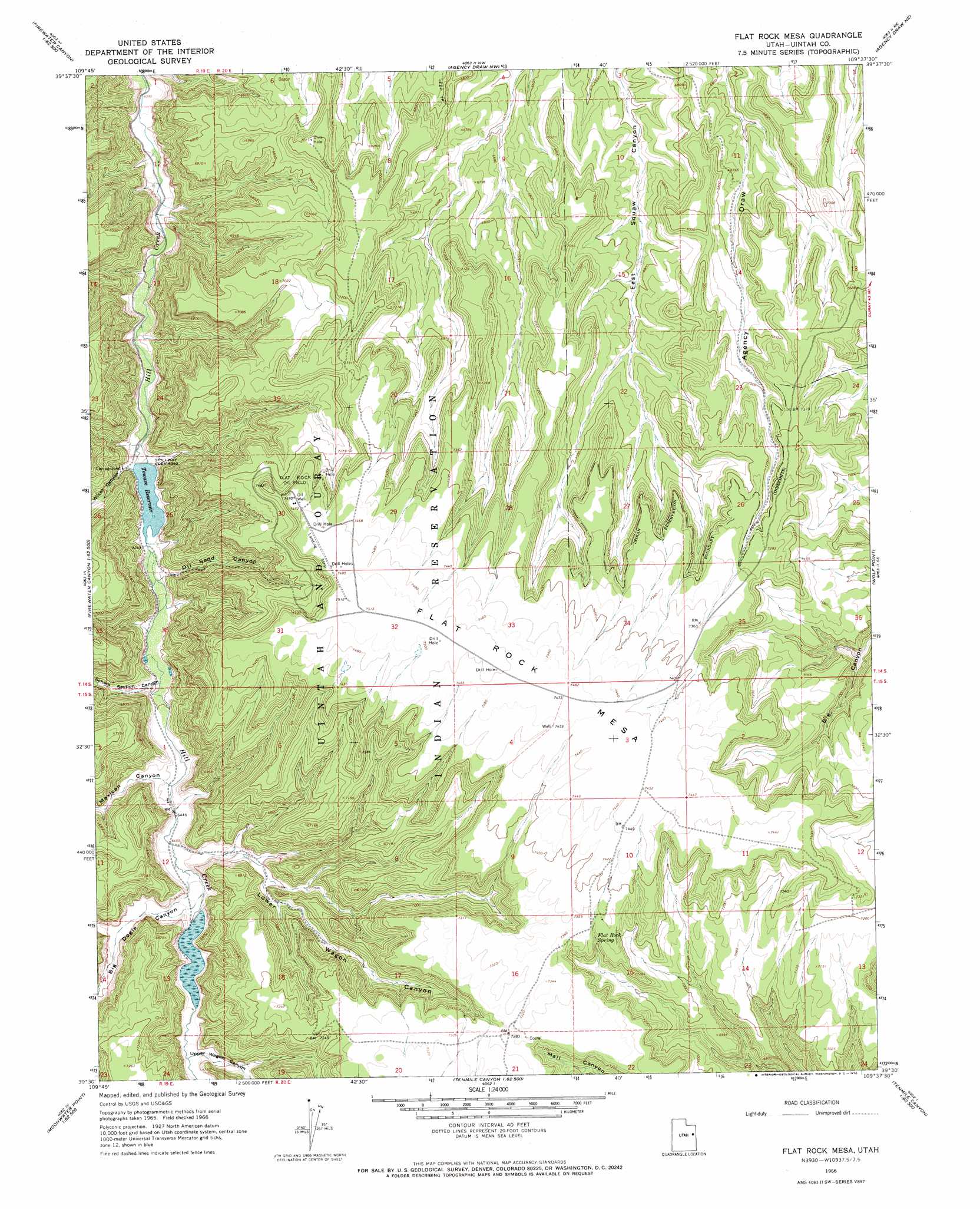
Flat Rock Mesa Topo Map Utah
To zoom in, hover over the map of Flat Rock Mesa
USGS Topo Quad 39109e6 - 1:24,000 scale
| Topo Map Name: | Flat Rock Mesa |
| USGS Topo Quad ID: | 39109e6 |
| Print Size: | ca. 21 1/4" wide x 27" high |
| Southeast Coordinates: | 39.5° N latitude / 109.625° W longitude |
| Map Center Coordinates: | 39.5625° N latitude / 109.6875° W longitude |
| U.S. State: | UT |
| Filename: | o39109e6.jpg |
| Download Map JPG Image: | Flat Rock Mesa topo map 1:24,000 scale |
| Map Type: | Topographic |
| Topo Series: | 7.5´ |
| Map Scale: | 1:24,000 |
| Source of Map Images: | United States Geological Survey (USGS) |
| Alternate Map Versions: |
Flat Rock Mesa UT 1966, updated 1970 Download PDF Buy paper map Flat Rock Mesa UT 2011 Download PDF Buy paper map Flat Rock Mesa UT 2014 Download PDF Buy paper map |
1:24,000 Topo Quads surrounding Flat Rock Mesa
Duches Hole |
Nutters Hole |
Big Pack Mountain |
Big Pack Mountain Se |
Buck Camp Canyon |
Firewater Canyon North |
Dog Knoll |
Agency Draw Nw |
Agency Draw Ne |
Bates Knolls |
Firewater Canyon South |
Wolf Flat |
Flat Rock Mesa |
Wolf Point |
Pine Spring Canyon |
Moonwater Point |
Chicken Fork |
Black Knolls |
Tenmile Canyon North |
Cedar Camp Canyon |
Lion Canyon |
Walker Point |
Supply Canyon |
Tenmile Canyon South |
Preacher Canyon |
> Back to 39109e1 at 1:100,000 scale
> Back to 39108a1 at 1:250,000 scale
> Back to U.S. Topo Maps home
Flat Rock Mesa topo map: Gazetteer
Flat Rock Mesa: Dams
Towave Dam elevation 1927m 6322′Flat Rock Mesa: Oilfields
Flat Rock Oil Field elevation 2277m 7470′Flat Rock Mesa: Pillars
Flat Rock elevation 2263m 7424′Flat Rock Mesa: Reservoirs
Towave Reservoir elevation 1927m 6322′Flat Rock Mesa: Springs
Flat Rock Spring elevation 2220m 7283′Flat Rock Mesa: Summits
Flat Rock Mesa elevation 2279m 7477′Flat Rock Mesa: Valleys
Big Doggie Canyon elevation 1983m 6505′Dry Fork Bull Canyon elevation 2190m 7185′
Little Doggie Canyon elevation 1998m 6555′
Lower Wagon Canyon elevation 1975m 6479′
Mexican Canyon elevation 1966m 6450′
Oil Sand Canyon elevation 1942m 6371′
School Section Canyon elevation 1954m 6410′
Upper Wagon Canyon elevation 2000m 6561′
Wilcox Canyon elevation 1936m 6351′
Flat Rock Mesa digital topo map on disk
Buy this Flat Rock Mesa topo map showing relief, roads, GPS coordinates and other geographical features, as a high-resolution digital map file on DVD: