Salt Marsh Canyon Topo Map Nevada
To zoom in, hover over the map of Salt Marsh Canyon
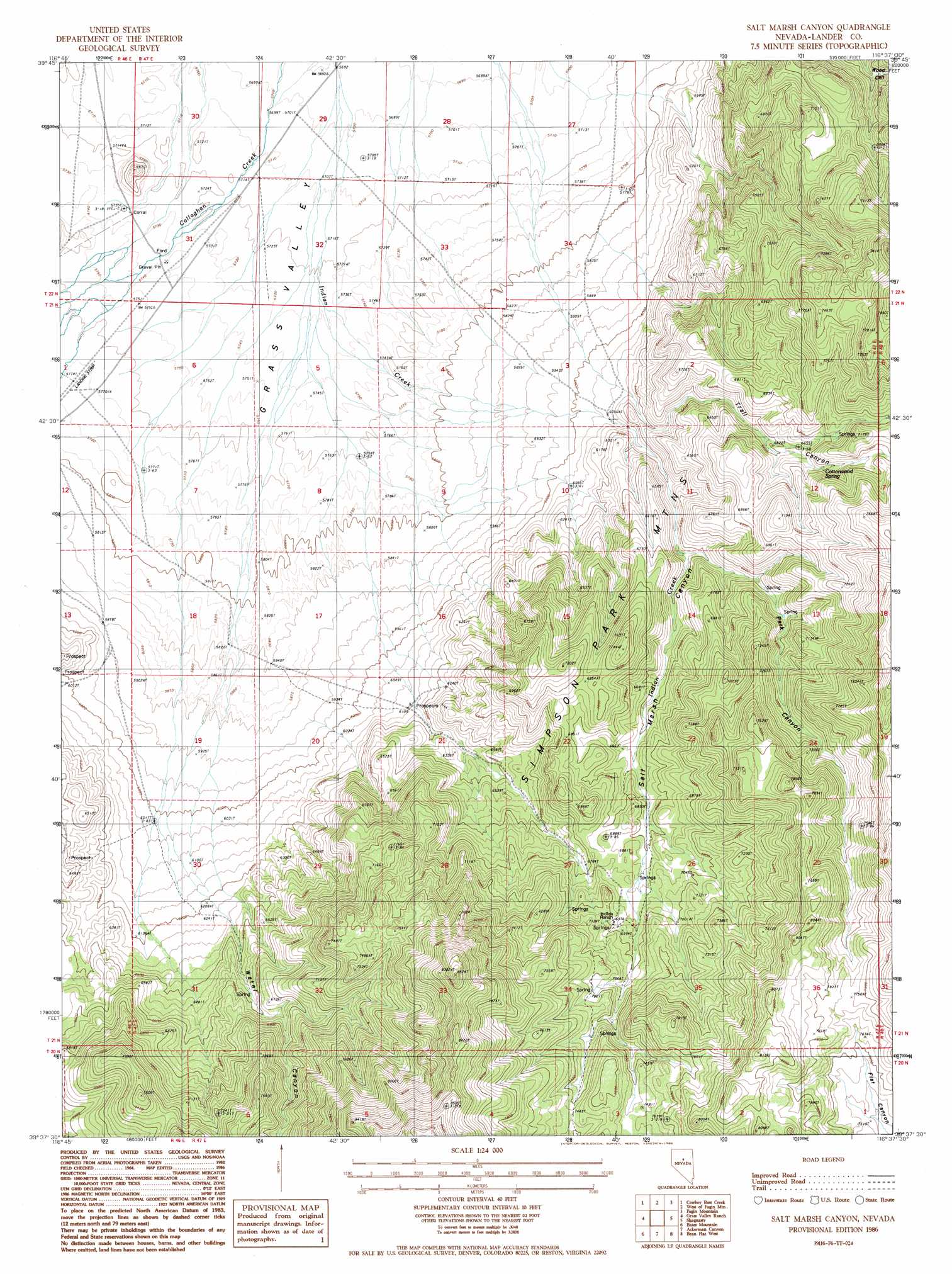
USGS Topo Quad 39116f6 - 1:24,000 scale
| Topo Map Name: | Salt Marsh Canyon |
| USGS Topo Quad ID: | 39116f6 |
| Print Size: | ca. 21 1/4" wide x 27" high |
| Southeast Coordinates: | 39.625° N latitude / 116.625° W longitude |
| Map Center Coordinates: | 39.6875° N latitude / 116.6875° W longitude |
| U.S. State: | NV |
| Filename: | o39116f6.jpg |
| Download Map JPG Image: | Salt Marsh Canyon topo map 1:24,000 scale |
| Map Type: | Topographic |
| Topo Series: | 7.5´ |
| Map Scale: | 1:24,000 |
| Source of Map Images: | United States Geological Survey (USGS) |
| Alternate Map Versions: |
Salt Marsh Canyon NV 1986, updated 1986 Download PDF Buy paper map Salt Marsh Canyon NV 2012 Download PDF Buy paper map Salt Marsh Canyon NV 2015 Download PDF Buy paper map |
1:24,000 Topo Quads surrounding Salt Marsh Canyon
Hall Creek North |
Corral Canyon |
Little Hot Springs |
Walti Hot Springs |
Tonkin Summit |
Hall Creek South |
Cowboy Rest Creek |
West Of Fagin Mountain |
Fagin Mountain |
Three Bar Ranch |
Mount Callaghan |
Grass Valley Ranch |
Salt Marsh Canyon |
Shagnasty |
Bartine Ranch Nw |
Barton Spring |
Bates Mountain |
Ackerman Canyon |
Bean Flat West |
Bean Flat East |
Simpson Park Canyon |
Cape Horn |
Hickison Summit |
Jackrabbit Spring |
Antelope Peak |
> Back to 39116e1 at 1:100,000 scale
> Back to 39116a1 at 1:250,000 scale
> Back to U.S. Topo Maps home
Salt Marsh Canyon topo map: Gazetteer
Salt Marsh Canyon: Springs
Allen Spring elevation 2235m 7332′Cottonwood Spring elevation 2063m 6768′
Liberty Springs elevation 2223m 7293′
Salt Marsh Canyon: Streams
Water Canyon Creek elevation 1769m 5803′Salt Marsh Canyon: Valleys
Park Canyon elevation 1955m 6414′Salt Marsh Canyon elevation 1830m 6003′
Trail Canyon elevation 1856m 6089′
Water Canyon elevation 1890m 6200′
Salt Marsh Canyon digital topo map on disk
Buy this Salt Marsh Canyon topo map showing relief, roads, GPS coordinates and other geographical features, as a high-resolution digital map file on DVD: