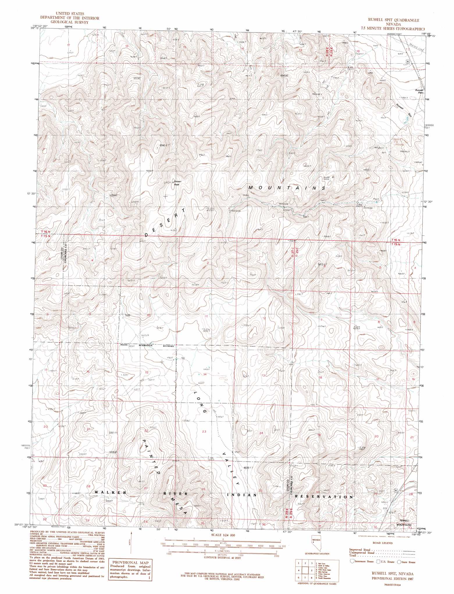
Russell Spit Topo Map Nevada
To zoom in, hover over the map of Russell Spit
USGS Topo Quad 39118b7 - 1:24,000 scale
| Topo Map Name: | Russell Spit |
| USGS Topo Quad ID: | 39118b7 |
| Print Size: | ca. 21 1/4" wide x 27" high |
| Southeast Coordinates: | 39.125° N latitude / 118.75° W longitude |
| Map Center Coordinates: | 39.1875° N latitude / 118.8125° W longitude |
| U.S. State: | NV |
| Filename: | o39118b7.jpg |
| Download Map JPG Image: | Russell Spit topo map 1:24,000 scale |
| Map Type: | Topographic |
| Topo Series: | 7.5´ |
| Map Scale: | 1:24,000 |
| Source of Map Images: | United States Geological Survey (USGS) |
| Alternate Map Versions: |
Russell Spit NV 1987, updated 1987 Download PDF Buy paper map Russell Spit NV 2011 Download PDF Buy paper map Russell Spit NV 2015 Download PDF Buy paper map |
1:24,000 Topo Quads surrounding Russell Spit
Lahontan Dam |
Sheckler Reservoir |
Fallon |
Grimes Point |
Lahontan Mountains |
Hooten Well |
Salt Cave |
South Of Fallon |
Carson Lake |
Bunejug Mountains |
Parker Butte |
Wild Horse Basin |
Russell Spit |
Allen Springs |
Diamond Field Jack Wash |
Hinkson Slough |
Weber Reservoir |
Weber Dam |
Terrill Mountains |
Red Ridge |
Yerington Ne |
Hussman Spring |
Schurz |
Gillis Canyon Nw |
Hu-Pwi Wash |
> Back to 39118a1 at 1:100,000 scale
> Back to 39118a1 at 1:250,000 scale
> Back to U.S. Topo Maps home
Russell Spit topo map: Gazetteer
Russell Spit: Ridges
Russell Spit elevation 1320m 4330′Russell Spit: Summits
Desert Peak elevation 1954m 6410′Russell Spit digital topo map on disk
Buy this Russell Spit topo map showing relief, roads, GPS coordinates and other geographical features, as a high-resolution digital map file on DVD: