Biggs Topo Map California
To zoom in, hover over the map of Biggs
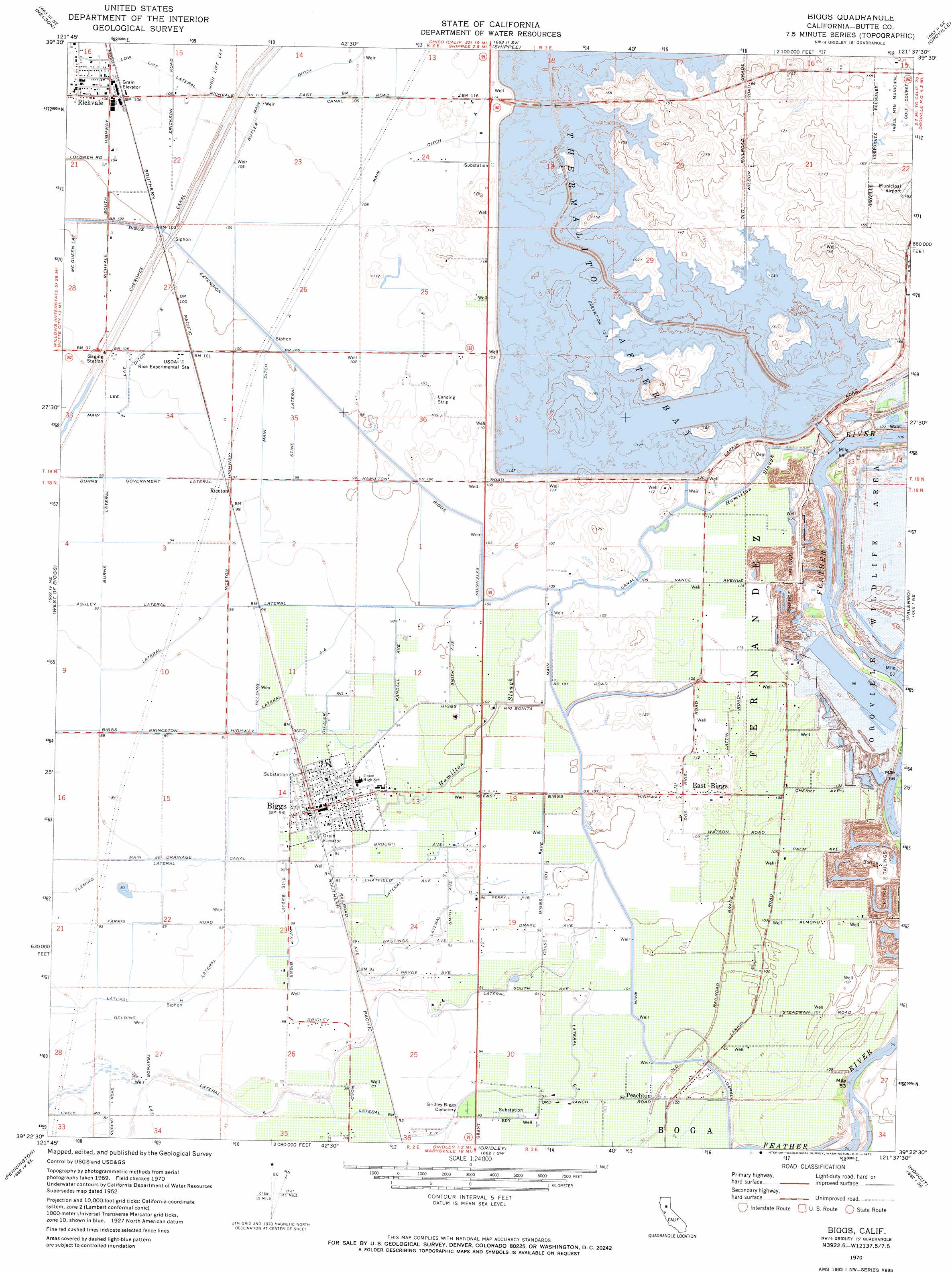
USGS Topo Quad 39121d6 - 1:24,000 scale
| Topo Map Name: | Biggs |
| USGS Topo Quad ID: | 39121d6 |
| Print Size: | ca. 21 1/4" wide x 27" high |
| Southeast Coordinates: | 39.375° N latitude / 121.625° W longitude |
| Map Center Coordinates: | 39.4375° N latitude / 121.6875° W longitude |
| U.S. State: | CA |
| Filename: | o39121d6.jpg |
| Download Map JPG Image: | Biggs topo map 1:24,000 scale |
| Map Type: | Topographic |
| Topo Series: | 7.5´ |
| Map Scale: | 1:24,000 |
| Source of Map Images: | United States Geological Survey (USGS) |
| Alternate Map Versions: |
Biggs CA 1952, updated 1953 Download PDF Buy paper map Biggs CA 1952, updated 1964 Download PDF Buy paper map Biggs CA 1970, updated 1973 Download PDF Buy paper map Biggs CA 1970, updated 1973 Download PDF Buy paper map Biggs CA 2012 Download PDF Buy paper map Biggs CA 2015 Download PDF Buy paper map |
1:24,000 Topo Quads surrounding Biggs
Ord Ferry |
Chico |
Hamlin Canyon |
Cherokee |
Berry Creek |
Llano Seco |
Nelson |
Shippee |
Oroville |
Oroville Dam |
Butte City |
West Of Biggs |
Biggs |
Palermo |
Bangor |
Sanborn Slough |
Pennington |
Gridley |
Honcut |
Loma Rica |
Meridian |
Sutter Buttes |
Sutter |
Yuba City |
Browns Valley |
> Back to 39121a1 at 1:100,000 scale
> Back to 39120a1 at 1:250,000 scale
> Back to U.S. Topo Maps home
Biggs topo map: Gazetteer
Biggs: Airports
Jones/Aviation Airport elevation 33m 108′Biggs: Canals
Biggs Extension elevation 32m 104′Burns Government Lateral elevation 29m 95′
Burns Lateral elevation 29m 95′
Butler Canal elevation 33m 108′
Cherokee Canal elevation 29m 95′
Fleming Lateral elevation 26m 85′
High Lift Lateral elevation 33m 108′
Lateral A elevation 28m 91′
Lateral A-6 elevation 28m 91′
Lateral East elevation 27m 88′
Lateral East-7 elevation 28m 91′
Lateral H elevation 29m 95′
Lateral H-3 elevation 29m 95′
Lee Lateral elevation 30m 98′
Low Lift Lateral elevation 34m 111′
Main Canal elevation 31m 101′
Main Ditch A elevation 31m 101′
Main Ditch B elevation 31m 101′
McQueen Lateral elevation 31m 101′
Stine Lateral elevation 31m 101′
Biggs: Dams
Thermalito Afterbay 1-055 Dam elevation 36m 118′Biggs: Guts
Hamilton Slough elevation 31m 101′Biggs: Populated Places
Biggs elevation 30m 98′East Biggs elevation 37m 121′
Haselbusch (historical) elevation 36m 118′
Hume (historical) elevation 34m 111′
Lorraine (historical) elevation 42m 137′
Peachton elevation 31m 101′
Riceton elevation 30m 98′
Richland (historical) elevation 31m 101′
Richvale elevation 33m 108′
Biggs: Post Offices
Biggs Post Office elevation 30m 98′Biggs: Reservoirs
Thermalito Afterbay elevation 42m 137′Biggs digital topo map on disk
Buy this Biggs topo map showing relief, roads, GPS coordinates and other geographical features, as a high-resolution digital map file on DVD: