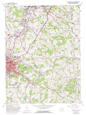
Washington East Topo Map Pennsylvania
To zoom in, hover over the map of Washington East
USGS Topo Quad 40080b2 - 1:24,000 scale
| Topo Map Name: | Washington East |
| USGS Topo Quad ID: | 40080b2 |
| Print Size: | ca. 21 1/4" wide x 27" high |
| Southeast Coordinates: | 40.125° N latitude / 80.125° W longitude |
| Map Center Coordinates: | 40.1875° N latitude / 80.1875° W longitude |
| U.S. State: | PA |
| Filename: | o40080b2.jpg |
| Download Map JPG Image: | Washington East topo map 1:24,000 scale |
| Map Type: | Topographic |
| Topo Series: | 7.5´ |
| Map Scale: | 1:24,000 |
| Source of Map Images: | United States Geological Survey (USGS) |
| Alternate Map Versions: |
Washington East PA 1953, updated 1955 Download PDF Buy paper map Washington East PA 1953, updated 1962 Download PDF Buy paper map Washington East PA 1953, updated 1970 Download PDF Buy paper map Washington East PA 1953, updated 1981 Download PDF Buy paper map Washington East PA 1953, updated 1981 Download PDF Buy paper map Washington East PA 2010 Download PDF Buy paper map Washington East PA 2013 Download PDF Buy paper map Washington East PA 2016 Download PDF Buy paper map |
1:24,000 Topo Quads surrounding Washington East
> Back to 40080a1 at 1:100,000 scale
> Back to 40080a1 at 1:250,000 scale
> Back to U.S. Topo Maps home
Washington East topo map: Gazetteer
Washington East: Airports
Gregg Airport elevation 355m 1164′Ram Airport elevation 355m 1164′
Washington East: Bridges
Clokey Bridge elevation 305m 1000′McLane Bridge elevation 296m 971′
Washington East: Mines
Lindley Mine Air Shaft elevation 303m 994′Washington East: Parks
Brooks Softball Field elevation 359m 1177′Bull Thistle elevation 340m 1115′
Cameron Stadium elevation 318m 1043′
Janet L Swanson Tennis Courts elevation 352m 1154′
Meadows Racetrack elevation 311m 1020′
Washington Park elevation 369m 1210′
Washington East: Populated Places
Allison Park elevation 373m 1223′Boon Terrace elevation 332m 1089′
Braddock elevation 406m 1332′
Clokeyville (historical) elevation 308m 1010′
East Washington elevation 348m 1141′
Eighty Four elevation 315m 1033′
Enterprise elevation 309m 1013′
Gambles elevation 309m 1013′
Glyde elevation 336m 1102′
Hill Church elevation 394m 1292′
Houston elevation 302m 990′
Laboratory elevation 410m 1345′
Linden elevation 298m 977′
Manifold elevation 321m 1053′
McGovern elevation 302m 990′
Meadow Lands elevation 298m 977′
Moniger Heights elevation 336m 1102′
Moninger elevation 298m 977′
Mount Pleasant elevation 410m 1345′
Rich Hill elevation 327m 1072′
Shingiss elevation 293m 961′
South Strabane elevation 362m 1187′
Vance elevation 339m 1112′
Washington elevation 356m 1167′
Wylandville elevation 308m 1010′
Zediker elevation 314m 1030′
Washington East: Post Offices
Central Station Washington Post Office elevation 352m 1154′Houston Post Office elevation 291m 954′
Strabane Post Office (historical) elevation 387m 1269′
Washington East: Reservoirs
Grims Lake elevation 356m 1167′Lake DiCio elevation 323m 1059′
Maplewood Lake elevation 352m 1154′
Washington East: Streams
Chartiers Run elevation 295m 967′Opossum Run elevation 315m 1033′
Plum Run elevation 294m 964′
Washington East: Summits
Hannas Knob elevation 417m 1368′Mount Wheeler elevation 450m 1476′
Washington East: Tunnels
Brady Tunnel elevation 407m 1335′Washington East: Valleys
Allison Hollow elevation 297m 974′Arnold Hollow elevation 300m 984′
Washington East digital topo map on disk
Buy this Washington East topo map showing relief, roads, GPS coordinates and other geographical features, as a high-resolution digital map file on DVD:


