Hartford City East Topo Map Indiana
To zoom in, hover over the map of Hartford City East
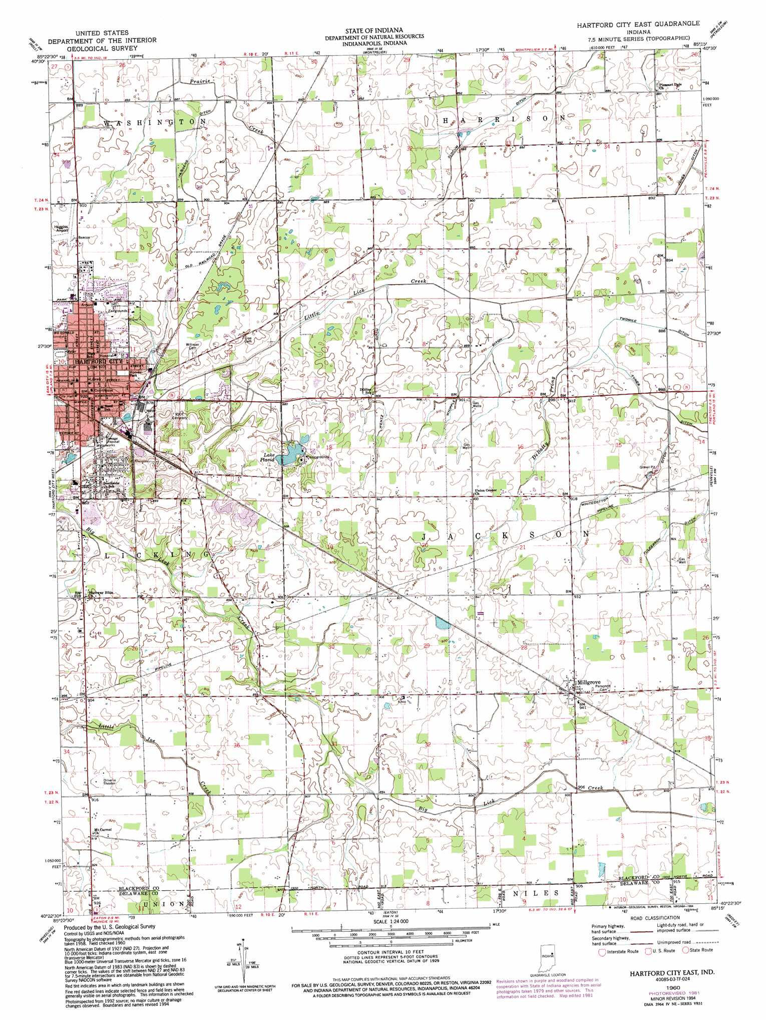
USGS Topo Quad 40085d3 - 1:24,000 scale
| Topo Map Name: | Hartford City East |
| USGS Topo Quad ID: | 40085d3 |
| Print Size: | ca. 21 1/4" wide x 27" high |
| Southeast Coordinates: | 40.375° N latitude / 85.25° W longitude |
| Map Center Coordinates: | 40.4375° N latitude / 85.3125° W longitude |
| U.S. State: | IN |
| Filename: | o40085d3.jpg |
| Download Map JPG Image: | Hartford City East topo map 1:24,000 scale |
| Map Type: | Topographic |
| Topo Series: | 7.5´ |
| Map Scale: | 1:24,000 |
| Source of Map Images: | United States Geological Survey (USGS) |
| Alternate Map Versions: |
Hartford City East IN 1960, updated 1961 Download PDF Buy paper map Hartford City East IN 1960, updated 1982 Download PDF Buy paper map Hartford City East IN 1960, updated 1994 Download PDF Buy paper map Hartford City East IN 2010 Download PDF Buy paper map Hartford City East IN 2013 Download PDF Buy paper map Hartford City East IN 2016 Download PDF Buy paper map |
1:24,000 Topo Quads surrounding Hartford City East
Mount Etna |
Warren |
Liberty Center |
Bluffton |
Linn Grove |
Van Buren |
Roll |
Montpelier |
Petroleum |
Domestic |
Gas City |
Hartford City West |
Hartford City East |
Pennville |
Blaine |
Gaston |
Wheeling |
Eaton |
Redkey |
Ridgeville |
Gilman |
Muncie West |
Muncie East |
Farmland |
Maxville |
> Back to 40085a1 at 1:100,000 scale
> Back to 40084a1 at 1:250,000 scale
> Back to U.S. Topo Maps home
Hartford City East topo map: Gazetteer
Hartford City East: Airports
Minneman Airport elevation 275m 902′Hartford City East: Canals
Fulkerson Ditch elevation 277m 908′Huggens Ditch elevation 271m 889′
Tyner Ditch elevation 272m 892′
Wentz Ditch elevation 271m 889′
Whipple Ditch elevation 273m 895′
Whitecotton Ditch elevation 276m 905′
Hartford City East: Populated Places
Hartford City elevation 280m 918′Hoover Park elevation 280m 918′
Millgrove elevation 286m 938′
Hartford City East: Reservoirs
Lake Placid elevation 278m 912′Hartford City East: Streams
DeBatty Prong elevation 271m 889′Hartford City East digital topo map on disk
Buy this Hartford City East topo map showing relief, roads, GPS coordinates and other geographical features, as a high-resolution digital map file on DVD:
Northern Illinois, Northern Indiana & Southwestern Michigan
Buy digital topo maps: Northern Illinois, Northern Indiana & Southwestern Michigan