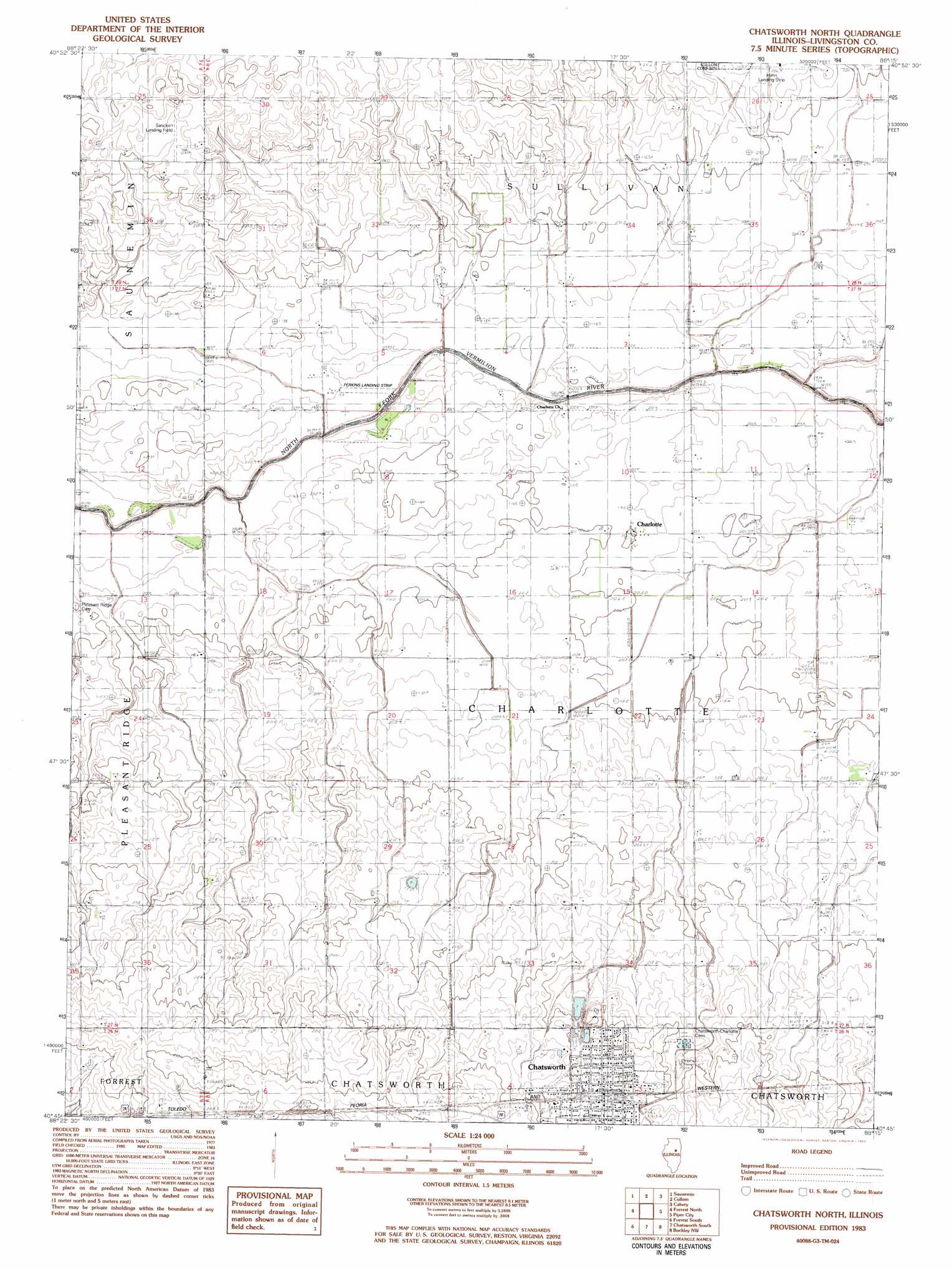
Chatsworth North Topo Map Illinois
To zoom in, hover over the map of Chatsworth North
USGS Topo Quad 40088g3 - 1:24,000 scale
| Topo Map Name: | Chatsworth North |
| USGS Topo Quad ID: | 40088g3 |
| Print Size: | ca. 21 1/4" wide x 27" high |
| Southeast Coordinates: | 40.75° N latitude / 88.25° W longitude |
| Map Center Coordinates: | 40.8125° N latitude / 88.3125° W longitude |
| U.S. State: | IL |
| Filename: | o40088g3.jpg |
| Download Map JPG Image: | Chatsworth North topo map 1:24,000 scale |
| Map Type: | Topographic |
| Topo Series: | 7.5´ |
| Map Scale: | 1:24,000 |
| Source of Map Images: | United States Geological Survey (USGS) |
| Alternate Map Versions: |
Chatsworth North IL 1983 Download PDF Buy paper map Chadsworth North IL 1998, updated 2003 Download PDF Buy paper map Chatsworth North IL 2012 Download PDF Buy paper map Chatsworth North IL 2015 Download PDF Buy paper map |
1:24,000 Topo Quads surrounding Chatsworth North
Odell |
Dwight |
Campus |
Buckingham |
Herscher |
Northeast Pontiac |
Saunemin |
Cullom |
Cabery |
Piper City Ne |
Southeast Pontiac |
Forrest North |
Chatsworth North |
Piper City |
La Hogue |
Fairbury |
Forrest South |
Chatsworth South |
Buckley Nw |
Onarga West |
Colfax |
Sibley |
Melvin West |
Melvin East |
Buckley |
> Back to 40088e1 at 1:100,000 scale
> Back to 40088a1 at 1:250,000 scale
> Back to U.S. Topo Maps home
Chatsworth North topo map: Gazetteer
Chatsworth North: Airports
Hahn Landing Strip elevation 207m 679′Perkins Landing Strip elevation 198m 649′
Sancken Airport elevation 213m 698′
Chatsworth North: Populated Places
Charlotte elevation 201m 659′Chatsworth elevation 222m 728′
Chatsworth North digital topo map on disk
Buy this Chatsworth North topo map showing relief, roads, GPS coordinates and other geographical features, as a high-resolution digital map file on DVD:
Northern Illinois, Northern Indiana & Southwestern Michigan
Buy digital topo maps: Northern Illinois, Northern Indiana & Southwestern Michigan