Long Island Topo Map Illinois
To zoom in, hover over the map of Long Island
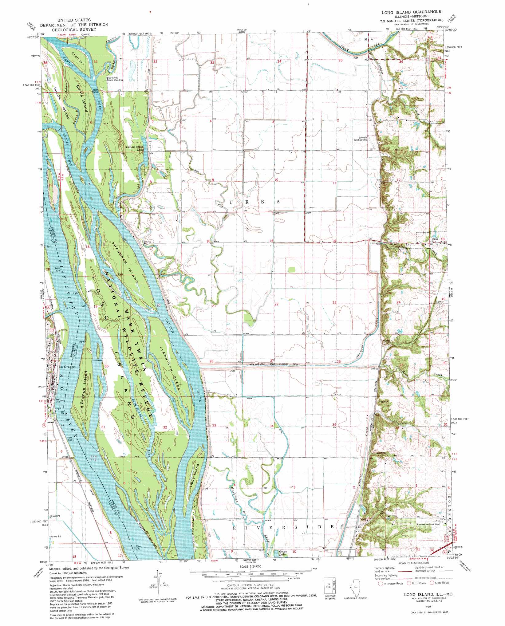
USGS Topo Quad 40091a4 - 1:24,000 scale
| Topo Map Name: | Long Island |
| USGS Topo Quad ID: | 40091a4 |
| Print Size: | ca. 21 1/4" wide x 27" high |
| Southeast Coordinates: | 40° N latitude / 91.375° W longitude |
| Map Center Coordinates: | 40.0625° N latitude / 91.4375° W longitude |
| U.S. States: | IL, MO |
| Filename: | o40091a4.jpg |
| Download Map JPG Image: | Long Island topo map 1:24,000 scale |
| Map Type: | Topographic |
| Topo Series: | 7.5´ |
| Map Scale: | 1:24,000 |
| Source of Map Images: | United States Geological Survey (USGS) |
| Alternate Map Versions: |
Long Island IL 1981, updated 1981 Download PDF Buy paper map Long Island IL 2012 Download PDF Buy paper map Long Island IL 2015 Download PDF Buy paper map |
1:24,000 Topo Quads surrounding Long Island
Saint Patrick |
Kahoka Se |
Warsaw |
Sutter |
West Point |
Benjamin |
Canton |
Lima |
Tioga |
Loraine |
Monticello |
La Grange |
Long Island |
Mendon |
Coatsburg |
Durham |
Maywood |
Quincy West |
Quincy East |
Columbus |
Philadelphia |
Palmyra |
Quincy Sw |
Marblehead |
Payson |
> Back to 40091a1 at 1:100,000 scale
> Back to 40090a1 at 1:250,000 scale
> Back to U.S. Topo Maps home
Long Island topo map: Gazetteer
Long Island: Airports
Blickhan Landing Area elevation 192m 629′Schnelle Airport elevation 147m 482′
Long Island: Canals
Main Ditch elevation 145m 475′Rock and Ursa Creek Diversion Canal elevation 147m 482′
Long Island: Channels
Canton Chute elevation 146m 479′Long Island: Guts
Corner Slough elevation 146m 479′Harkness Branch elevation 143m 469′
Long Island: Islands
Barns Island elevation 145m 475′Chatton Island elevation 146m 479′
Dillon Island elevation 146m 479′
Flannigan Island elevation 146m 479′
Island Number 419 elevation 147m 482′
La Grange Island elevation 147m 482′
Libby Island elevation 145m 475′
Long Island elevation 143m 469′
Shandrew Island elevation 146m 479′
Long Island: Lakes
Indian Grave Lake elevation 146m 479′Long Island: Mines
Campbell Quarry elevation 178m 583′Long Island: Parks
Bear Creek Public Use Area elevation 146m 479′Long Island: Populated Places
La Grange elevation 149m 488′Rock Creek elevation 149m 488′
Long Island: Streams
Jenkins Creek elevation 153m 501′Oyster Branch elevation 146m 479′
Rock Creek elevation 148m 485′
Ursa Creek elevation 151m 495′
Wyaconda River elevation 144m 472′
Long Island digital topo map on disk
Buy this Long Island topo map showing relief, roads, GPS coordinates and other geographical features, as a high-resolution digital map file on DVD: