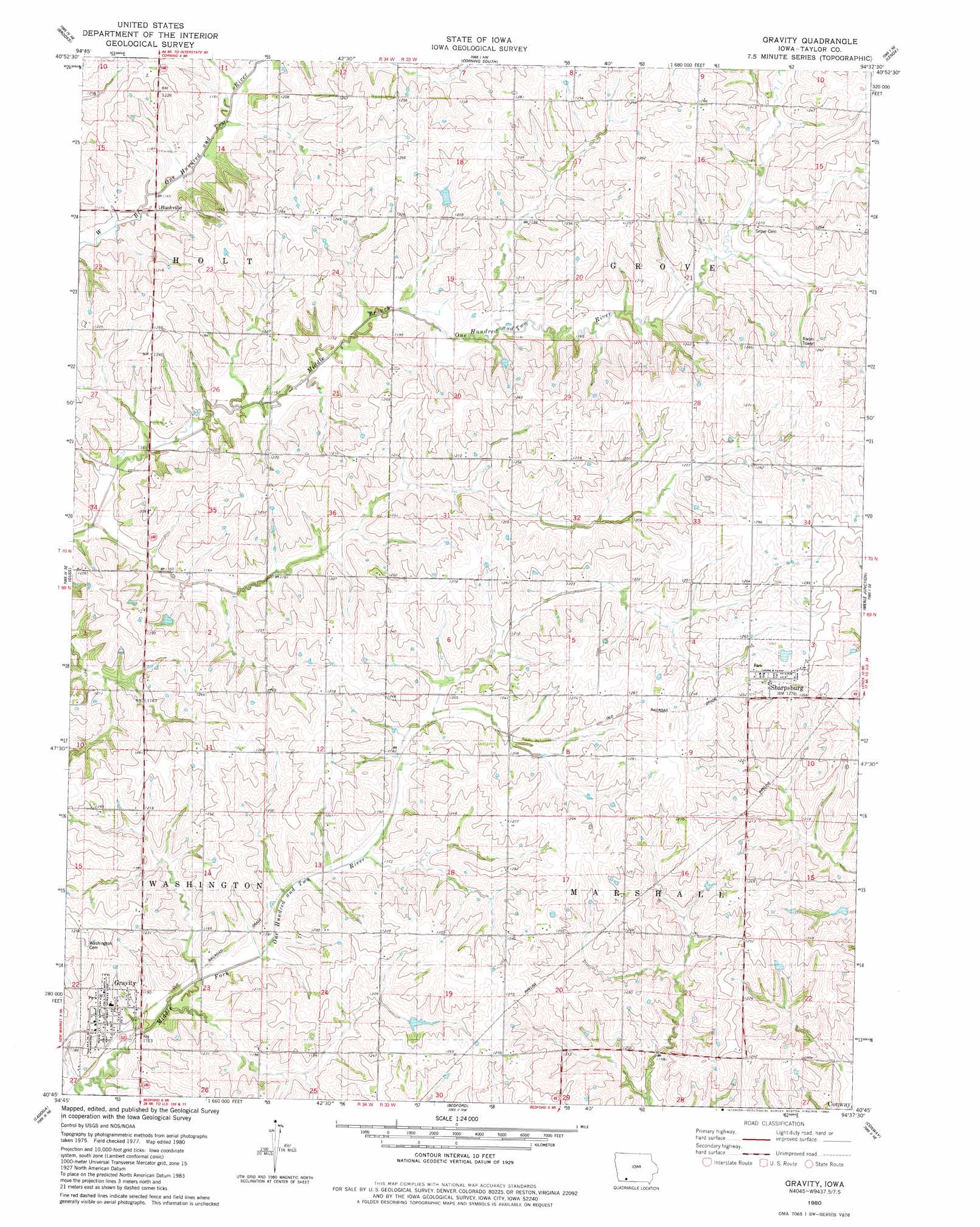
Gravity Topo Map Iowa
To zoom in, hover over the map of Gravity
USGS Topo Quad 40094g6 - 1:24,000 scale
| Topo Map Name: | Gravity |
| USGS Topo Quad ID: | 40094g6 |
| Print Size: | ca. 21 1/4" wide x 27" high |
| Southeast Coordinates: | 40.75° N latitude / 94.625° W longitude |
| Map Center Coordinates: | 40.8125° N latitude / 94.6875° W longitude |
| U.S. State: | IA |
| Filename: | o40094g6.jpg |
| Download Map JPG Image: | Gravity topo map 1:24,000 scale |
| Map Type: | Topographic |
| Topo Series: | 7.5´ |
| Map Scale: | 1:24,000 |
| Source of Map Images: | United States Geological Survey (USGS) |
| Alternate Map Versions: |
Gravity IA 1980, updated 1980 Download PDF Buy paper map Gravity IA 2010 Download PDF Buy paper map Gravity IA 2013 Download PDF Buy paper map Gravity IA 2015 Download PDF Buy paper map |
1:24,000 Topo Quads surrounding Gravity
Morton Mills |
Carbon |
Corning North |
Prescott |
Creston West |
Villisca |
Brooks |
Corning South |
Lenox |
Kent |
Hawleyville |
Guss |
Gravity |
Merle Junction |
Clearfield |
New Market |
Ladoga |
Bedford |
Conway |
Maloy |
Hopkins Sw |
Hopkins |
Bedford Sw |
Sheridan |
Blockton |
> Back to 40094e1 at 1:100,000 scale
> Back to 40094a1 at 1:250,000 scale
> Back to U.S. Topo Maps home
Gravity topo map: Gazetteer
Gravity: Populated Places
Bushville elevation 353m 1158′Gravity elevation 366m 1200′
Sharpsburg elevation 389m 1276′
Gravity: Post Offices
Dan Post Office (historical) elevation 385m 1263′Leonard Post Office (historical) elevation 384m 1259′
Sharpsburg Post Office elevation 389m 1276′
Gravity digital topo map on disk
Buy this Gravity topo map showing relief, roads, GPS coordinates and other geographical features, as a high-resolution digital map file on DVD: