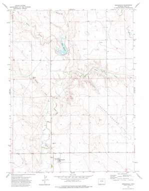
Briggsdale Topo Map Colorado
To zoom in, hover over the map of Briggsdale
USGS Topo Quad 40104f3 - 1:24,000 scale
| Topo Map Name: | Briggsdale |
| USGS Topo Quad ID: | 40104f3 |
| Print Size: | ca. 21 1/4" wide x 27" high |
| Southeast Coordinates: | 40.625° N latitude / 104.25° W longitude |
| Map Center Coordinates: | 40.6875° N latitude / 104.3125° W longitude |
| U.S. State: | CO |
| Filename: | o40104f3.jpg |
| Download Map JPG Image: | Briggsdale topo map 1:24,000 scale |
| Map Type: | Topographic |
| Topo Series: | 7.5´ |
| Map Scale: | 1:24,000 |
| Source of Map Images: | United States Geological Survey (USGS) |
| Alternate Map Versions: |
Briggsdale CO 1972, updated 1975 Download PDF Buy paper map Briggsdale CO 1972, updated 1975 Download PDF Buy paper map Briggsdale CO 1997, updated 2000 Download PDF Buy paper map Briggsdale CO 2011 Download PDF Buy paper map Briggsdale CO 2013 Download PDF Buy paper map Briggsdale CO 2016 Download PDF Buy paper map |
| FStopo: | US Forest Service topo Briggsdale is available: Download FStopo PDF Download FStopo TIF |
1:24,000 Topo Quads surrounding Briggsdale
> Back to 40104e1 at 1:100,000 scale
> Back to 40104a1 at 1:250,000 scale
> Back to U.S. Topo Maps home
Briggsdale topo map: Gazetteer
Briggsdale: Dams
Heart Dam elevation 1496m 4908′Briggsdale: Flats
Crow Valley Park elevation 1472m 4829′Briggsdale: Populated Places
Briggsdale elevation 1483m 4865′Briggsdale: Reservoirs
Heart Reservoir elevation 1496m 4908′Murphy Reservoir elevation 1503m 4931′
Briggsdale: Streams
Geary Creek elevation 1503m 4931′Howard Creek elevation 1476m 4842′
Little Crow Creek elevation 1487m 4878′
Willow Creek elevation 1496m 4908′
Briggsdale: Summits
Seven Cross Hill elevation 1537m 5042′Briggsdale: Wells
Headquarters Waterwell elevation 1481m 4858′Briggsdale digital topo map on disk
Buy this Briggsdale topo map showing relief, roads, GPS coordinates and other geographical features, as a high-resolution digital map file on DVD:


