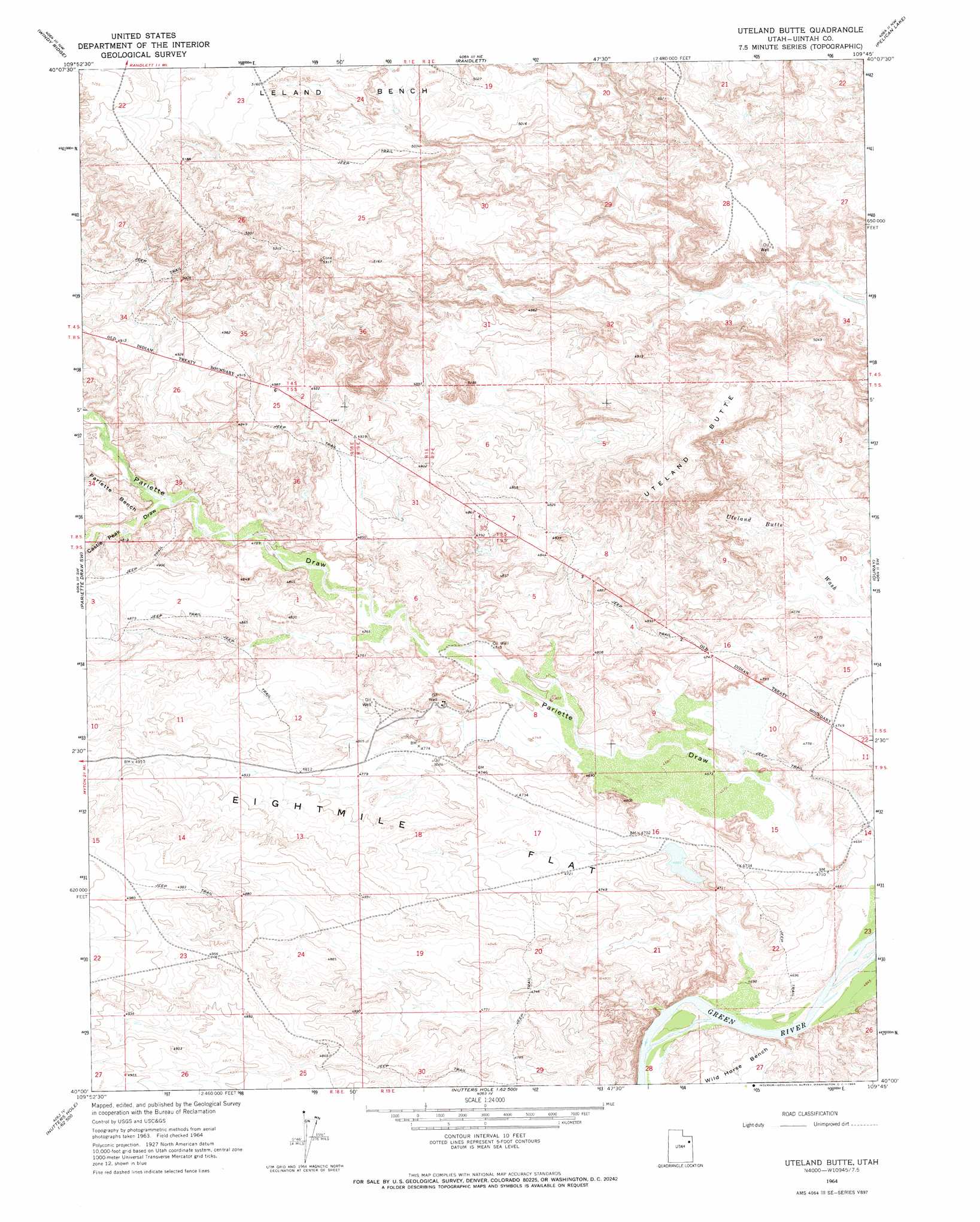
Uteland Butte Topo Map Utah
To zoom in, hover over the map of Uteland Butte
USGS Topo Quad 40109a7 - 1:24,000 scale
| Topo Map Name: | Uteland Butte |
| USGS Topo Quad ID: | 40109a7 |
| Print Size: | ca. 21 1/4" wide x 27" high |
| Southeast Coordinates: | 40° N latitude / 109.75° W longitude |
| Map Center Coordinates: | 40.0625° N latitude / 109.8125° W longitude |
| U.S. State: | UT |
| Filename: | o40109a7.jpg |
| Download Map JPG Image: | Uteland Butte topo map 1:24,000 scale |
| Map Type: | Topographic |
| Topo Series: | 7.5´ |
| Map Scale: | 1:24,000 |
| Source of Map Images: | United States Geological Survey (USGS) |
| Alternate Map Versions: |
Uteland Butte UT 1964, updated 1966 Download PDF Buy paper map Uteland Butte UT 2011 Download PDF Buy paper map Uteland Butte UT 2014 Download PDF Buy paper map |
1:24,000 Topo Quads surrounding Uteland Butte
Hancock Cove |
Roosevelt |
Fort Duchesne |
Vernal Sw |
Vernal Se |
Myton |
Windy Ridge |
Randlett |
Pelican Lake |
Brennan Basin |
Myton Se |
Pariette Draw Sw |
Uteland Butte |
Ouray |
Ouray Se |
Wilkin Ridge |
Crow Knoll |
Moon Bottom |
Big Pack Mountain Nw |
Big Pack Mountain Ne |
Pinnacle Canyon |
Duches Hole |
Nutters Hole |
Big Pack Mountain |
Big Pack Mountain Se |
> Back to 40109a1 at 1:100,000 scale
> Back to 40108a1 at 1:250,000 scale
> Back to U.S. Topo Maps home
Uteland Butte topo map: Gazetteer
Uteland Butte: Dams
Pariette East Dike Dam elevation 1423m 4668′Pariette Flood Control Dam elevation 1509m 4950′
Uteland Butte: Parks
Pariette Waterfowl Habitat Management Area elevation 1444m 4737′Uteland Butte: Reservoirs
Pariette East Dike Reservoir elevation 1423m 4668′Pariette Flood Control Reservoir elevation 1509m 4950′
Uteland Butte: Summits
Uteland Butte elevation 1583m 5193′Uteland Butte: Valleys
Castle Peak Draw elevation 1457m 4780′Uteland Butte digital topo map on disk
Buy this Uteland Butte topo map showing relief, roads, GPS coordinates and other geographical features, as a high-resolution digital map file on DVD: