Lion Spring Topo Map Nevada
To zoom in, hover over the map of Lion Spring
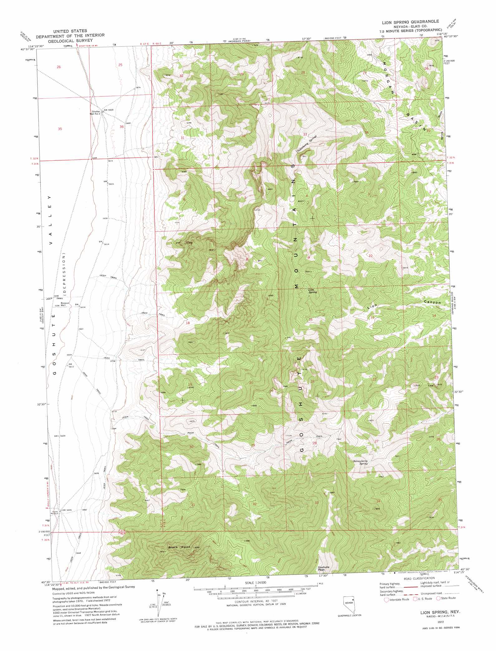
USGS Topo Quad 40114e3 - 1:24,000 scale
| Topo Map Name: | Lion Spring |
| USGS Topo Quad ID: | 40114e3 |
| Print Size: | ca. 21 1/4" wide x 27" high |
| Southeast Coordinates: | 40.5° N latitude / 114.25° W longitude |
| Map Center Coordinates: | 40.5625° N latitude / 114.3125° W longitude |
| U.S. State: | NV |
| Filename: | o40114e3.jpg |
| Download Map JPG Image: | Lion Spring topo map 1:24,000 scale |
| Map Type: | Topographic |
| Topo Series: | 7.5´ |
| Map Scale: | 1:24,000 |
| Source of Map Images: | United States Geological Survey (USGS) |
| Alternate Map Versions: |
Lion Spring NV 1972, updated 1975 Download PDF Buy paper map Lion Spring NV 2012 Download PDF Buy paper map Lion Spring NV 2014 Download PDF Buy paper map |
1:24,000 Topo Quads surrounding Lion Spring
Independence Valley Se |
Shafter |
West Morris Basin |
Pilot |
Leppy Peak |
Flowery Lake |
Decoy |
Morgan Pass |
Ola |
Wendover |
Dolly Varden |
Decoy Sw |
Lion Spring |
Spring Gulch |
Wendover Se |
Mizpah Point |
White Horse Mountain Nw |
Goshute Peak |
Ferguson Mountain |
Ferguson Flat |
Sharp Peak |
Dolly Varden Spring |
White Horse Mountain |
White Horse Pass |
Utah Peak |
> Back to 40114e1 at 1:100,000 scale
> Back to 40114a1 at 1:250,000 scale
> Back to U.S. Topo Maps home
Lion Spring topo map: Gazetteer
Lion Spring: Basins
Morgan Basin elevation 1918m 6292′Lion Spring: Springs
Chokecherry Springs elevation 1820m 5971′Lion Spring elevation 1862m 6108′
Serviceberry Spring elevation 2013m 6604′
Lion Spring: Summits
Black Point elevation 2078m 6817′Lion Spring: Valleys
Spring Gulch elevation 1809m 5935′Lion Spring: Wells
Basque Well elevation 1881m 6171′Shafter Well Number Four elevation 2104m 6902′
Shafter Well Number Three elevation 1862m 6108′
Lion Spring digital topo map on disk
Buy this Lion Spring topo map showing relief, roads, GPS coordinates and other geographical features, as a high-resolution digital map file on DVD: