West Morris Basin Topo Map Nevada
To zoom in, hover over the map of West Morris Basin
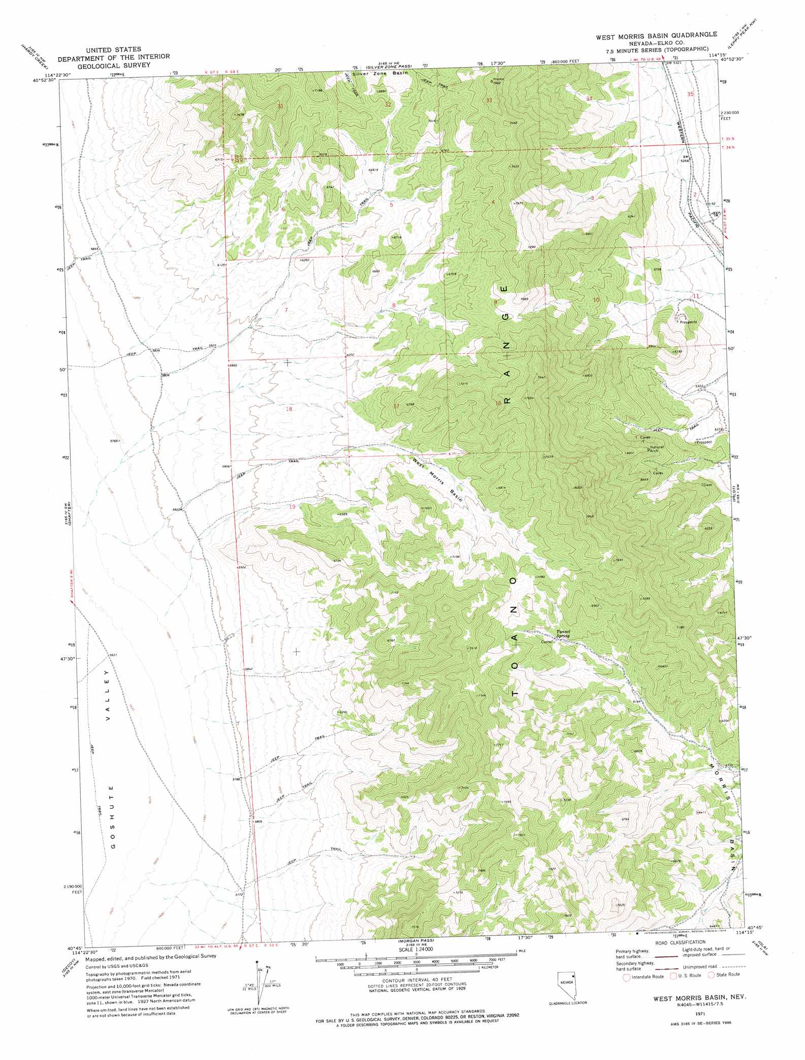
USGS Topo Quad 40114g3 - 1:24,000 scale
| Topo Map Name: | West Morris Basin |
| USGS Topo Quad ID: | 40114g3 |
| Print Size: | ca. 21 1/4" wide x 27" high |
| Southeast Coordinates: | 40.75° N latitude / 114.25° W longitude |
| Map Center Coordinates: | 40.8125° N latitude / 114.3125° W longitude |
| U.S. State: | NV |
| Filename: | o40114g3.jpg |
| Download Map JPG Image: | West Morris Basin topo map 1:24,000 scale |
| Map Type: | Topographic |
| Topo Series: | 7.5´ |
| Map Scale: | 1:24,000 |
| Source of Map Images: | United States Geological Survey (USGS) |
| Alternate Map Versions: |
West Morris Basin NV 1971, updated 1974 Download PDF Buy paper map West Morris Basin NV 2012 Download PDF Buy paper map West Morris Basin NV 2015 Download PDF Buy paper map |
1:24,000 Topo Quads surrounding West Morris Basin
Pequop Summit |
Cobre |
Cobre Se |
Pilot Peak Sw |
Pilot Peak |
Independence Valley Ne |
Hardy Creek |
Silver Zone Pass |
Leppy Peak Nw |
Miners Canyon |
Independence Valley Se |
Shafter |
West Morris Basin |
Pilot |
Leppy Peak |
Flowery Lake |
Decoy |
Morgan Pass |
Ola |
Wendover |
Dolly Varden |
Decoy Sw |
Lion Spring |
Spring Gulch |
Wendover Se |
> Back to 40114e1 at 1:100,000 scale
> Back to 40114a1 at 1:250,000 scale
> Back to U.S. Topo Maps home
West Morris Basin topo map: Gazetteer
West Morris Basin: Basins
Morris Basin elevation 1836m 6023′West Morris Basin elevation 1994m 6541′
West Morris Basin: Springs
Tunnel Spring elevation 2032m 6666′West Morris Basin digital topo map on disk
Buy this West Morris Basin topo map showing relief, roads, GPS coordinates and other geographical features, as a high-resolution digital map file on DVD: