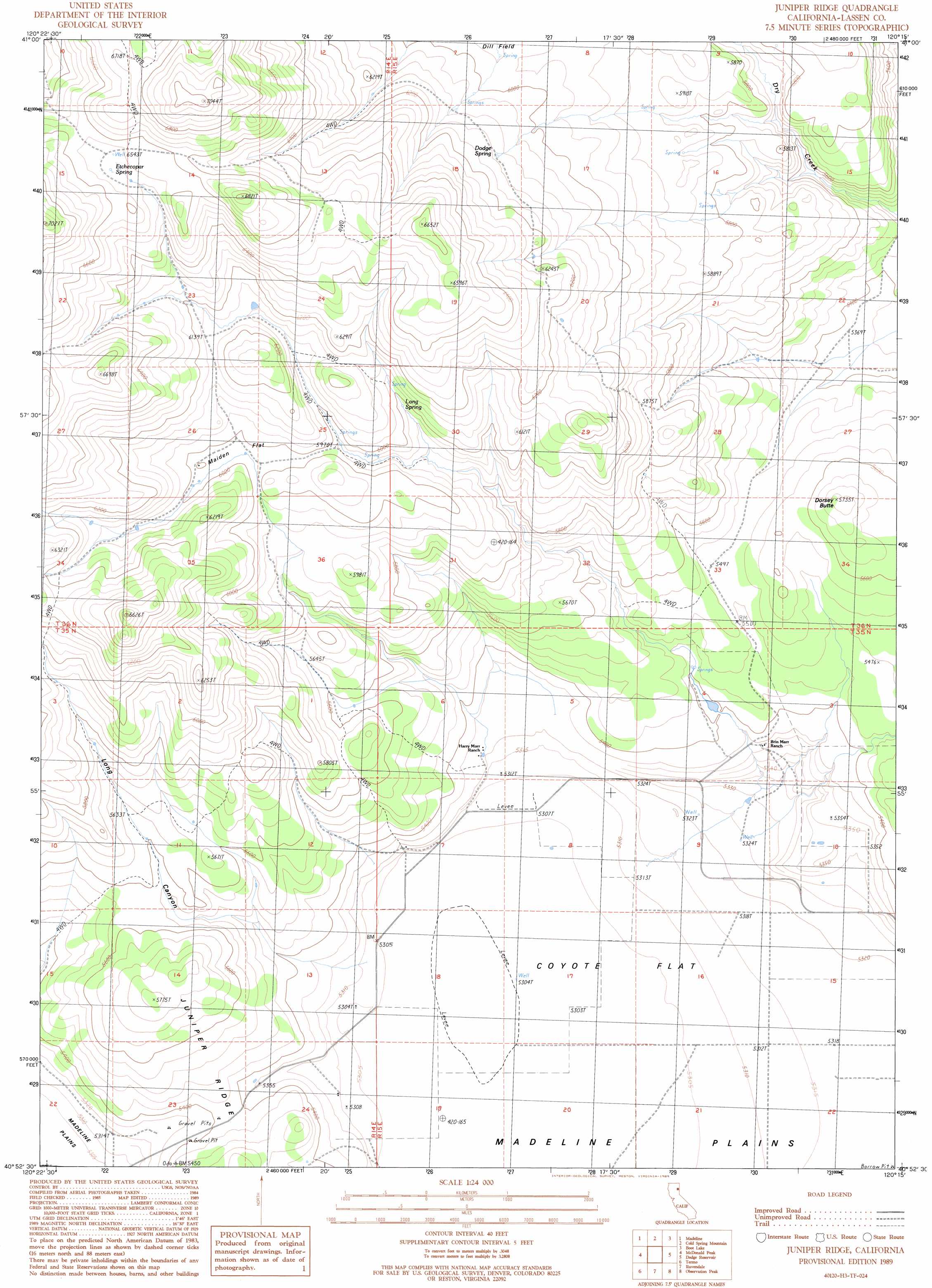
Juniper Ridge Topo Map California
To zoom in, hover over the map of Juniper Ridge
USGS Topo Quad 40120h3 - 1:24,000 scale
| Topo Map Name: | Juniper Ridge |
| USGS Topo Quad ID: | 40120h3 |
| Print Size: | ca. 21 1/4" wide x 27" high |
| Southeast Coordinates: | 40.875° N latitude / 120.25° W longitude |
| Map Center Coordinates: | 40.9375° N latitude / 120.3125° W longitude |
| U.S. State: | CA |
| Filename: | o40120h3.jpg |
| Download Map JPG Image: | Juniper Ridge topo map 1:24,000 scale |
| Map Type: | Topographic |
| Topo Series: | 7.5´ |
| Map Scale: | 1:24,000 |
| Source of Map Images: | United States Geological Survey (USGS) |
| Alternate Map Versions: |
Juniper Ridge CA 1989, updated 1989 Download PDF Buy paper map Juniper Ridge CA 2012 Download PDF Buy paper map Juniper Ridge CA 2015 Download PDF Buy paper map |
1:24,000 Topo Quads surrounding Juniper Ridge
Likely |
Tule Mountain |
Jess Valley |
Emerson Peak |
Snake Lake |
Holbrook Canyon |
Madeline |
Cold Spring Mountain |
Boot Lake |
Little Hat Mountain |
Anderson Mountain |
Mcdonald Peak |
Juniper Ridge |
Dodge Reservoir |
Buckhorn Lake |
Cleghorn Flat |
Termo |
Ravendale |
Observation Peak |
Buckhorn Canyon |
Fredonyer Peak |
West Of Snowstorm Mountain |
Snowstorm Mountain |
Shinn Mountain |
Al Shinn Canyon |
> Back to 40120e1 at 1:100,000 scale
> Back to 40120a1 at 1:250,000 scale
> Back to U.S. Topo Maps home
Juniper Ridge topo map: Gazetteer
Juniper Ridge: Flats
Coyote Flat elevation 1616m 5301′Maiden Flat elevation 1827m 5994′
Juniper Ridge: Ridges
Juniper Ridge elevation 1659m 5442′Juniper Ridge: Springs
Dodge Spring elevation 1859m 6099′Etchecopar Spring elevation 1989m 6525′
Long Spring elevation 1824m 5984′
Poulsen Spring elevation 1930m 6332′
Juniper Ridge: Summits
Dorsey Butte elevation 1747m 5731′Juniper Ridge: Valleys
Long Canyon elevation 1630m 5347′Juniper Ridge digital topo map on disk
Buy this Juniper Ridge topo map showing relief, roads, GPS coordinates and other geographical features, as a high-resolution digital map file on DVD: