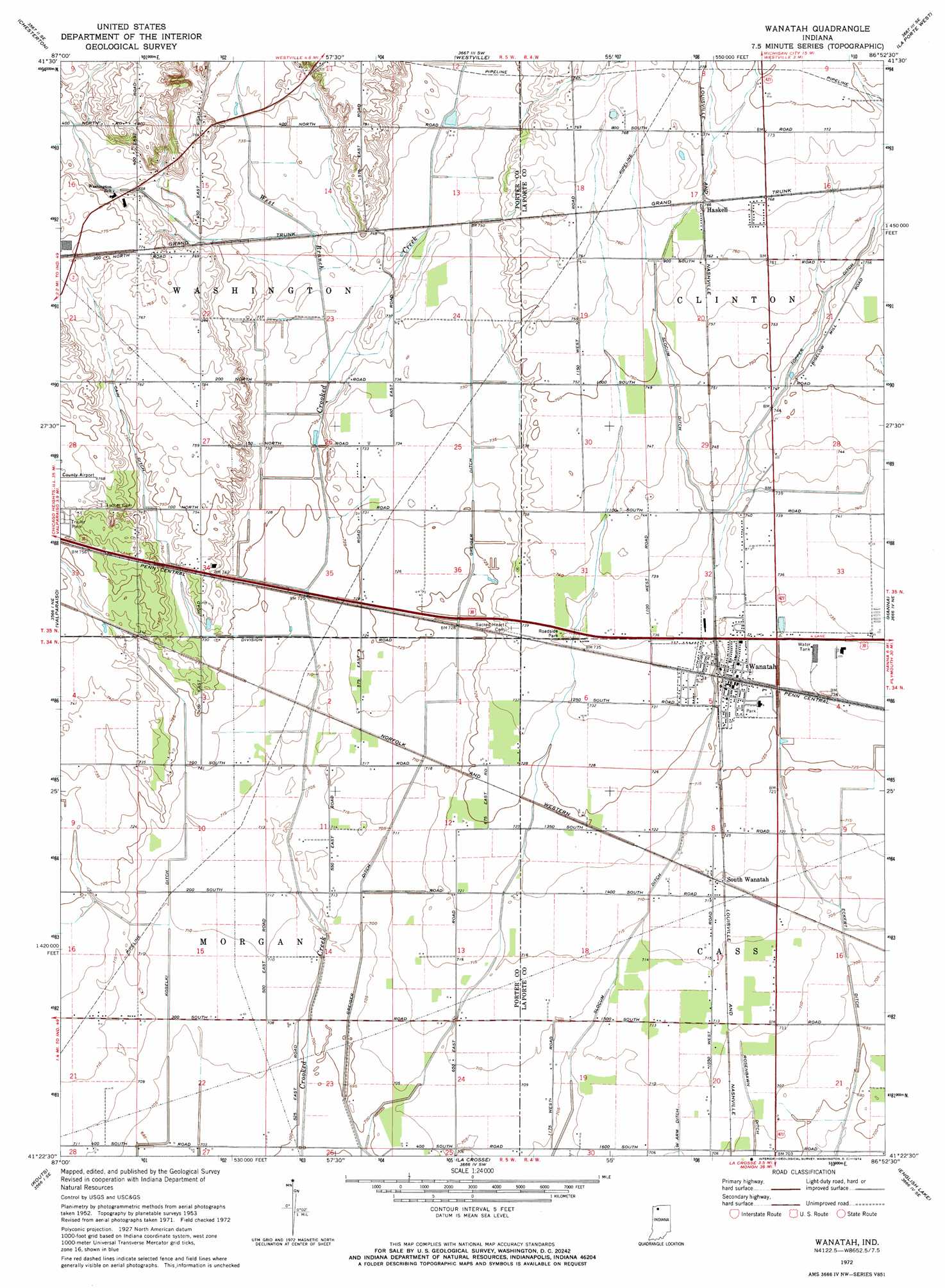
Wanatah Topo Map Indiana
To zoom in, hover over the map of Wanatah
USGS Topo Quad 41086d8 - 1:24,000 scale
| Topo Map Name: | Wanatah |
| USGS Topo Quad ID: | 41086d8 |
| Print Size: | ca. 21 1/4" wide x 27" high |
| Southeast Coordinates: | 41.375° N latitude / 86.875° W longitude |
| Map Center Coordinates: | 41.4375° N latitude / 86.9375° W longitude |
| U.S. State: | IN |
| Filename: | o41086d8.jpg |
| Download Map JPG Image: | Wanatah topo map 1:24,000 scale |
| Map Type: | Topographic |
| Topo Series: | 7.5´ |
| Map Scale: | 1:24,000 |
| Source of Map Images: | United States Geological Survey (USGS) |
| Alternate Map Versions: |
Wanatah IN 1953, updated 1955 Download PDF Buy paper map Wanatah IN 1972, updated 1974 Download PDF Buy paper map Wanatah IN 2010 Download PDF Buy paper map Wanatah IN 2013 Download PDF Buy paper map Wanatah IN 2016 Download PDF Buy paper map |
1:24,000 Topo Quads surrounding Wanatah
Ogden Dunes |
Dune Acres |
Michigan City West |
Michigan City East |
Springville |
Portage |
Chesterton |
Westville |
Laporte West |
Laporte East |
Palmer |
Valparaiso |
Wanatah |
Hanna |
Kingsford Heights |
Hebron |
Kouts |
La Crosse |
English Lake |
Knox West |
Demotte |
Wheatfield |
San Pierre |
North Judson |
Denham |
> Back to 41086a1 at 1:100,000 scale
> Back to 41086a1 at 1:250,000 scale
> Back to U.S. Topo Maps home
Wanatah topo map: Gazetteer
Wanatah: Airports
Wyckoff Airstrip elevation 227m 744′Wanatah: Canals
Cain Ditch elevation 228m 748′Greiger Ditch elevation 216m 708′
Slocum Ditch elevation 217m 711′
Wanatah: Populated Places
Haskell elevation 233m 764′South Wanatah elevation 219m 718′
Wanatah elevation 223m 731′
Wanatah: Streams
West Branch Crooked Creek elevation 222m 728′Wanatah digital topo map on disk
Buy this Wanatah topo map showing relief, roads, GPS coordinates and other geographical features, as a high-resolution digital map file on DVD:
Northern Illinois, Northern Indiana & Southwestern Michigan
Buy digital topo maps: Northern Illinois, Northern Indiana & Southwestern Michigan