Garrison Topo Map Nebraska
To zoom in, hover over the map of Garrison
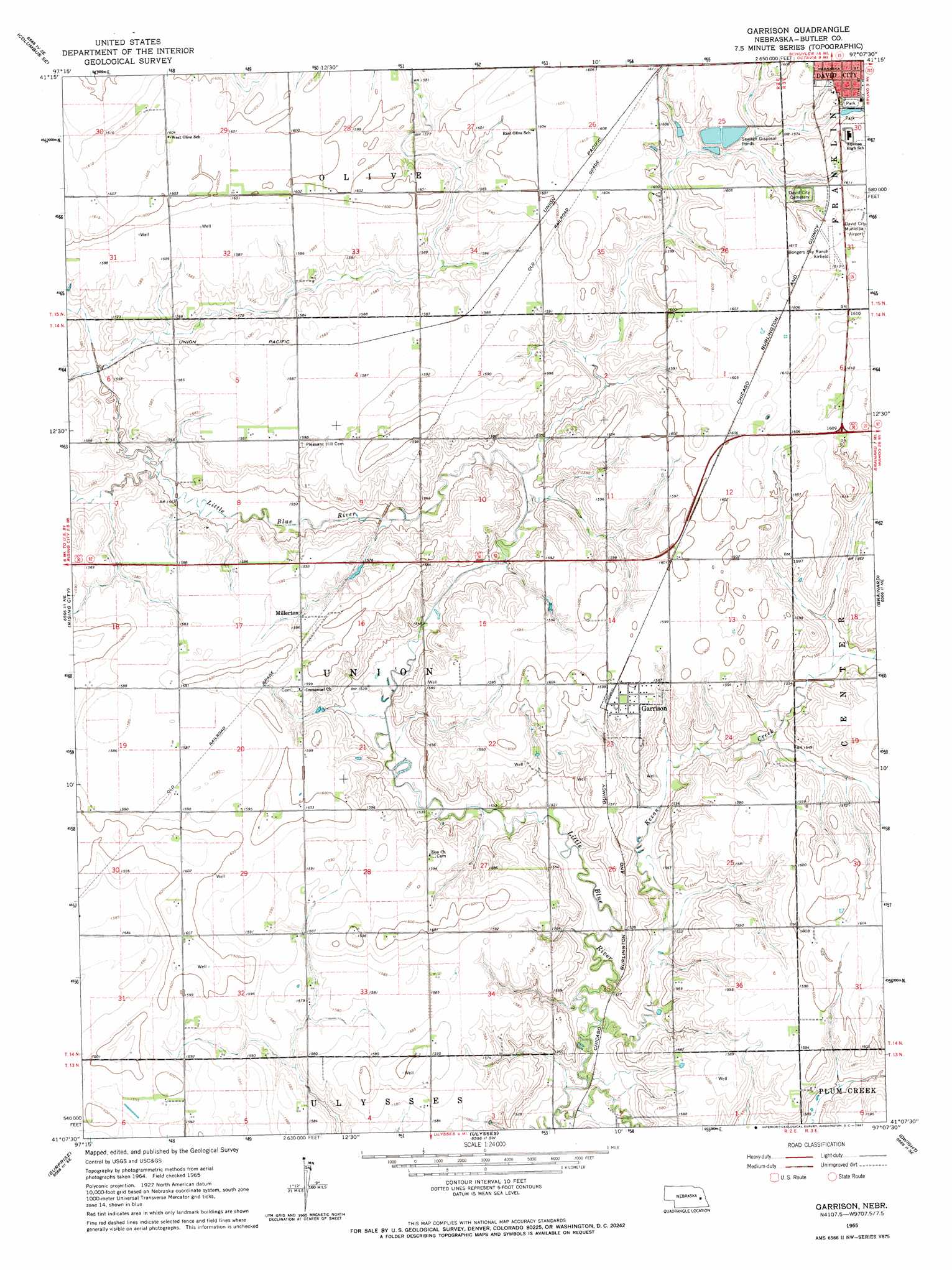
USGS Topo Quad 41097b2 - 1:24,000 scale
| Topo Map Name: | Garrison |
| USGS Topo Quad ID: | 41097b2 |
| Print Size: | ca. 21 1/4" wide x 27" high |
| Southeast Coordinates: | 41.125° N latitude / 97.125° W longitude |
| Map Center Coordinates: | 41.1875° N latitude / 97.1875° W longitude |
| U.S. State: | NE |
| Filename: | O41097B2.jpg |
| Download Map JPG Image: | Garrison topo map 1:24,000 scale |
| Map Type: | Topographic |
| Topo Series: | 7.5´ |
| Map Scale: | 1:24,000 |
| Source of Map Images: | United States Geological Survey (USGS) |
| Alternate Map Versions: |
Garrison NE 1965, updated 1967 Download PDF Buy paper map Garrison NE 2011 Download PDF Buy paper map Garrison NE 2014 Download PDF Buy paper map |
1:24,000 Topo Quads surrounding Garrison
Duncan |
Columbus |
Richland |
Schuyler |
Rogers |
Columbus Sw |
Columbus Se |
David City West |
David City East |
Bruno |
Shelby |
Rising City |
Garrison |
Brainard |
Loma |
Gresham |
Surprise |
Ulysses |
Dwight |
Valparaiso Sw |
Waco |
Utica |
Staplehurst |
Seward |
Garland |
> Back to 41097a1 at 1:100,000 scale
> Back to 41096a1 at 1:250,000 scale
> Back to U.S. Topo Maps home
Garrison topo map: Gazetteer
Garrison: Airports
Bongers Sky Ranch Airfield elevation 491m 1610′Garrison: Parks
David City Park elevation 485m 1591′Lincoln Park elevation 487m 1597′
Garrison: Populated Places
Garrison elevation 488m 1601′Millerton elevation 482m 1581′
Garrison: Post Offices
Garrison Post Office elevation 488m 1601′Millerton Post Office (historical) elevation 482m 1581′
Garrison: Streams
Kezan Creek elevation 463m 1519′Garrison digital topo map on disk
Buy this Garrison topo map showing relief, roads, GPS coordinates and other geographical features, as a high-resolution digital map file on DVD: