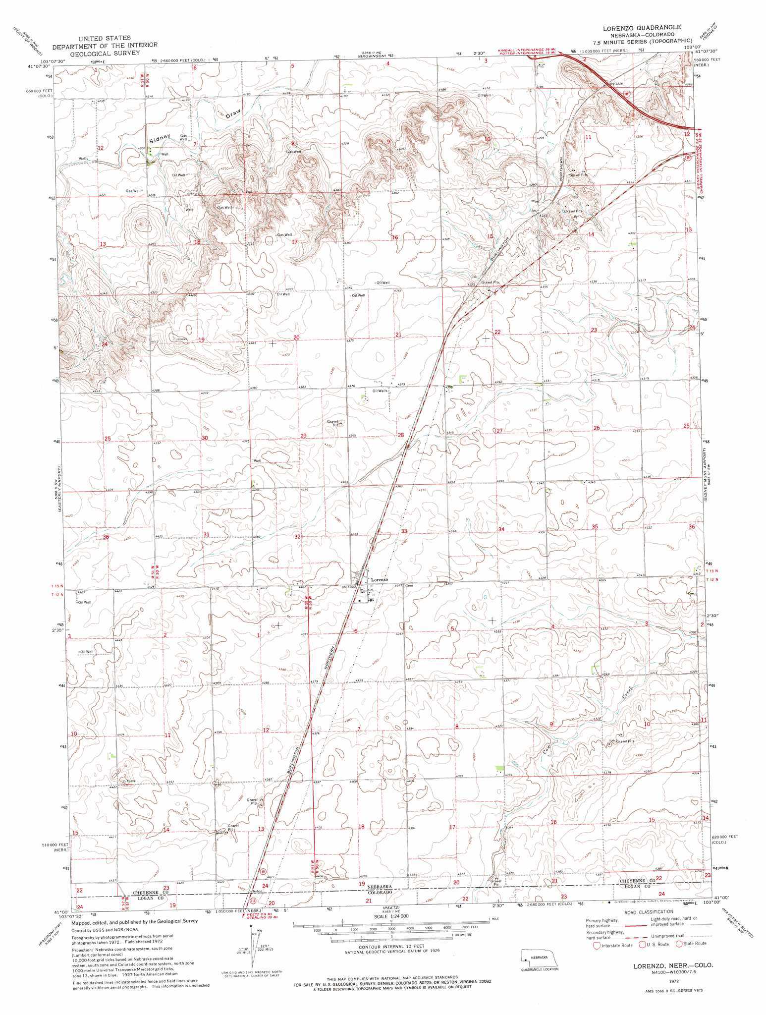
Lorenzo Topo Map Nebraska
To zoom in, hover over the map of Lorenzo
USGS Topo Quad 41103a1 - 1:24,000 scale
| Topo Map Name: | Lorenzo |
| USGS Topo Quad ID: | 41103a1 |
| Print Size: | ca. 21 1/4" wide x 27" high |
| Southeast Coordinates: | 41° N latitude / 103° W longitude |
| Map Center Coordinates: | 41.0625° N latitude / 103.0625° W longitude |
| U.S. States: | NE, CO |
| Filename: | O41103A1.jpg |
| Download Map JPG Image: | Lorenzo topo map 1:24,000 scale |
| Map Type: | Topographic |
| Topo Series: | 7.5´ |
| Map Scale: | 1:24,000 |
| Source of Map Images: | United States Geological Survey (USGS) |
| Alternate Map Versions: |
Lorenzo NE 1972, updated 1975 Download PDF Buy paper map Lorenzo NE 2010 Download PDF Buy paper map Lorenzo NE 2011 Download PDF Buy paper map Lorenzo NE 2014 Download PDF Buy paper map |
1:24,000 Topo Quads surrounding Lorenzo
Potter 2 Se |
Mud Springs Sw |
Mud Springs Se |
Gurley |
Dalton Se |
Potter |
Point Of Rocks |
Brownson |
Sidney |
Sunol |
Potter Se |
Easterly Airport |
Lorenzo |
Sidney Municipal Airport |
Sidney Se |
Kirchnavy Butte |
Padroni Nw |
Peetz |
Haystack Butte |
Twin Buttes |
North Sterling Reservoir |
Padroni |
Iliff |
Proctor |
Crook |
> Back to 41103a1 at 1:100,000 scale
> Back to 41102a1 at 1:250,000 scale
> Back to U.S. Topo Maps home
Lorenzo topo map: Gazetteer
Lorenzo: Airports
Phelps Airport elevation 1330m 4363′Lorenzo: Populated Places
Lorenzo elevation 1338m 4389′Lorenzo: Post Offices
Lorenzo Post Office (historical) elevation 1338m 4389′Lorenzo digital topo map on disk
Buy this Lorenzo topo map showing relief, roads, GPS coordinates and other geographical features, as a high-resolution digital map file on DVD:
Eastern Wyoming & Western South Dakota
Buy digital topo maps: Eastern Wyoming & Western South Dakota