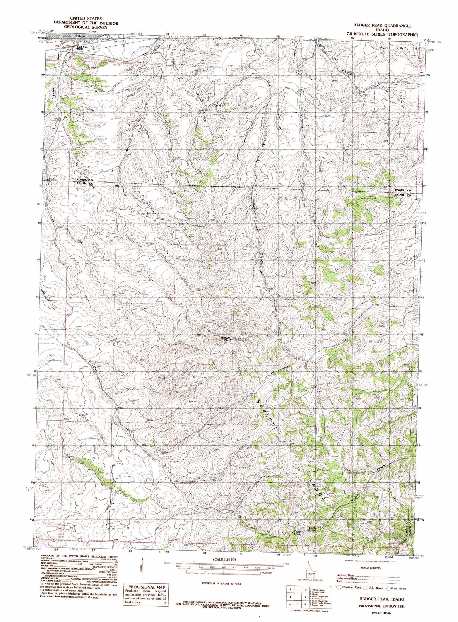
Badger Peak Topo Map Idaho
To zoom in, hover over the map of Badger Peak
USGS Topo Quad 42113e1 - 1:24,000 scale
| Topo Map Name: | Badger Peak |
| USGS Topo Quad ID: | 42113e1 |
| Print Size: | ca. 21 1/4" wide x 27" high |
| Southeast Coordinates: | 42.5° N latitude / 113° W longitude |
| Map Center Coordinates: | 42.5625° N latitude / 113.0625° W longitude |
| U.S. State: | ID |
| Filename: | o42113e1.jpg |
| Download Map JPG Image: | Badger Peak topo map 1:24,000 scale |
| Map Type: | Topographic |
| Topo Series: | 7.5´ |
| Map Scale: | 1:24,000 |
| Source of Map Images: | United States Geological Survey (USGS) |
| Alternate Map Versions: |
Badger Peak ID 1984, updated 1984 Download PDF Buy paper map Badger Peak ID 2010 Download PDF Buy paper map Badger Peak ID 2013 Download PDF Buy paper map |
1:24,000 Topo Quads surrounding Badger Peak
Schodde Well |
Rattlesnake Butte |
Pillar Butte Se |
American Falls Sw |
American Falls |
Lake Walcott East |
Gifford Spring |
Register Rock |
Neeley |
Indian Springs |
Lake Walcott Se |
North Chapin Mountain |
Badger Peak |
Rockland West |
Rockland East |
Malta Ne |
South Chapin Mountain |
North Heglar Canyon |
Hartley Peak |
Roy Ne |
Malta |
Sublett |
Sublett Reservoir |
Sublett Troughs |
Roy |
> Back to 42113e1 at 1:100,000 scale
> Back to 42112a1 at 1:250,000 scale
> Back to U.S. Topo Maps home
Badger Peak topo map: Gazetteer
Badger Peak: Springs
Calder Spring elevation 1910m 6266′Dairy Spring elevation 1901m 6236′
Badger Peak: Summits
Badger Peak elevation 1956m 6417′Badger Peak: Valleys
Lanes Gulch elevation 1284m 4212′Badger Peak digital topo map on disk
Buy this Badger Peak topo map showing relief, roads, GPS coordinates and other geographical features, as a high-resolution digital map file on DVD: