Hanford Topo Map Iowa
To zoom in, hover over the map of Hanford
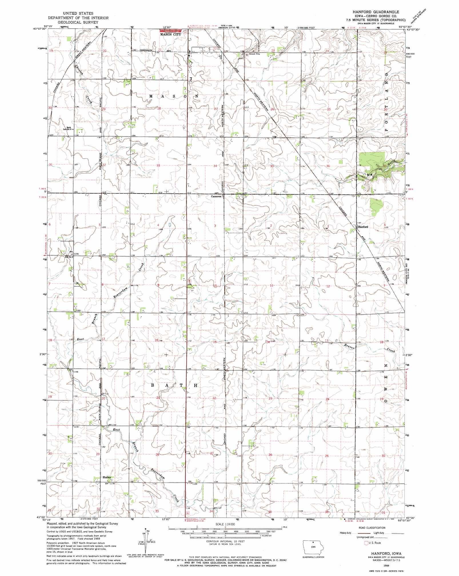
USGS Topo Quad 43093a2 - 1:24,000 scale
| Topo Map Name: | Hanford |
| USGS Topo Quad ID: | 43093a2 |
| Print Size: | ca. 21 1/4" wide x 27" high |
| Southeast Coordinates: | 43° N latitude / 93.125° W longitude |
| Map Center Coordinates: | 43.0625° N latitude / 93.1875° W longitude |
| U.S. State: | IA |
| Filename: | o43093a2.jpg |
| Download Map JPG Image: | Hanford topo map 1:24,000 scale |
| Map Type: | Topographic |
| Topo Series: | 7.5´ |
| Map Scale: | 1:24,000 |
| Source of Map Images: | United States Geological Survey (USGS) |
| Alternate Map Versions: |
Hanford IA 1959, updated 1966 Download PDF Buy paper map Hanford IA 2010 Download PDF Buy paper map Hanford IA 2013 Download PDF Buy paper map Hanford IA 2015 Download PDF Buy paper map |
1:24,000 Topo Quads surrounding Hanford
Fertile |
Fertile Se |
Manly |
Grafton |
Osage Sw |
Clear Lake West |
Clear Lake East |
Mason City |
Nora Springs |
Rudd |
Ventura Heights |
Burchinal |
Hanford |
Mason City Se |
Rockford |
Thornton |
Swaledale |
Sheffield |
Dougherty |
Aureola |
Alexander |
Latimer |
Hampton North |
Hansell |
Dumont North |
> Back to 43093a1 at 1:100,000 scale
> Back to 43092a1 at 1:250,000 scale
> Back to U.S. Topo Maps home
Hanford topo map: Gazetteer
Hanford: Areas
Blazing Star Prairie elevation 352m 1154′Hanford: Dams
Lake Fin-Feather Dam elevation 369m 1210′Hanford: Mines
Portland Quarry elevation 333m 1092′Hanford: Parks
Mike Zack Wildlife Area elevation 368m 1207′Hanford: Populated Places
Cameron elevation 372m 1220′Hanford elevation 363m 1190′
Hurley elevation 357m 1171′
Mason City Junction elevation 360m 1181′
Hanford: Post Offices
Bath Post Office (historical) elevation 364m 1194′Hanford Post Office (historical) elevation 363m 1190′
Hanford: Reservoirs
Clark Lake elevation 368m 1207′Lake Fin-Feather elevation 369m 1210′
Hanford digital topo map on disk
Buy this Hanford topo map showing relief, roads, GPS coordinates and other geographical features, as a high-resolution digital map file on DVD: