Osage Sw Topo Map Iowa
To zoom in, hover over the map of Osage Sw
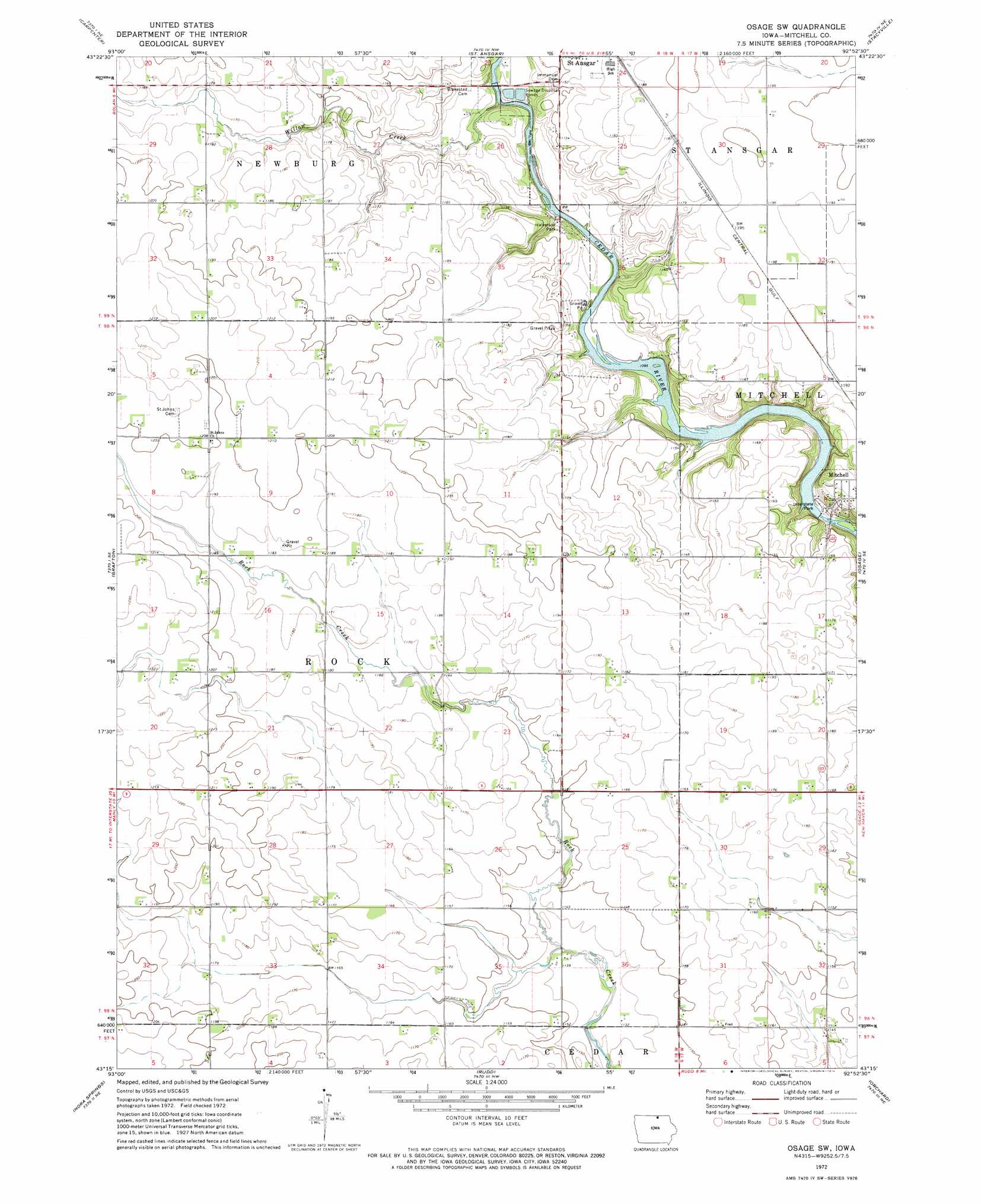
USGS Topo Quad 43092c8 - 1:24,000 scale
| Topo Map Name: | Osage Sw |
| USGS Topo Quad ID: | 43092c8 |
| Print Size: | ca. 21 1/4" wide x 27" high |
| Southeast Coordinates: | 43.25° N latitude / 92.875° W longitude |
| Map Center Coordinates: | 43.3125° N latitude / 92.9375° W longitude |
| U.S. State: | IA |
| Filename: | o43092c8.jpg |
| Download Map JPG Image: | Osage Sw topo map 1:24,000 scale |
| Map Type: | Topographic |
| Topo Series: | 7.5´ |
| Map Scale: | 1:24,000 |
| Source of Map Images: | United States Geological Survey (USGS) |
| Alternate Map Versions: |
Osage SW IA 1972, updated 1974 Download PDF Buy paper map Osage SW IA 2010 Download PDF Buy paper map Osage SW IA 2013 Download PDF Buy paper map Osage SW IA 2015 Download PDF Buy paper map |
1:24,000 Topo Quads surrounding Osage Sw
Myrtle |
London |
Lyle |
Rose Creek |
Adams |
Northwood |
Carpenter |
Saint Ansgar |
Stacyville |
Little Cedar |
Manly |
Grafton |
Osage Sw |
Osage |
New Haven |
Mason City |
Nora Springs |
Rudd |
Orchard |
Floyd |
Hanford |
Mason City Se |
Rockford |
Roseville |
Charles City |
> Back to 43092a1 at 1:100,000 scale
> Back to 43092a1 at 1:250,000 scale
> Back to U.S. Topo Maps home
Osage Sw topo map: Gazetteer
Osage Sw: Parks
County 'S' Refuge elevation 344m 1128′Halverson Park elevation 335m 1099′
Interstate Park elevation 336m 1102′
Osage Sw: Populated Places
Dixie elevation 363m 1190′Osage Sw: Post Offices
Dixie Post Office (historical) elevation 363m 1190′Olin Post Office (historical) elevation 362m 1187′
Rock Creek Post Office (historical) elevation 357m 1171′
Osage Sw: Streams
Willow Creek elevation 334m 1095′Osage Sw digital topo map on disk
Buy this Osage Sw topo map showing relief, roads, GPS coordinates and other geographical features, as a high-resolution digital map file on DVD: