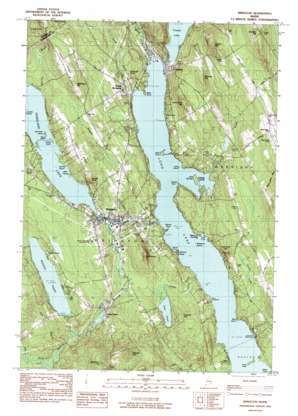
Bridgton Topo Map Maine
To zoom in, hover over the map of Bridgton
USGS Topo Quad 44070a6 - 1:24,000 scale
| Topo Map Name: | Bridgton |
| USGS Topo Quad ID: | 44070a6 |
| Print Size: | ca. 21 1/4" wide x 27" high |
| Southeast Coordinates: | 44° N latitude / 70.625° W longitude |
| Map Center Coordinates: | 44.0625° N latitude / 70.6875° W longitude |
| U.S. State: | ME |
| Filename: | o44070a6.jpg |
| Download Map JPG Image: | Bridgton topo map 1:24,000 scale |
| Map Type: | Topographic |
| Topo Series: | 7.5´ |
| Map Scale: | 1:24,000 |
| Source of Map Images: | United States Geological Survey (USGS) |
| Alternate Map Versions: |
Bridgton ME 1983, updated 1984 Download PDF Buy paper map Bridgton ME 2000, updated 2001 Download PDF Buy paper map Bridgton ME 2011 Download PDF Buy paper map Bridgton ME 2014 Download PDF Buy paper map |
1:24,000 Topo Quads surrounding Bridgton
> Back to 44070a1 at 1:100,000 scale
> Back to 44070a1 at 1:250,000 scale
> Back to U.S. Topo Maps home
Bridgton topo map: Gazetteer
Bridgton: Airports
Maple Ridge Airport elevation 170m 557′Bridgton: Bays
Little Cove elevation 82m 269′Sandy Cove elevation 82m 269′
Bridgton: Capes
Abners Nose elevation 101m 331′Adams Point elevation 81m 265′
Bear Point elevation 82m 269′
Bells Point elevation 82m 269′
Bluff Point elevation 85m 278′
Cape Monday elevation 86m 282′
Kellys Point elevation 82m 269′
Knolls Point elevation 130m 426′
Long Point elevation 82m 269′
Monk Point elevation 82m 269′
Salmon Point elevation 82m 269′
Bridgton: Dams
Bog Dam elevation 133m 436′Crystal Lake Dam elevation 94m 308′
Highland Lake Dam elevation 130m 426′
Stevens Brook Dam elevation 94m 308′
Woods Pond Dam elevation 138m 452′
Bridgton: Islands
Fowler Island elevation 129m 423′Loon Island elevation 82m 269′
Mile Island elevation 129m 423′
Mosquito Island elevation 82m 269′
Oak Knoll Island elevation 129m 423′
Penny Island elevation 130m 426′
Shorey Island elevation 129m 423′
Zakelo Island elevation 85m 278′
Bridgton: Lakes
Crystal Lake elevation 94m 308′Long Lake elevation 82m 269′
Otter Pond elevation 120m 393′
Bridgton: Populated Places
Bridgton elevation 137m 449′Harrison elevation 88m 288′
North Bridgton elevation 99m 324′
Plummer Landing elevation 82m 269′
Sandy Creek elevation 130m 426′
Bridgton: Reservoirs
Highland Lake elevation 130m 426′Stevens Pond elevation 117m 383′
Willett Brook elevation 133m 436′
Woods Pond elevation 138m 452′
Bridgton: Ridges
Lower Ridge elevation 197m 646′Maple Ridge elevation 183m 600′
Upper Ridge elevation 224m 734′
Bridgton: Streams
Bear River elevation 82m 269′Carsley Brook elevation 82m 269′
Day Brook elevation 135m 442′
Jack Branch elevation 135m 442′
Rodgers Brook elevation 82m 269′
Smith Brook elevation 82m 269′
Stevens Brook elevation 82m 269′
Thomes Brook elevation 94m 308′
Willett Brook elevation 121m 396′
Bridgton: Summits
Brigham Hill elevation 220m 721′Choate Hill elevation 255m 836′
Dearborn Hill elevation 270m 885′
Hobbs Hill elevation 224m 734′
Mount Henry elevation 198m 649′
Packard Hill elevation 168m 551′
Summit Hill elevation 272m 892′
Sunset Rock elevation 183m 600′
Town Farm Hill elevation 181m 593′
Whitney Hill elevation 195m 639′
Bridgton digital topo map on disk
Buy this Bridgton topo map showing relief, roads, GPS coordinates and other geographical features, as a high-resolution digital map file on DVD:
Maine, New Hampshire, Rhode Island & Eastern Massachusetts
Buy digital topo maps: Maine, New Hampshire, Rhode Island & Eastern Massachusetts


