Stewart Topo Map Minnesota
To zoom in, hover over the map of Stewart
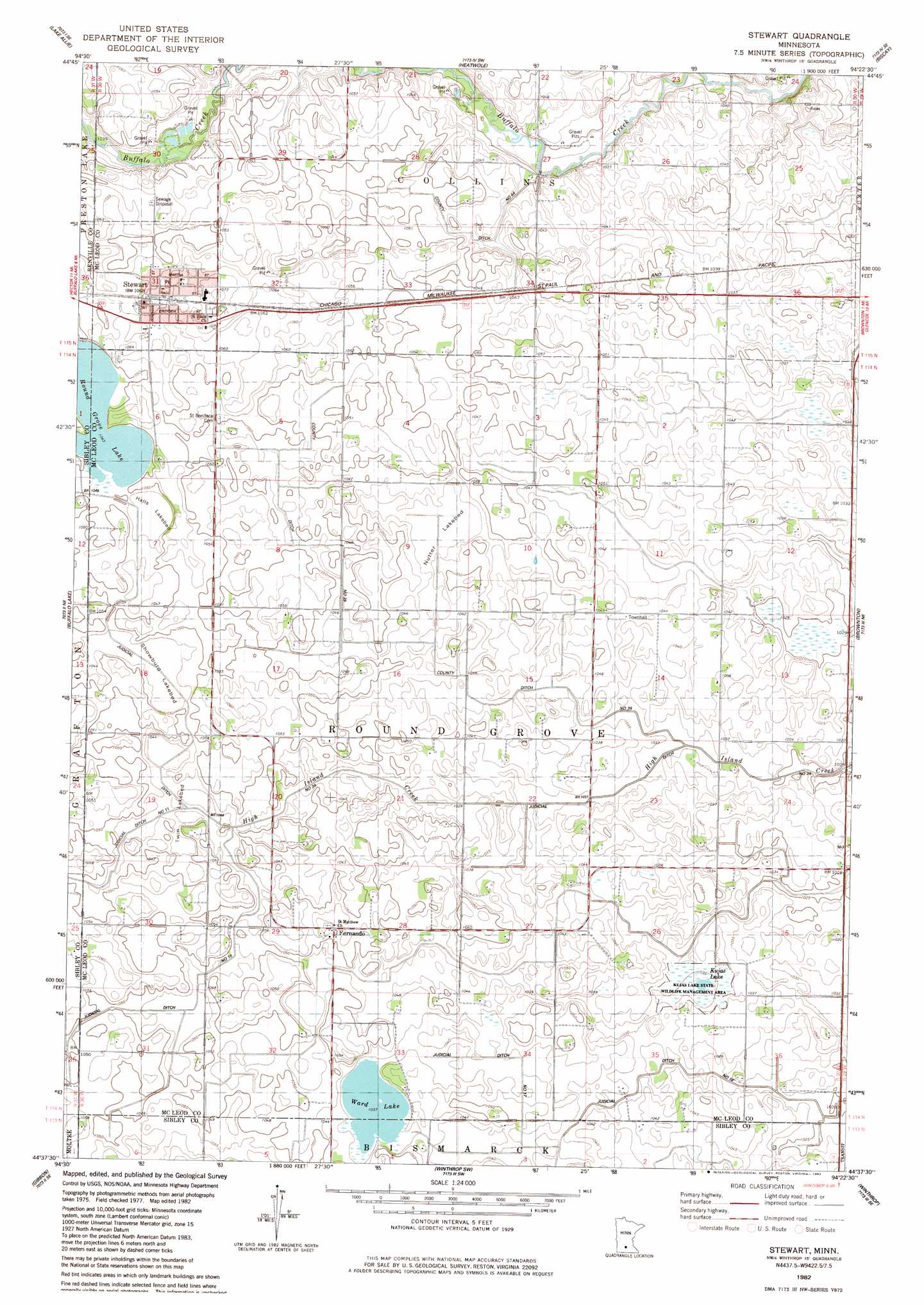
USGS Topo Quad 44094f4 - 1:24,000 scale
| Topo Map Name: | Stewart |
| USGS Topo Quad ID: | 44094f4 |
| Print Size: | ca. 21 1/4" wide x 27" high |
| Southeast Coordinates: | 44.625° N latitude / 94.375° W longitude |
| Map Center Coordinates: | 44.6875° N latitude / 94.4375° W longitude |
| U.S. State: | MN |
| Filename: | o44094f4.jpg |
| Download Map JPG Image: | Stewart topo map 1:24,000 scale |
| Map Type: | Topographic |
| Topo Series: | 7.5´ |
| Map Scale: | 1:24,000 |
| Source of Map Images: | United States Geological Survey (USGS) |
| Alternate Map Versions: |
Stewart MN 1982, updated 1983 Download PDF Buy paper map Stewart MN 2010 Download PDF Buy paper map Stewart MN 2013 Download PDF Buy paper map Stewart MN 2016 Download PDF Buy paper map |
1:24,000 Topo Quads surrounding Stewart
Cosmos |
Cedar Mills |
Hutchinson West |
Hutchinson East |
Silver Lake |
Churchill |
Lake Allie |
Heatwole |
Biscay |
Glenco |
Hector |
Buffalo Lake |
Stewart |
Brownton |
New Auburn |
Fairfax |
Gibbon |
Winthrop Sw |
Winthrop |
Gaylord |
Sleepy Eye Nw |
Saint George |
Lafayette |
Bernadotte |
New Sweden |
> Back to 44094e1 at 1:100,000 scale
> Back to 44094a1 at 1:250,000 scale
> Back to U.S. Topo Maps home
Stewart topo map: Gazetteer
Stewart: Canals
County Ditch Number Sixtyfour elevation 316m 1036′County Ditch Number Thirtynine elevation 314m 1030′
Judicial Ditch Number Fifteen elevation 317m 1040′
Judicial Ditch Number Seventeen elevation 314m 1030′
Stewart: Dams
Round Grove Lake Dam elevation 317m 1040′Stewart: Flats
Halls Lakebed elevation 317m 1040′Nutter Lakebed elevation 320m 1049′
Showburg Lakebed elevation 316m 1036′
Twin Lakebed elevation 316m 1036′
Stewart: Lakes
Kujas Lake elevation 313m 1026′Round Grove Lake elevation 318m 1043′
Ward Lake elevation 316m 1036′
Stewart: Parks
Kujas Lake State Wildlife Management Area elevation 314m 1030′Stewart: Populated Places
Fernando elevation 323m 1059′Remus Trailer Lots elevation 325m 1066′
Stewart elevation 325m 1066′
Stewart: Post Offices
Fernando Post Office (historical) elevation 323m 1059′Stewart Post Office elevation 325m 1066′
Stewart: Reservoirs
Round Grove Lake elevation 317m 1040′Stewart digital topo map on disk
Buy this Stewart topo map showing relief, roads, GPS coordinates and other geographical features, as a high-resolution digital map file on DVD: