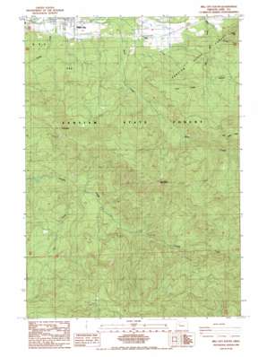
Mill City South Topo Map Oregon
To zoom in, hover over the map of Mill City South
USGS Topo Quad 44122f4 - 1:24,000 scale
| Topo Map Name: | Mill City South |
| USGS Topo Quad ID: | 44122f4 |
| Print Size: | ca. 21 1/4" wide x 27" high |
| Southeast Coordinates: | 44.625° N latitude / 122.375° W longitude |
| Map Center Coordinates: | 44.6875° N latitude / 122.4375° W longitude |
| U.S. State: | OR |
| Filename: | o44122f4.jpg |
| Download Map JPG Image: | Mill City South topo map 1:24,000 scale |
| Map Type: | Topographic |
| Topo Series: | 7.5´ |
| Map Scale: | 1:24,000 |
| Source of Map Images: | United States Geological Survey (USGS) |
| Alternate Map Versions: |
Mill City South OR 1985, updated 1985 Download PDF Buy paper map Mill City South OR 2011 Download PDF Buy paper map Mill City South OR 2014 Download PDF Buy paper map |
1:24,000 Topo Quads surrounding Mill City South
> Back to 44122e1 at 1:100,000 scale
> Back to 44122a1 at 1:250,000 scale
> Back to U.S. Topo Maps home
Mill City South topo map: Gazetteer
Mill City South: Airports
Davis Airstrip elevation 369m 1210′Mill City South: Forests
Santiam State Forest elevation 708m 2322′Mill City South: Pillars
High Rock elevation 1199m 3933′Tom Rock elevation 1039m 3408′
Mill City South: Reservoirs
Howell Pond elevation 315m 1033′Mill City South: Streams
DeFord Creek elevation 246m 807′East Rock Creek elevation 587m 1925′
Hall Creek elevation 414m 1358′
Little Rock Creek elevation 321m 1053′
Snake Creek elevation 281m 921′
Mill City South: Summits
Potato Hill elevation 541m 1774′Mill City South digital topo map on disk
Buy this Mill City South topo map showing relief, roads, GPS coordinates and other geographical features, as a high-resolution digital map file on DVD:


