South Lagrange Topo Map Maine
To zoom in, hover over the map of South Lagrange
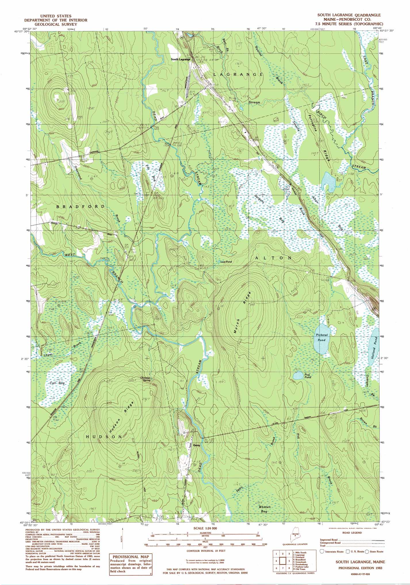
USGS Topo Quad 45068a7 - 1:24,000 scale
| Topo Map Name: | South Lagrange |
| USGS Topo Quad ID: | 45068a7 |
| Print Size: | ca. 21 1/4" wide x 27" high |
| Southeast Coordinates: | 45° N latitude / 68.75° W longitude |
| Map Center Coordinates: | 45.0625° N latitude / 68.8125° W longitude |
| U.S. State: | ME |
| Filename: | o45068a7.jpg |
| Download Map JPG Image: | South Lagrange topo map 1:24,000 scale |
| Map Type: | Topographic |
| Topo Series: | 7.5´ |
| Map Scale: | 1:24,000 |
| Source of Map Images: | United States Geological Survey (USGS) |
| Alternate Map Versions: |
South Lagrange ME 1975, updated 1981 Download PDF Buy paper map South Lagrange ME 1983, updated 1984 Download PDF Buy paper map South Lagrange ME 2011 Download PDF Buy paper map South Lagrange ME 2014 Download PDF Buy paper map |
1:24,000 Topo Quads surrounding South Lagrange
Brownville Junction |
Milo North |
Hardy Pond |
Seboeis |
Lincoln West |
South Sebec |
Milo South |
Lagrange |
Howland |
Passadumkeag |
Charleston |
Bradford |
South Lagrange |
Greenbush |
Olamon |
West Corinth |
Kenduskeag |
Pushaw Lake |
Old Town |
Otter Chain Ponds |
Carmel |
Hermon |
Bangor |
Veazie |
Chemo Pond |
> Back to 45068a1 at 1:100,000 scale
> Back to 45068a1 at 1:250,000 scale
> Back to U.S. Topo Maps home
South Lagrange topo map: Gazetteer
South Lagrange: Lakes
Holland Pond elevation 58m 190′Lost Pond elevation 47m 154′
Pickerel Pond elevation 55m 180′
Pug Pond elevation 58m 190′
South Lagrange: Populated Places
Gerry elevation 53m 173′South Lagrange elevation 63m 206′
South Lagrange: Ridges
Hudson Ridge elevation 95m 311′Murch Ridge elevation 103m 337′
Porcupine Ridge elevation 53m 173′
South Lagrange: Springs
Christian Spring elevation 66m 216′South Lagrange: Streams
Bear Brook elevation 46m 150′Dairy Brook elevation 35m 114′
East Branch Birch Stream elevation 40m 131′
Greenland Brook elevation 41m 134′
Logan Brook elevation 39m 127′
Rawlins Brook elevation 42m 137′
Tenmile Brook elevation 43m 141′
West Branch Dead Stream elevation 37m 121′
South Lagrange: Swamps
Call Bog elevation 44m 144′Fitz Bog elevation 54m 177′
Sargent Bog elevation 47m 154′
Whitten Bog elevation 36m 118′
South Lagrange digital topo map on disk
Buy this South Lagrange topo map showing relief, roads, GPS coordinates and other geographical features, as a high-resolution digital map file on DVD:
Maine, New Hampshire, Rhode Island & Eastern Massachusetts
Buy digital topo maps: Maine, New Hampshire, Rhode Island & Eastern Massachusetts