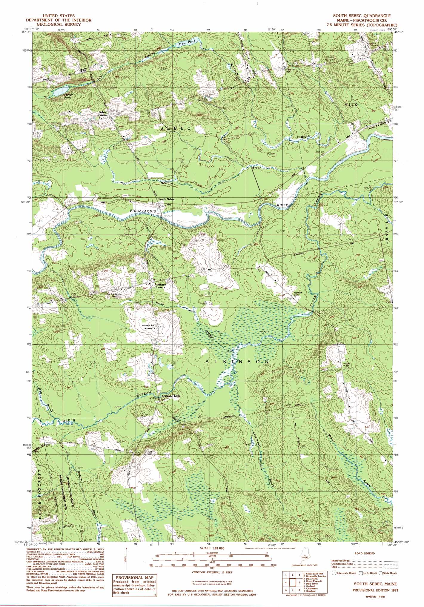
South Sebec Topo Map Maine
To zoom in, hover over the map of South Sebec
USGS Topo Quad 45069b1 - 1:24,000 scale
| Topo Map Name: | South Sebec |
| USGS Topo Quad ID: | 45069b1 |
| Print Size: | ca. 21 1/4" wide x 27" high |
| Southeast Coordinates: | 45.125° N latitude / 69° W longitude |
| Map Center Coordinates: | 45.1875° N latitude / 69.0625° W longitude |
| U.S. State: | ME |
| Filename: | o45069b1.jpg |
| Download Map JPG Image: | South Sebec topo map 1:24,000 scale |
| Map Type: | Topographic |
| Topo Series: | 7.5´ |
| Map Scale: | 1:24,000 |
| Source of Map Images: | United States Geological Survey (USGS) |
| Alternate Map Versions: |
Dover-Foxcroft NE ME 1975, updated 1980 Download PDF Buy paper map South Sebec ME 1983, updated 1984 Download PDF Buy paper map South Sebec ME 2011 Download PDF Buy paper map South Sebec ME 2014 Download PDF Buy paper map |
1:24,000 Topo Quads surrounding South Sebec
Barren Mountain East |
Silver Lake |
Ebeemee Mountain |
Seboeis Lake |
Endless Lake |
Sebec Lake West |
Sebec Lake East |
Brownville Junction |
Milo North |
Hardy Pond |
Sangerville |
Dover-Foxcroft |
South Sebec |
Milo South |
Lagrange |
Dexter |
Garland |
Charleston |
Bradford |
South Lagrange |
Corinna |
Stetson |
West Corinth |
Kenduskeag |
Pushaw Lake |
> Back to 45069a1 at 1:100,000 scale
> Back to 45068a1 at 1:250,000 scale
> Back to U.S. Topo Maps home
South Sebec topo map: Gazetteer
South Sebec: Lakes
Dow Pond elevation 141m 462′Parker Pond elevation 152m 498′
South Sebec: Populated Places
Atkinson Mills elevation 103m 337′Sebec Corners elevation 151m 495′
South Sebec elevation 89m 291′
South Sebec: Streams
Gulf Stream elevation 148m 485′Hall Brook elevation 99m 324′
Meadow Brook elevation 83m 272′
Morrison Brook elevation 81m 265′
South Sebec digital topo map on disk
Buy this South Sebec topo map showing relief, roads, GPS coordinates and other geographical features, as a high-resolution digital map file on DVD:
Maine, New Hampshire, Rhode Island & Eastern Massachusetts
Buy digital topo maps: Maine, New Hampshire, Rhode Island & Eastern Massachusetts